What connection could there be between an enigmatic label on a Google aerial photo and Texas Electric corporate spokesbolt Reddy Kilowatt?
Google aerial photos are presented to us using the latest in technology, of course: satellites and the Internet. But once in a while the labels on these aerial photos are downright antediluvian. For example, below is a current Google aerial photo of the courthouse, Trinity River, and Paddock Viaduct:
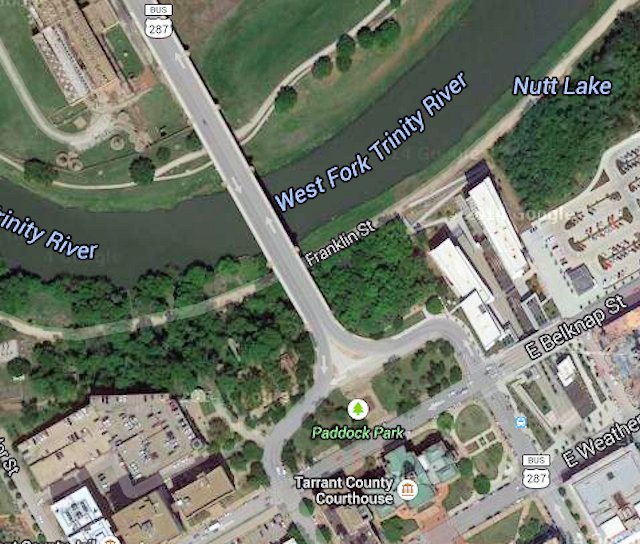 Those of you familiar with the area may be scratching your head over two labels on the photo:
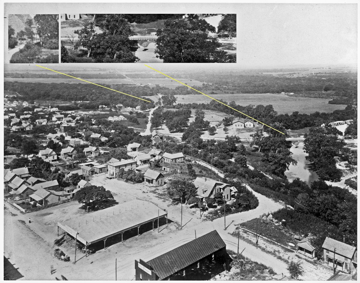
1. Today there is no Franklin Street. It once connected the north end of Houston Street with Courthouse Avenue (today’s White Settlement Road) via the Franklin Street Bridge over the river. (What is labeled “Franklin Street” on this Google photo is just a narrow path alongside the river between North Taylor Street and Tarrant County College’s Trinity River Campus East. Franklin Street ran west from the north end of Houston Street to a bridge over the river.)
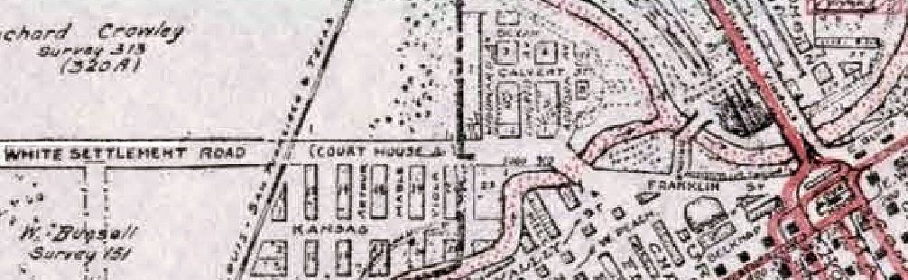 Franklin Street in 1925. There was a wire bridge just east of the confluence of the West and Clear forks. (From Pete Charlton’s “1000+ Lost Antique Maps of Texas & the Southwest on DVD-ROM.”)
2. There is no Nutt Lake east of the Paddock Viaduct.
Well, actually, there is. And there isn’t. There was. And there wasn’t.
It’s complicated.
See, for forty-five years there was a Nutt Dam on the Trinity River just west of the viaduct. So, I guess that technically you could call water impounded by that Nutt Dam “Nutt Lake,” although I have yet to see that place name on an old map, and the Star-Telegram never referred to a “Nutt Lake.”
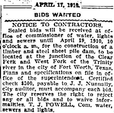 In 1910 the city advertised for bids for construction of a dam just below the confluence of the two forks of the river. Why did the city want a dam at that location? We’ll get to that.
Here is Nutt Dam west of the viaduct:
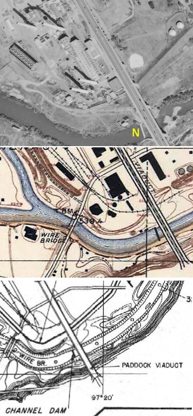 On the 1952 aerial photo above I have marked the dam with a yellow N. The dam also is shown on maps of 1915 (center) and 1939 (bottom). (Map details from Pete Charlton’s “1000+ Lost Antique Maps of Texas & the Southwest on DVD-ROM.”)
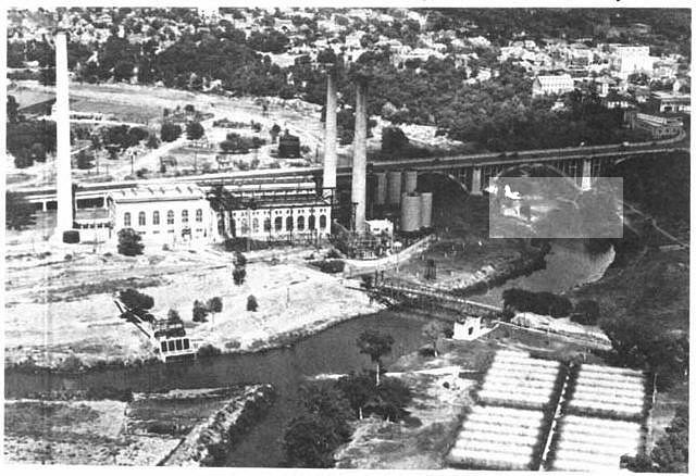
 This remarkable photo, taken about 1894 from the new county courthouse, looks northwest over the intersection of Houston and West Belknap streets. The photo shows two early bridges over the Trinity River. The left inset details the Franklin Street bridge over the Clear Fork; the right inset details the Bridge Street cable suspension bridge (1892) just below the confluence of the Clear and West forks. The dam would be built to the right of the Bridge Street bridge. (Photo from University of Texas at Arlington Library.)
 This 1920 photo shows Nutt Dam just in front of the viaduct. The photo also shows the 1892 Bridge Street bridge just below the confluence. (Photo from Pete Charlton’s “1000+ Lost Antique Maps of Texas & the Southwest on DVD-ROM.”)
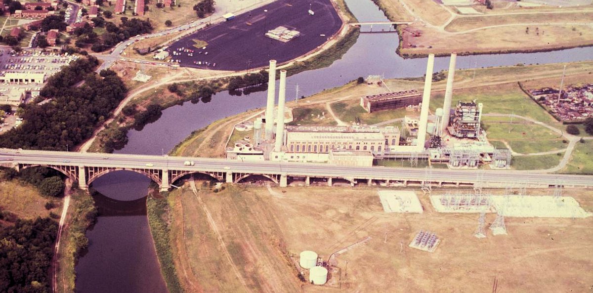
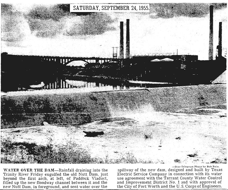 For a brief time in the 1950s there were two Nutt Dams. In the early 1950s a second Nutt Dam was built 1,200 feet east of the viaduct. This Star-Telegram caption says both Nutt Dams were visible in this photo, poorly reproduced here.
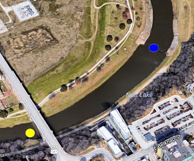 Yellow dot locates the site of the old Nutt Dam. Blue dot locates the new Nutt Dam. So the Google aerial photo label “Nutt Lake” refers to the river immediately upstream of the new dam. For more than twenty years as the Corps of Engineers widened and straightened the river channel in sections, the new Nutt Dam marked the eastern end of the widened channel, but few people would call that widened part of the channel a “lake.” The section of the channel from the dam downstream to Cold Springs Road remained narrow into the 1970s.
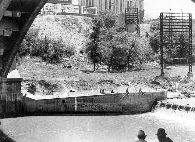
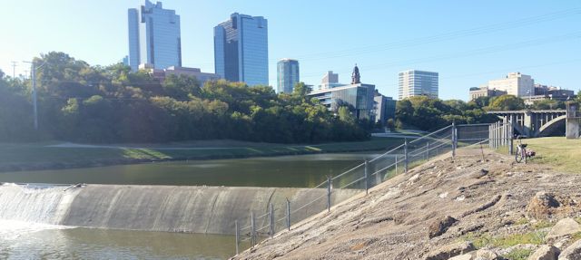 The second Nutt Dam today.
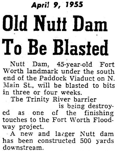 The old Nutt Dam was removed in 1955 as the Corps of Engineers dredged and straightened the river channel and built levees for flood control in response to the flood of 1949.
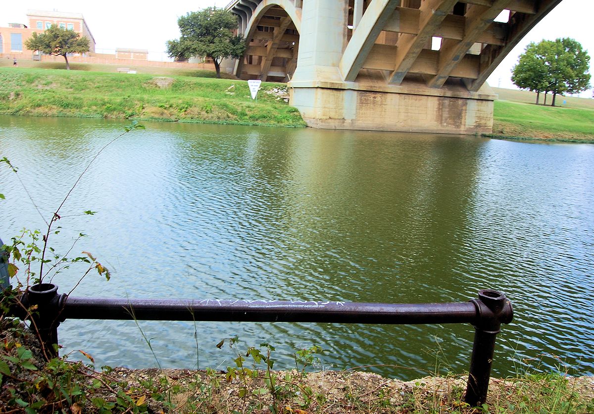
But it appears that a remnant of the old Nutt Dam has survived. Recently while poking around that area I found this section of iron pipe railing atop a concrete abutment sixty feet west of the viaduct on the south bank of the river. The railing and abutment were partially obscured by vegetation (and are located just a few feet off that “Franklin Street” path).
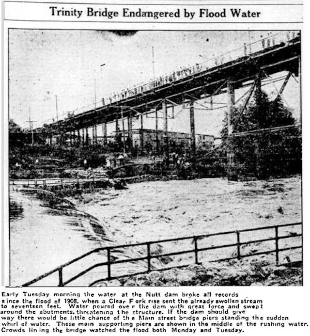 Compare my photo with this September 5, 1911 Star-Telegram photo showing water running over Nutt Dam. Note the iron pipe railing on both ends of the dam. In the background is the 1880s North Main Street iron bridge, which the Paddock Viaduct would replace in 1914.
And this undated photo clearly shows the iron pipe railing atop a concrete retaining wall. Water is flowing over Nutt Dam on the right. The arch of the Paddock Viaduct is on the left. (Photo from University of Texas at Arlington Libraries.)
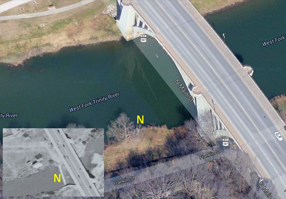
The yellow N in the 1952 aerial (inset) shows Nutt Dam. The yellow N in the contemporary Google aerial shows the location of the iron pipe railing atop a concrete abutment that I photographed.
Okay, enough about the Nutt Dams already. What connection, you ask, could there be between the “Nutt Lake” label on a Google aerial photo and Reddy Kilowatt?
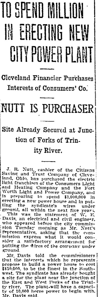 Enter the man himself: Joseph Randolph Nutt (born March 9, 1869) of Cleveland, Ohio. In this August 23, 1910 Star-Telegram clip don’t let that word cashier fool you. Nutt was not a cashier in the “next window, please” teller sense. Back then a cashier was a bank officer. Nutt was a friend of President Herbert Hoover, treasurer of the Republican National Committee from 1928 to 1933, and a financier. In 1910 Nutt bought Fort Worth’s two electric companies and announced that he would build a $1 million ($24.6 million today) generating plant for his new Fort Worth Power & Light Company near the confluence of the West and Clear forks of the river. An adjunct of the generating plant would be Nutt Dam on the river south of the plant and just west of the North Main Street bridge.
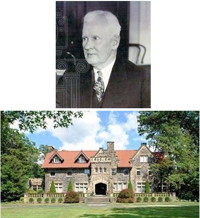 Joseph Randolph Nutt and his house in Cleveland, which he built as he was building the Fort Worth generating plant.
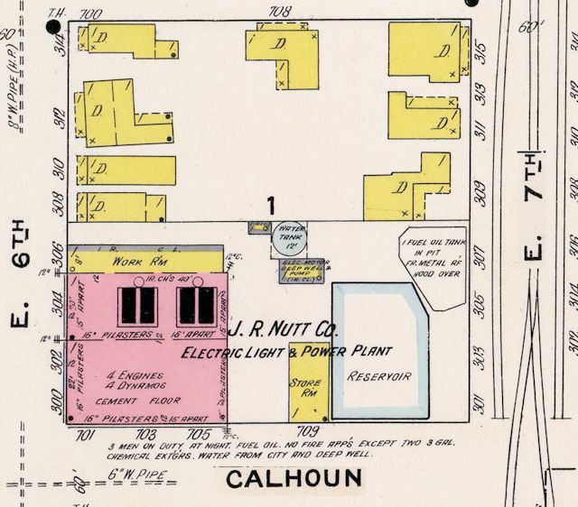 This 1911 Sanborn map, printed soon after Nutt bought Fort Worth Light & Power Company, shows the old generating plant with a new name at East 6th and Calhoun streets. Note the railroad spur in East 7th Street to deliver fuel to the plant.
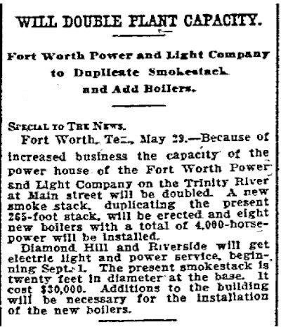
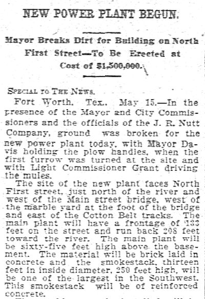 On May 15, 1911 ground was broken—with a plow—for the new plant, which by then had a $1.5 million price tag. At 250 feet the plant’s smokestack would be taller than any building in town. Clip is from the May 16 Dallas Morning News.
The new generating plant was just part of a building boom in Fort Worth, spurred in part by the Stockyards and packing plants. The intersection of the river and North Main Street was an especially busy place: In December 1912 work on the Paddock Viaduct began. The city was also building four other bridges over the river.
In addition Fort Worth was building the West Fork reservoir (later named “Lake Worth”). In September 1911 the city awarded a contract of $512,982 ($12.6 million today) for the Lake Worth dam and a pipeline to carry water six miles to the city. Work began on September 25, 1911, and the lake was filled on August 19, 1914. Lake Worth was built, in part, in response to the South Side fire of 1909.
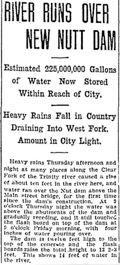 This Star-Telegram clip of July 14, 1911 says Nutt Dam would hold 225 million gallons of water.
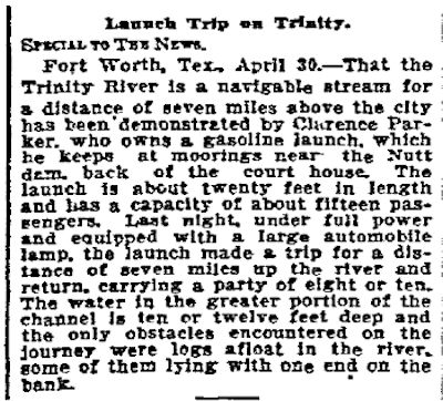 Nutt Dam was only twelve feet high, but it and the mighty Lake Worth dam allowed the city to control the level of the river. Indeed, this Star-Telegram clip from May 1, 1913 shows that the West Fork was now navigable in a small launch from Nutt Dam seven miles upstream, which would have been about to the Lake Worth dam.
Lake Worth was built to provide flood control and a water supply. But J. R. Nutt built his eponymous dam to provide water for the steam necessary for his new generating plant.
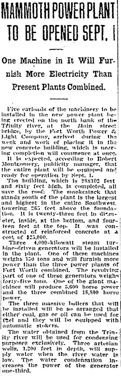 On June 23, 1912 the Star-Telegram announced that the plant would open September 1. Such predictions are rarely accurate. The plant was completed in early 1913. Note that the clip says the original building measured only 98 by 102 feet.
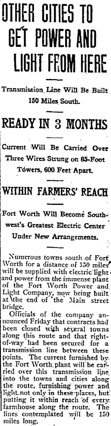 On August 6, 1912 the Star-Telegram announced that Fort Worth would become the “Southwest’s greatest electric center” as the new plant supplied electricity to “towns 150 miles distant.”
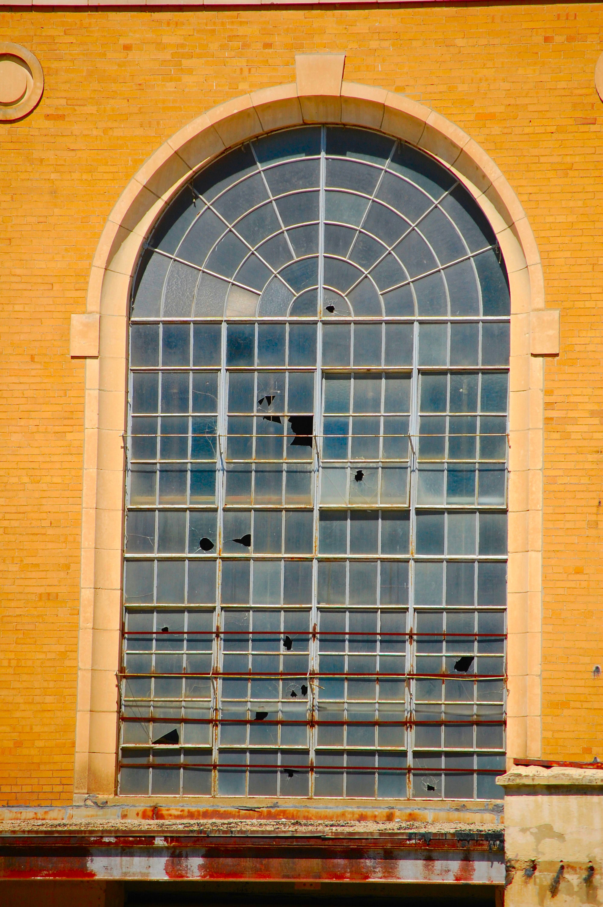
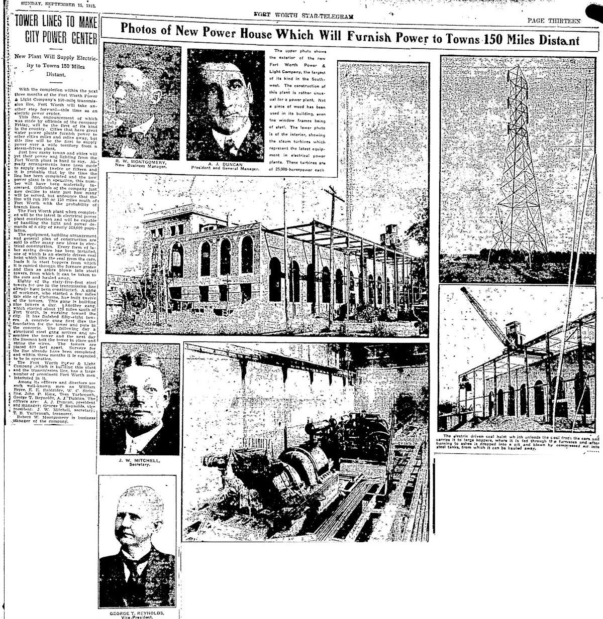 On September 15, 1912 the Star-Telegram published this feature about the plant as it neared completion, showing the coal hoist, the turbines, the tall arched windows. The story said “not a piece of wood has been used in this building, even the window frames being of steel.” Note that vice president was cattleman George T. Reynolds, who lived for sixteen years with a Native American arrowhead in his back.
 On May 30, 1913, not long after the plant began operation, the Dallas Morning News announced that the plant would be enlarged to double its generating capacity. A second smokestack and more boilers would be installed.
 The power plant in 1921.
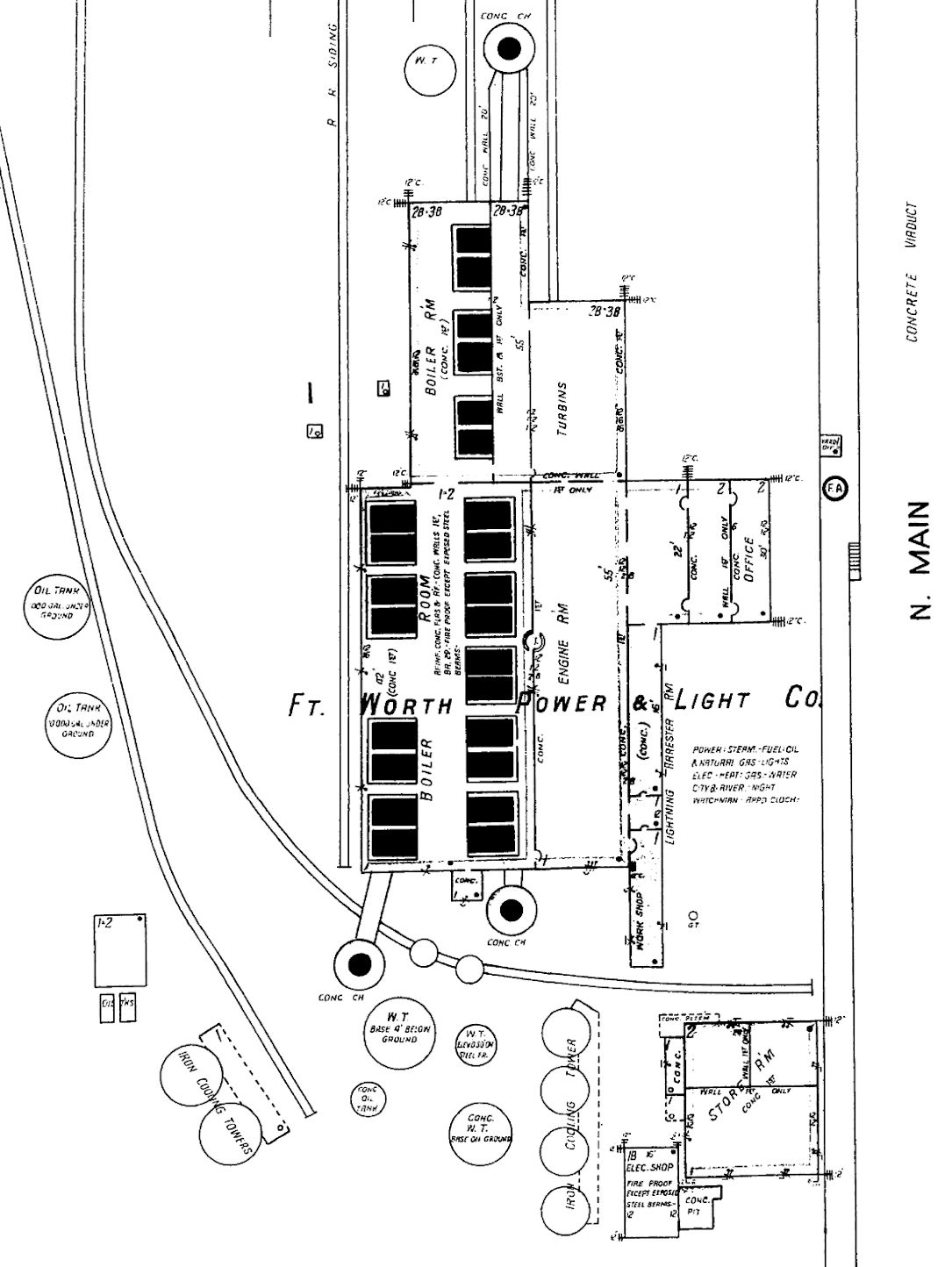 By 1926 this is what the power plant looked like, with numerous water and oil tanks, cooling towers, and three concrete chimneys (labeled “conc ch”). Note the railroad tracks to deliver fuel from the north.
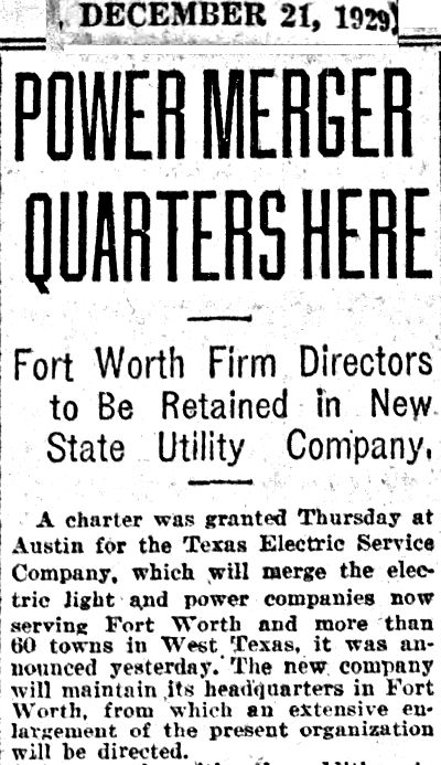
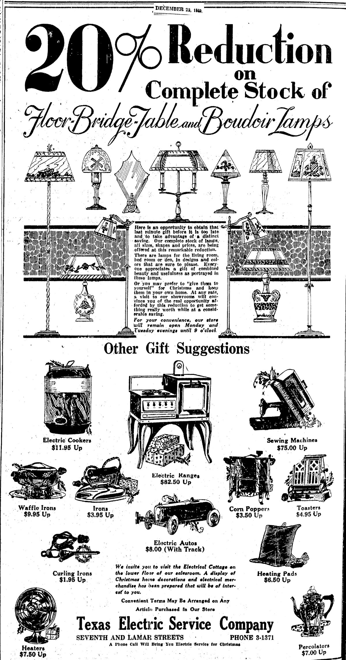
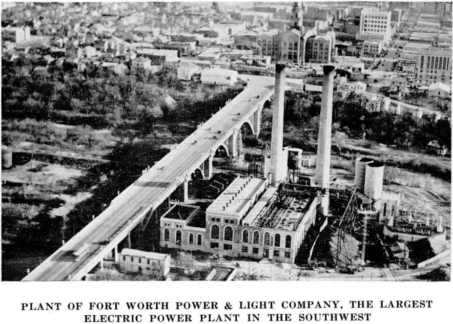
Fast-forward to 1929. That’s when Texas Electric Service Company (TESCO) took over Fort Worth Power & Light and its power plant. TESCO’s headquarters in Fort Worth was the new Electric Building.
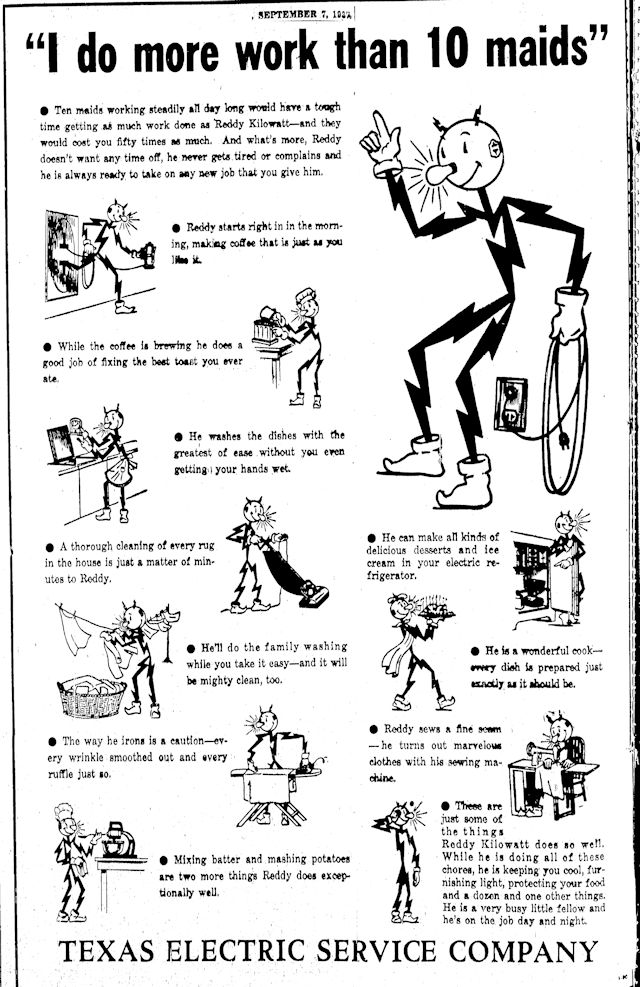 Reddy Kilowatt came along in 1937 as the perky corporate spokesbolt for TESCO and Dallas Power & Light.
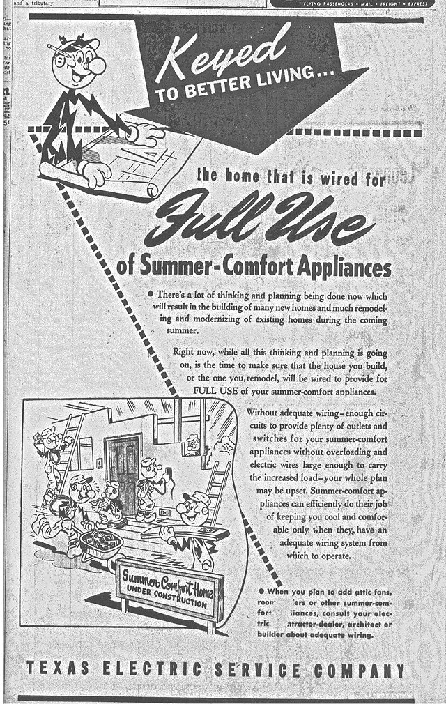 By 1948 Reddy had the appearance that is more familiar to us. Clip is from the Fort Worth Press.
 Two Reddy Kilowatt TV commercials on YouTube:
Pacific Gas and Electric commercial
 The power plant in the 1970s. (Photo from UNT Libraries Special Collections.)
TESCO became a subsidiary of Texas Utilities Electric Company in 1984. In 1999 “TXU” became the new name. TXU shut down the generating plant about 2000. About 2004 Tarrant County College District bought the property when TCCD envisioned building a trans-Trinity River campus downtown. That didn’t happen, but TCCD still owns the property. The last of the plant’s four tall smokestacks were torn down in 2005. The interior of the huge building has been gutted. Now the old power plant sits in neglect, its future doubly uncertain because of the ambitious Panther Island “urban waterfront neighborhood” planned for that area. Coincidentally, Panther Island will include a thirty-three-acre Town Lake just upstream from where the old Nutt Dam was. As for the historic power plant, will it be demolished, or could the former home of Fort Worth Power & Light be renovated to find a second life as a centerpiece of Panther Island? Panther Power!
Somewhere amid all this change, Reddy Kilowatt, too, disappeared, perhaps taking early retirement to go fishing, maybe on Nutt Lake.
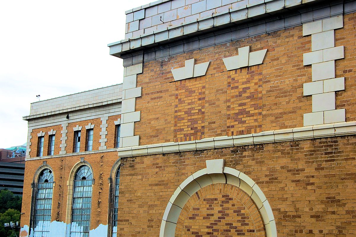
Some views of the generating plant:
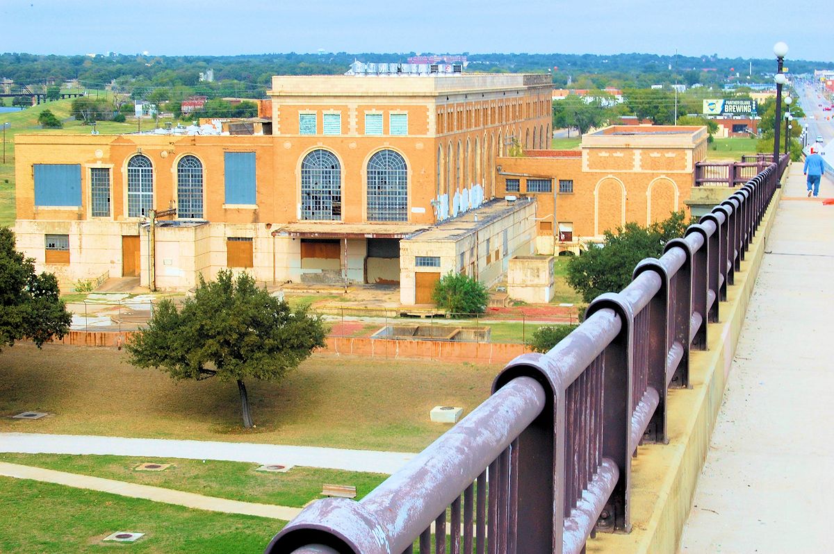 View from the viaduct.
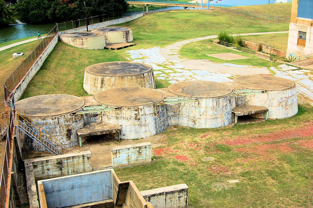 Bases of six cooling towers.
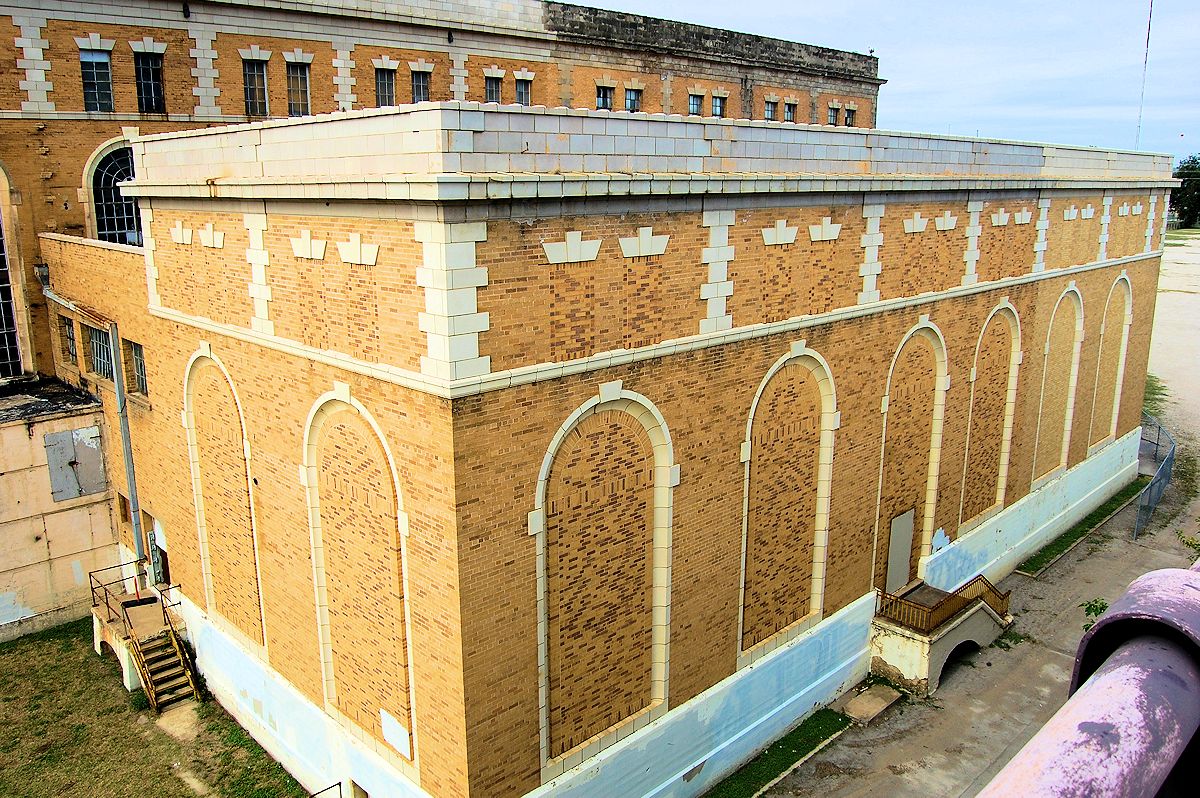

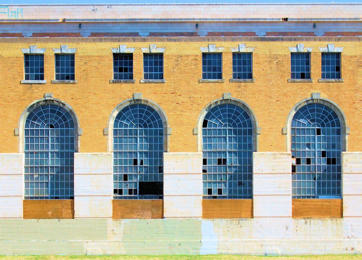
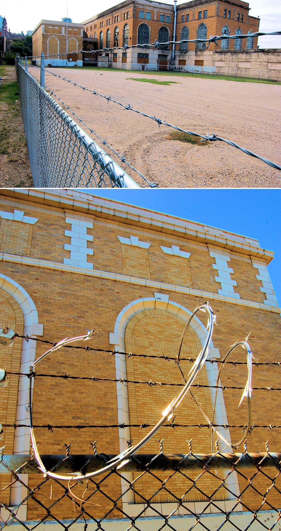 The old plant has taken on a prison-like appearance.
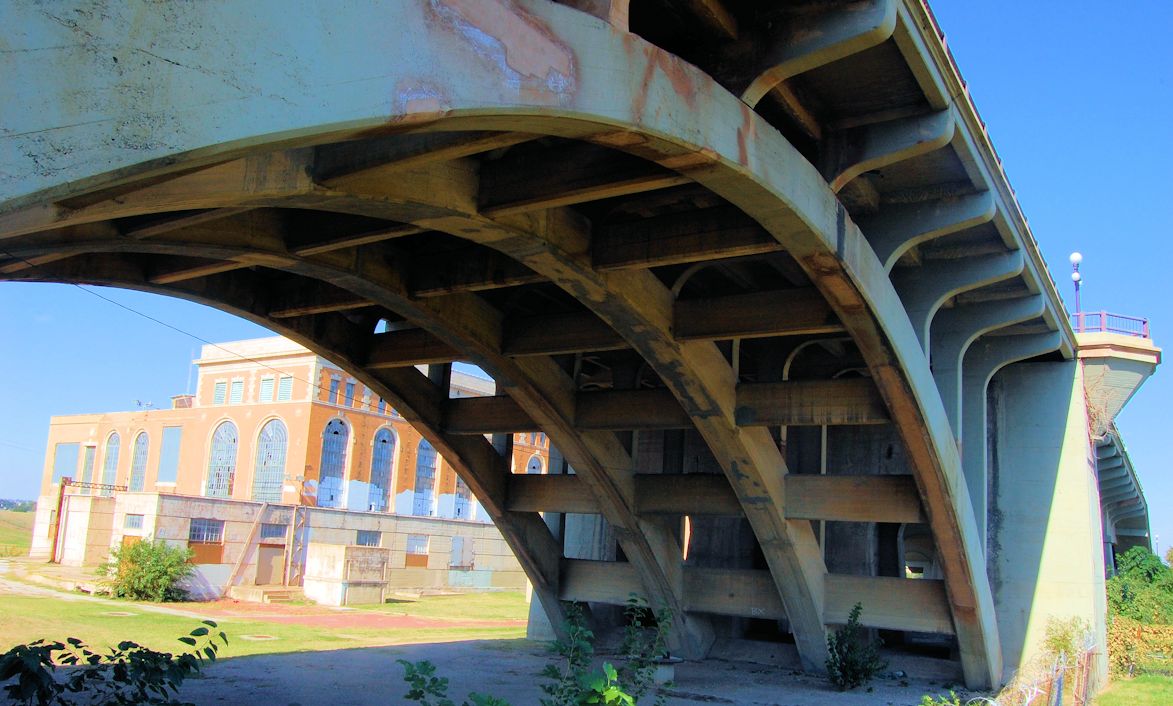 The power plant seen from under an arch of the viaduct.
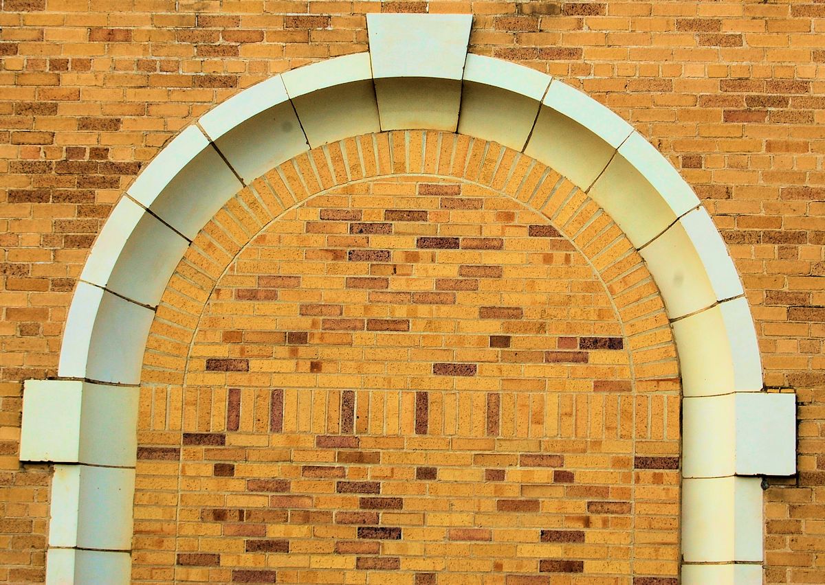
![]() Three historicons: the power plant, the viaduct, and the courthouse.
Three historicons: the power plant, the viaduct, and the courthouse.


Anytime our past is retold through newspapers I turn into a skeptic. I grew up here often I have felt as if something is hidden below us. I know there were massive tunnel system in Hells half acre. The subway system and as well for another tunnel coming all the way from the eastside to right under the jail…. With all its hidden lore the past of our city has differences that have me trying to patch this “message” together, and solve Fort Worths early days..
Your diligence in collecting and assembling this material is an important public service. Your wit and your breezy writing style add a lovely human touch. Thank you for this.
Thank you, Jackee, for your kind words. Made my day.
Thank you, Hometown by Handlebar. I have often wondered about the history of this power plant. I bike near it all the time. The pictures are
interesting too.
Thanks, Bob. Grand old building with a lot of history. Hope it survives all the changes coming to that area.
Great web site! Do you know of any history on Two B-24 Liberators colliding and crashing in Birdville (Haltom City) in the early 1940? Thanks
Thanks. Have e-mailed you two clips on the September 3, 1943 collision.
I tried to deleted “Nutt Lake” off GoogleMaps. To delete such a feature takes multiple reviews. The first two reviewers concurred it should be removed, but the third overturned the deletion based up the US Army Corps of Engineers’ listing here:
http://geonames.usgs.gov/apex/f?p=136:3:0::NO::P3_FID%2CP3_TITLE:1864022%2CNutt+Lake
Chris, personally I am glad the label is still there because it motivated me to learn something. At worst the label is located slightly off target.