Sycamore Creek has always meant one thing to adults and another thing to kids.
 To adults among first Native Americans and then among the first white settlers in the 1850s the creek was a resource to live near because it offered food and water.

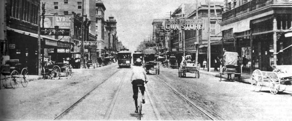
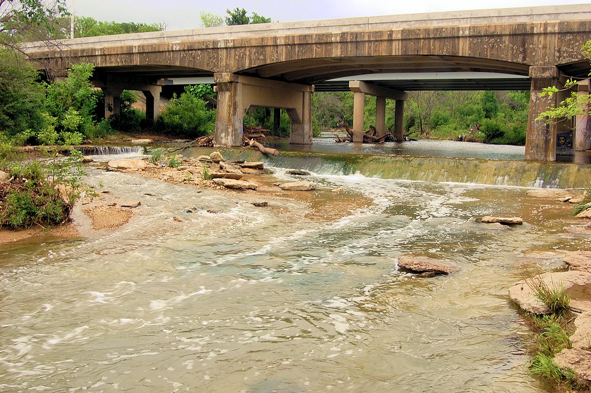
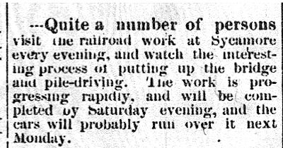 But to adults the creek also has meant an obstacle to get across. First by foot and then by horse and then by railroad. In 1876, near the present-day trestle over the creek near the seventh green of Sycamore Creek Golf Course, laborers of the Texas & Pacific railroad laying track west from Eagle Ford in Dallas County had to slap together a makeshift wooden trestle to get the rails across the creek as they worked frantically to meet a state-imposed deadline to bring the first railroad to Fort Worth. On July 14 the Fort Worth Democrat reported that citizens were driving out to Sycamore Creek every evening to watch the bridge being built.

These Star-Telegram clips document the challenge that crossing Sycamore Creek has presented to interurban trains, motor vehicles, and horses and buggies.
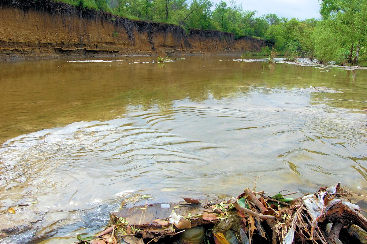
The creek has also been a flood hazard. For example, during the flood of 1922 Sycamore Creek was fifty feet deep in places, washing away homes. And after a heavy rain one low-water crossing in Cobb Park was notorious for sweeping away the cars of motorists who didn’t think the current was that strong.
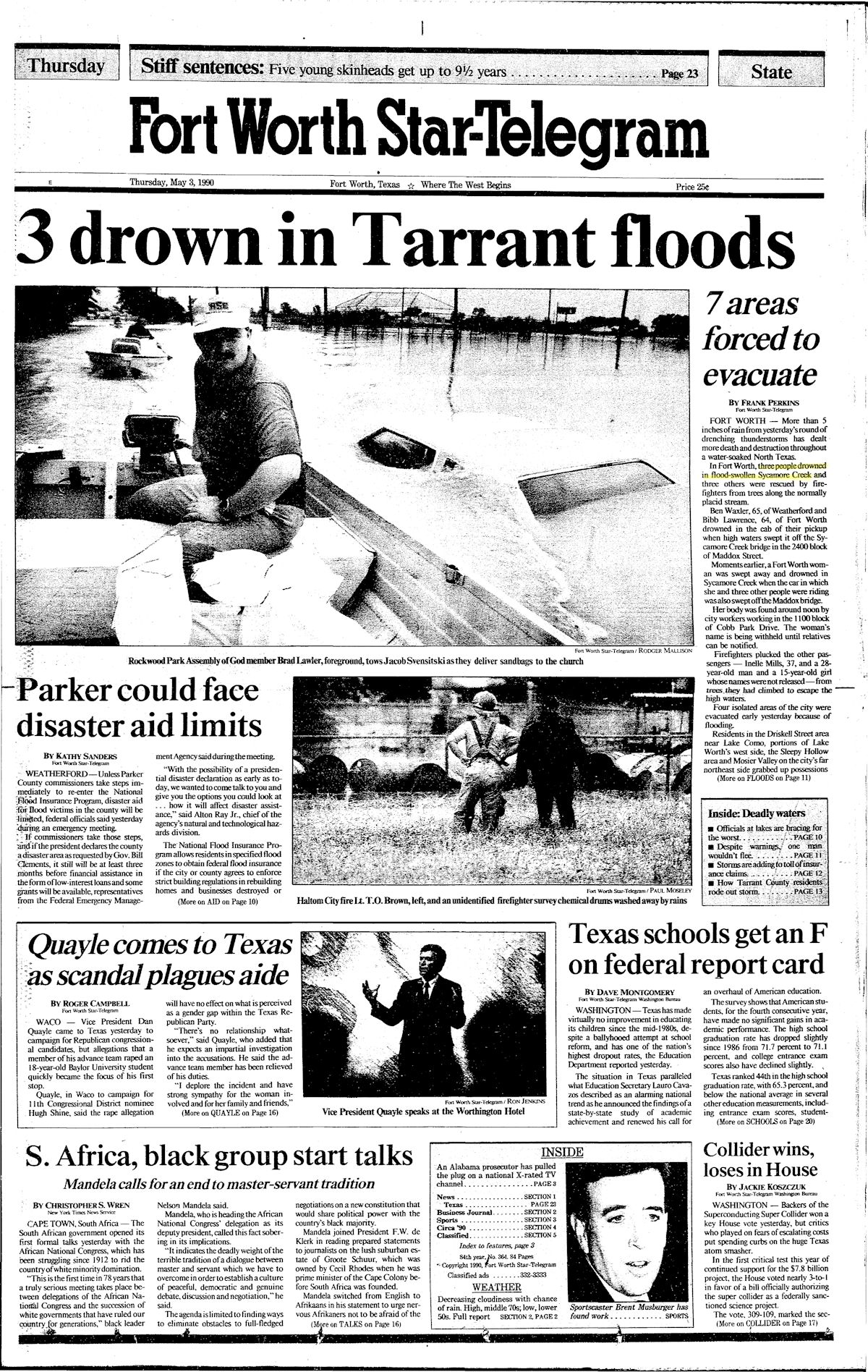 In 1985 three people drowned when their cars were swept off the Maddox Street bridge by the flooded creek.
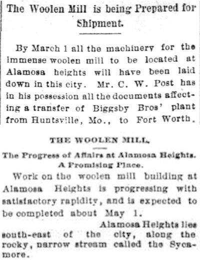 To adults, Sycamore Creek also has meant business. In 1890 future cereal king C. W. Post planned a woolen mill and a subdivision called “Alamosa Heights” on Sycamore Creek.

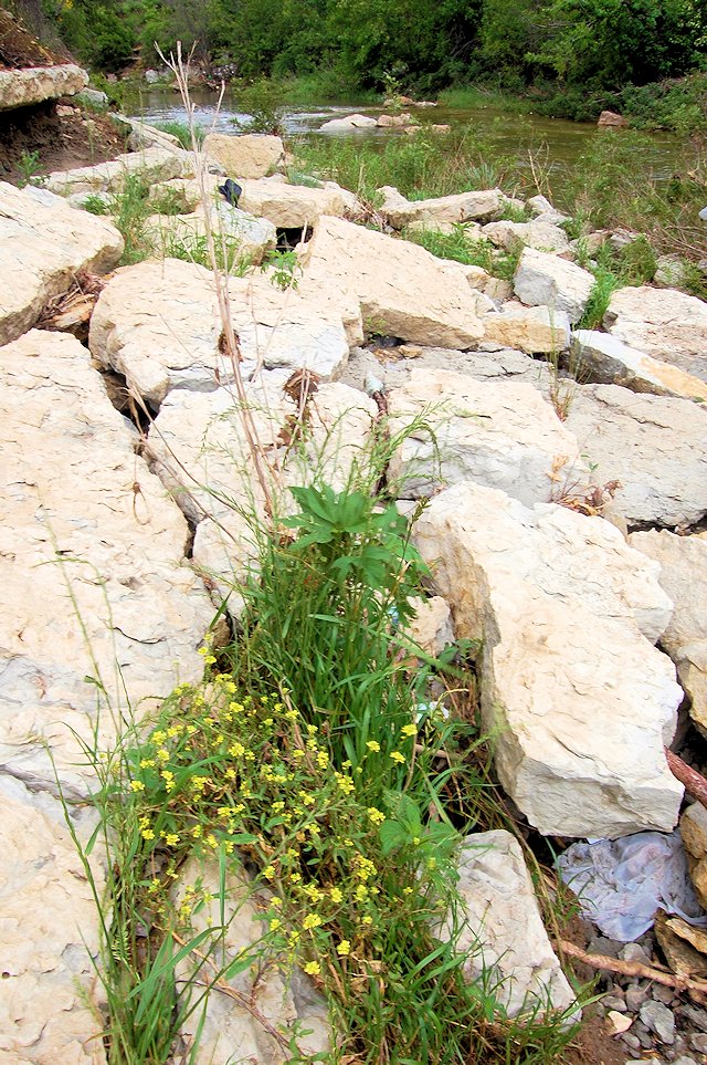
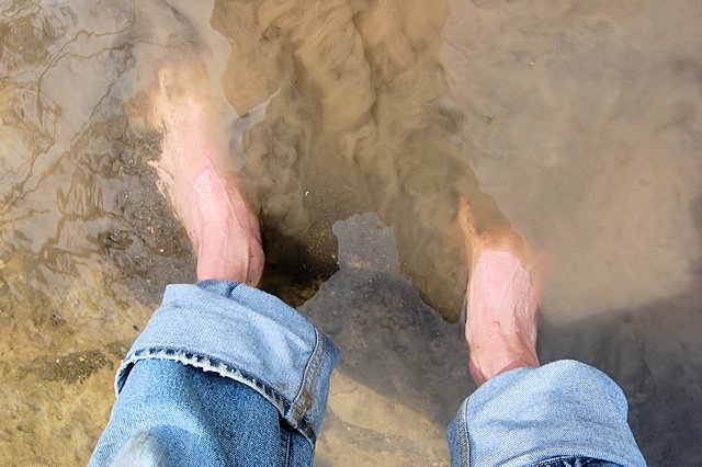
But to kids, Sycamore Creek has been a playground, a source of fun and adventure. It has been our Mississippi River, our “Big Muddy,” and it has made generations of us feel like urban Huck Finns and Tom Sawyers. We have brushed against poison ivy along its banks, snagged our clothes on its thickets of briars, and dodged delegates from its resident snake population. We have skipped rocks over it, fished in it, caught crawdads, frogs, and turtles in it, flipped over flat rocks to see what’s underneath in it, swum in it, shot BB guns in it, lost golfballs and baseballs in it, slipped on its mud and mossy rocks and fallen flat on our official Davy Crockett wallet in it, and cut our bare feet wading on broken bottles in it. Hey, can a kid have more fun than that?!
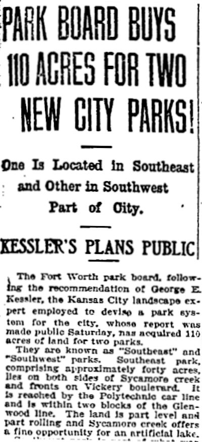 In 1909 Sycamore Park was conceived as part of the ambitious city park plan of urban designer George Kessler. When conceived the park was called “Southeast Park,” but by the time it opened in 1910 it was called “Glenwood Park” and finally, in 1911, “Sycamore Park.” In 1923 the city bought Tyler’s Lake and park in Glenwood from the Ku Klux Klan and by 1929 had converted them into “Glenwood Park.”
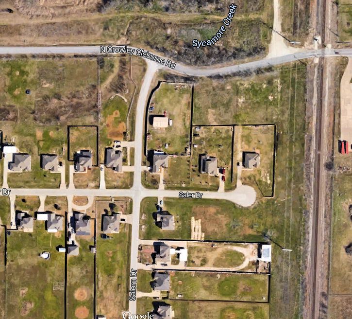 Our inner-city Mississippi begins humbly enough in southwest Fort Worth. According to Google maps, Sycamore Creek begins at the site of a former pond on North Crowley-Cleburne Road.

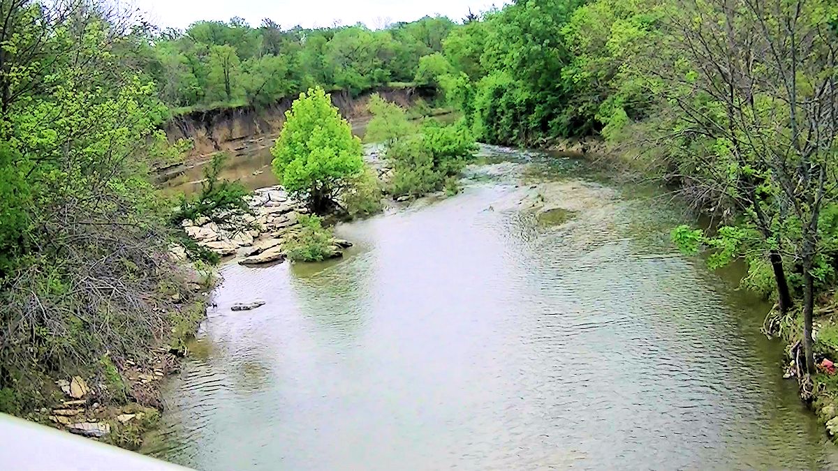
But Sycamore Creek is fed by many smaller streams, most of them in turn fed by storm runoff. For example, this storm drain outlet at Risinger Road and Garden Springs Drive in far southwest Fort Worth is the most-distant “headwaters” of a Sycamore Creek tributary that I have been able to trace. Before far southwest Fort Worth was developed, the headwaters of Sycamore Creek was a network of anonymous gullies and ponds on pasture and prairie. All that land has been developed and paved with concrete and asphalt.
Now rain drains from roof gutters into street gutters into storm drain tunnels (see video) that empty into creeks such as Sycamore, all bound for the Trinity River. From these beginnings in southwest Fort Worth Sycamore Creek wiggles its way northeast, . . .
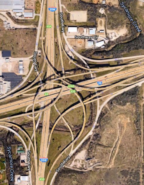 avoiding detection by the thousands of drivers passing overhead daily at the junction of south Loop 820 and I-35W, and through the East Side to flow unceremoniously . . .

into the Trinity River near I-30 at Riverside Drive—fifteen miles away.

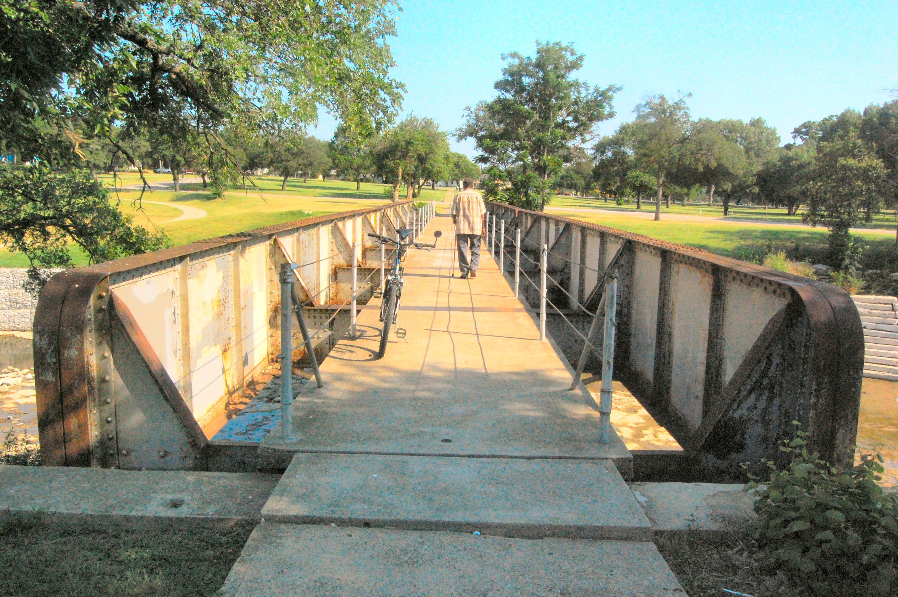
We have paved, piped, bridged, trestled, channelized, landscaped, and otherwise “civilized” Sycamore Creek and its tributaries in places, such as in Cobb Park and Sycamore Park on the East Side, where it flows under the little interurban trestle mentioned in the 1907 news article.
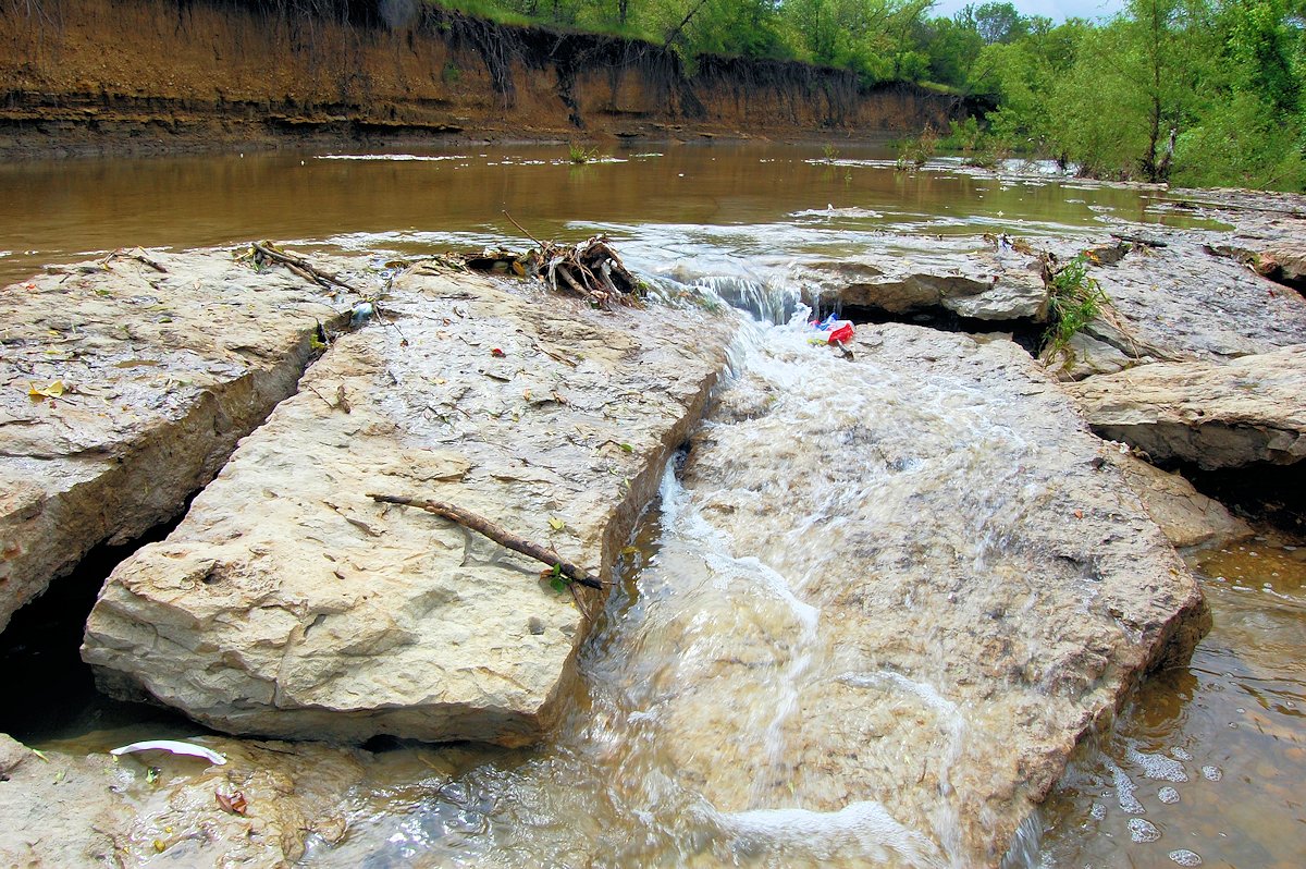 But much of Sycamore Creek’s ancient limestone bed remains unchanged as the creek continues to fulfill its duties:
1. to carry local raindrops on the first leg of their journey ever downward on the Gravity Express to the Gulf of Mexico, where they rub elbows with raindrops carried there by, among other streams, the real Mississippi.
2. to let kids be kids.
Here are two video clips of the Big Muddy of the East Side:
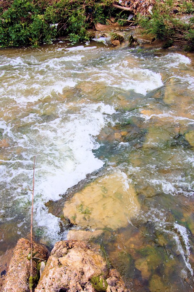
Sycamore Creek after it has had a big sip of rain:
Time marches backward (and barefoot):
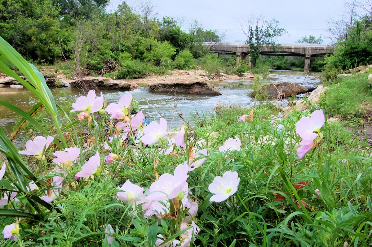
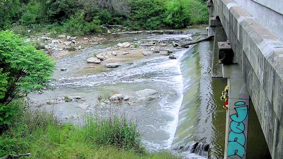
Some more views of Sycamore Creek:
More on Sycamore Creek: Cowtown Yoostabes, Sycamore Edition: Movies, Mobsters, and the Marlboro Monkey


Any updates on the restored Sycamore Creek channel in Gateway Park?
I have not biked that area in months, but very little work was going on last time I was there. The stretch of the creek that connects to the original river channel behind the drive-in screen has been restored from the new river channel, but the original river channel-orphaned by the floodway project-had not been restored. The original channel is quite narrow compared with the new channel.
My Brother and I found an old freezer that someone had dumped (sad) and used it as a pirate ship to float down the last couple of miles of the Sycamore to where it meets the trinity. So many great memories made on the part of the creek between Sycamore Park and the Trinity!!!
What a great story of modern-day Tom Sawyer and Huck Finn sailing down the mighty Sycamore. My friend Larry Roberts and I spent many an hour exploring the creek from Berry to Vickery. When I played golf at the little nine-hole Sycamore course, most of the balls I used I had fished out of the creek along the eastern edge of the course.
You brought it all back, Mike- the sticky heat, the wildness, the gnats and mosquitoes and water snakes and leeches; playing pirates and Robin Hood and King Arthur and Treasure Island. Boy, that was MY creek, and not just mine but my mother’s and her older brothers- who were fishing crawdads out of it by 1925.
Thanks, Nancy. It was a second home to generations of kids. I wonder if today’s kids . . .
Was raised off of S. Riverside Drive on Stella between Vickery & Lancaster…used to start out at R. Vickery Elementary School grounds at the creek tunnel & follow the creek all the way to the ‘swimming hole’ at the train tressle. What fun. My sisters & I would pack a picnic lunch & make a day of it…
I enjoyed your posts in pics about Sycamore Creek. I found it fascinating and well-written. Thanks!
Thank you, Donnis. Sycamore Creek has always been special to me. I was one of those urban Toms and Hucks.