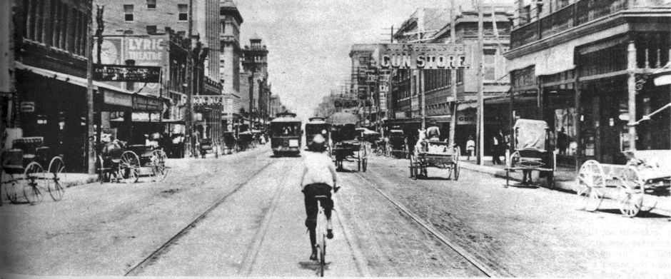
The Trinity River that we know is not the Trinity River that our parents and grandparents and great-grandparents knew. And they’d probably tell us we are fortunate. In the old days Fort Worth suffered severe floods (as in 1889, 1908, 1915, 1922, and 1949) because the Trinity River channel—both forks—was narrow, shallow, and convoluted. That meant the river could not move a large volume of water quickly after heavy rain. The quickness with which the river could rise out of its banks was frightening. And fatal. People might go to bed at night listening to the lullaby of raindrops on rooftops and wake up in the morning as their bed was floating out the door or as their house was floating down the street.
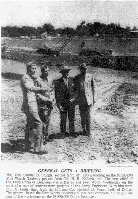 Although attempts to tame the Trinity had been made before, especially after major floods, it was the flood of 1949 that caused the Army Corps of Engineers to roll up its sleeves and give the river a serious makeover in Fort Worth. With an infusion of federal dollars, Benbrook Lake was impounded, levees were built, existing bridges were lengthened and new bridges built, the river was dredged, widened, straightened in a project called the “Fort Worth floodway.” The work continued into the 1970s. Clip is from the April 16, 1953 Dallas Morning News.
 Widening of the Clear Fork channel in the 1960s rendered the two truss spans of the University Drive bridge, built in 1936 and 1952, too short. The spans were extended on their north end. The 1936 span, seen in the foreground on the right, shows how narrow the channel originally was.
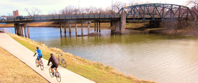
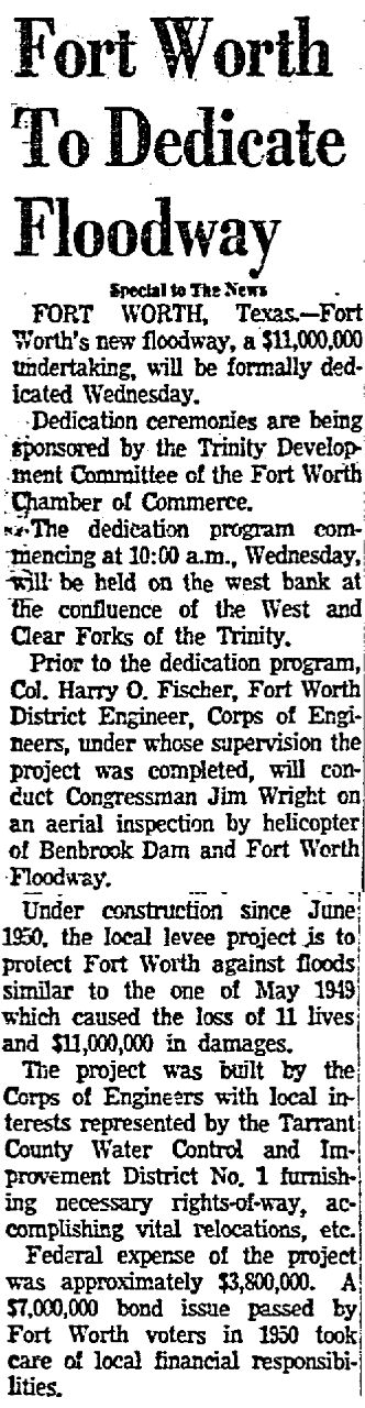 On April 1, 1956 the Dallas Morning News reported that the $11 million ($93 million today) Fort Worth floodway was completed, although work on the “new river” continued into the 1960s. When you travel along the river today and see the amount of dirt that the Corps moved to dig new river channel and to build levees, the scope of the project is staggering.
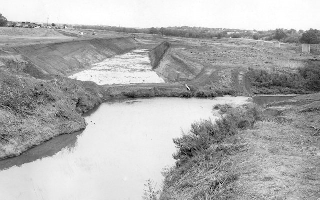
This photo from the early 1950s shows the transformation of the river just north of East Belknap Street. At bottom is the winding, narrow old channel; at top is the straight, wide new channel. (Photo from University of Texas at Arlington Libraries.)
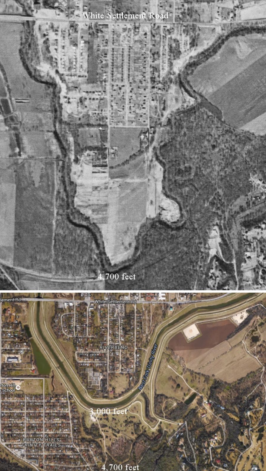 These “before and after” aerial photos show a typical Corps of Engineers “operation” on the clogged river. Below Lake Worth, south of White Settlement Road, and east of Burton Hill Elementary School the West Fork pre-floodway plunged 4,700 feet south of White Settlement Road. Today, after a “bob job” by the Corps, the river plunges only 3,000 feet and is wider and less wiggly. The new channel also has a high levee on both sides. The Trinity Trails path runs along both sides of the river there.
That one operation excised 5,800 linear feet of slow-flowing river channel. The channel was so narrow that the “before” aerial photo shows not the water but the canopy of trees over the water. At the bottom of the photo you can see the tree-lined, wiggly old channel.
Today on both forks, if you know where to look, you can still find remnants of the wiggly “old river.”
 Map shows the locations of just ten of the “ghosts” of Trinity past.
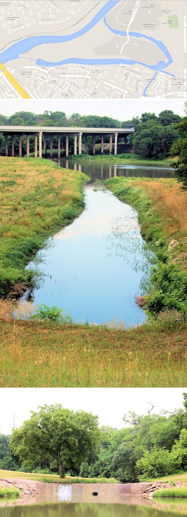 1. Lockheed Martin Recreation Association area and the adjacent new Waterside commercial development. Top image locates this orphaned bend between Highway 183 and Bryant Irvin Road. The bend comes off the river as a modest channel (middle image) but is fed by storm drains and thus receives enough water to form a small waterfall (bottom image) where it flows into the new Clear Fork river channel downstream. This part of the river was not straightened until the 1970s.
 Today the orphaned bend not only survives but also has two bridges over it—both vehicular and pedestrian—on Watercourse Drive.
 This mural under the Clearfork Bridge west of Hulen Street on the Clear Fork shows wonderfully the old channel (light blue) and the new channel (dark blue) between Bryant Irvin Road (left north-south street) and Hulen Street (right north-south street).
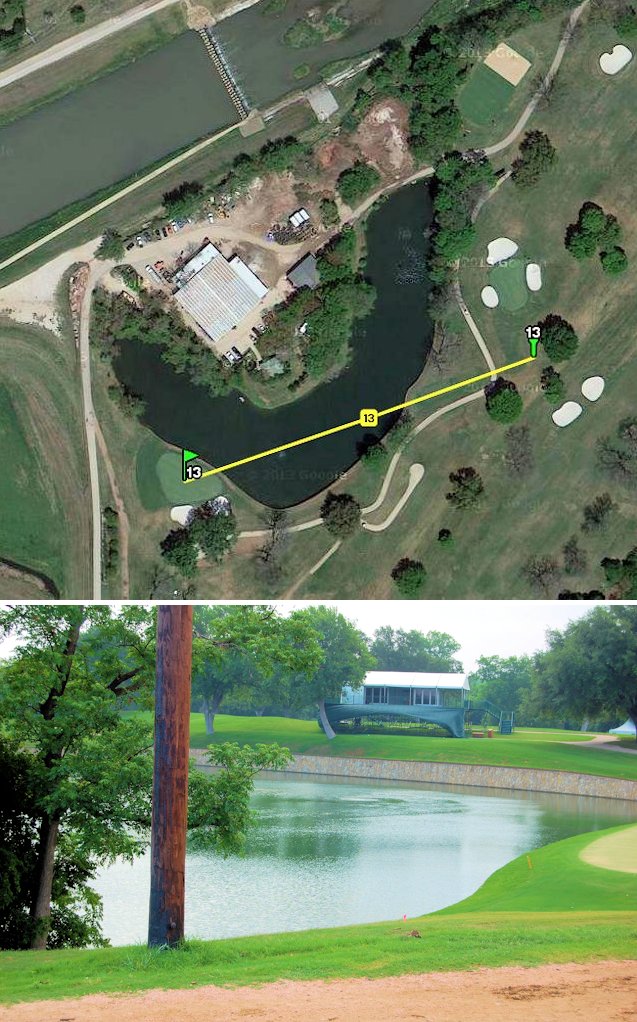 2. Colonial Country Club. Straightening the river made an orphan of this kink in the Clear Fork. So, the kink just retired and took up golf: It now serves as a water hazard on the thirteenth hole.
Fore!
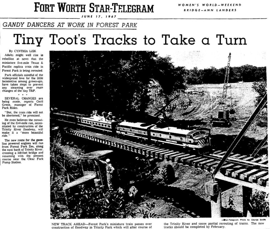
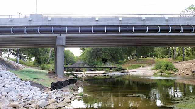
 3. Forest Park. The five-mile miniature train (1959) crosses the inlet (top photo) and outlet (bottom photo) of a tree-lined bend of the old channel of the Clear Fork. This part of the river was not straightened until the 1960s. Originally the train crossed the river on its own bridge right beside the University Drive bridge, but widening the channel rendered the old bridge too short, so a new bridge was installed downstream over the new channel in 1968, and the old bridge (bottom photo) was moved to the outlet of the old channel.
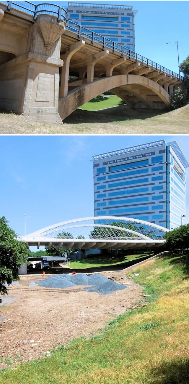 4. West 7th Street bridge. The trough of the old channel of the Clear Fork could be seen under the arch on the east end of the old 7th Street bridge. After grading of the ground under the new bridge, the trough is no longer visible under the easternmost arch. The 1914 West 7th Street bridge had to be lengthened in 1954 after the river channel was moved and widened in the floodway project.
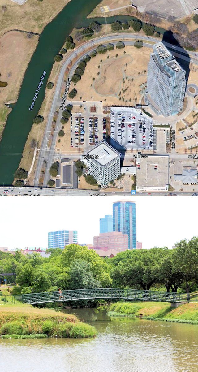 5. North of Chesapeake Plaza and west of Bluff Street. This is the outlet of another orphaned bend in the Clear Fork. Forest Park Boulevard follows the curve of the old channel.
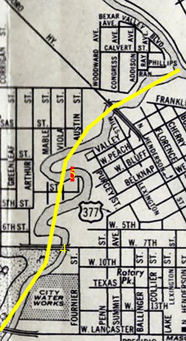 Map shows the location of 4 and 5 on the old Clear Fork channel. Yellow line indicates the new channel. (Map detail from Pete Charlton’s “1000+ Lost Antique Maps of Texas & the Southwest on DVD-ROM.”)
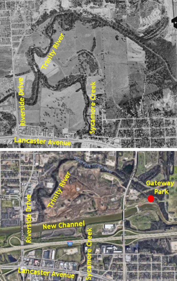 6. North of I-30 and east of Riverside Drive. Aerial photos of 1952 and 2018 show that east of Riverside Drive a tree-lined arc of the river channel was cut off when the river was straightened and a levee built. The river originally veered north behind the Meadowbrook Drive-In Theater. The old channel of Sycamore Creek flowed into the river behind the theater.
 The red dot on the 2018 aerial photo shows the location of a footbridge that crosses the old river channel just east of Beach Street. You can see the new channel and Beach Street in the background.
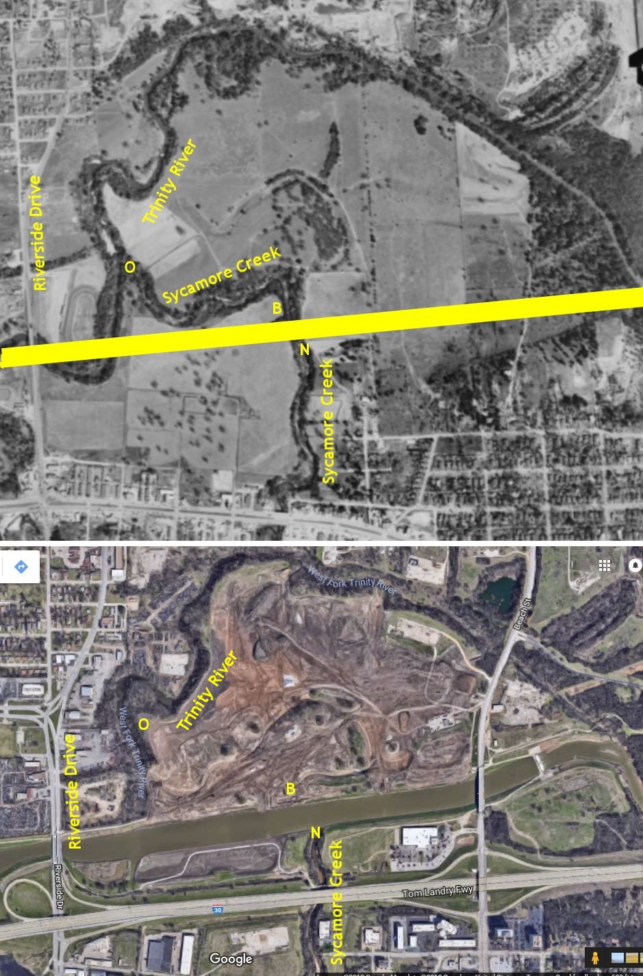
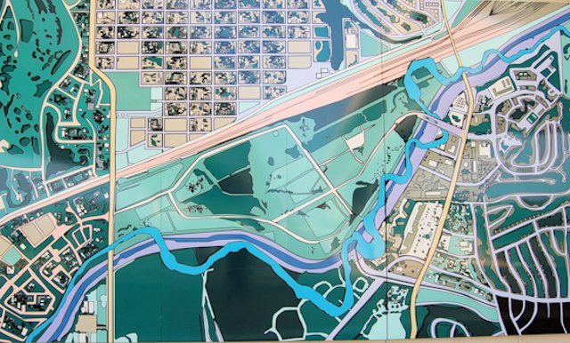
2018 update: This area is undergoing major changes as Gateway Park is expanded to the west. According to the Gateway Park Master Plan this “Riverside Oxbow” will be restored and opened to kayakers and canoeists. The arc of the Trinity River that was orphaned by the new channel is being connected to the new channel (yellow line) by restoring the old Sycamore Creek channel. Aerial photos of 1952 and 2018 show how the new channel and a levee made an orphan of the arc of the river.
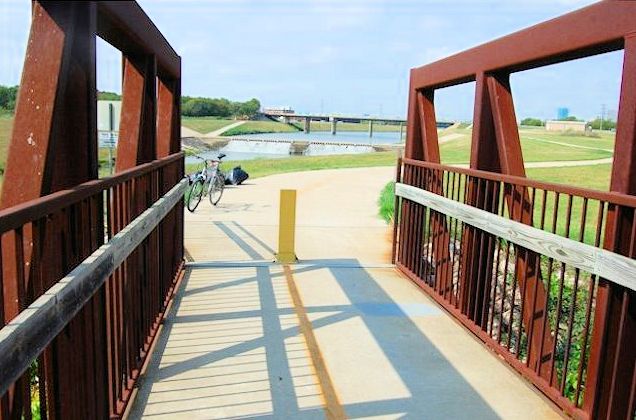
This photo is taken from a new pedestrian bridge (B on map) over the restored Sycamore Creek channel as it flows north from the new channel of the river. The tree-lined area across the river is the new outlet (N on map) where the creek flows into the river. O on the map is where the creek originally flowed into the original river channel.
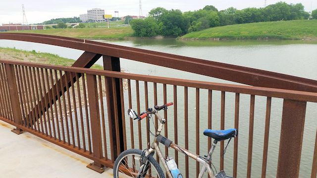
In this photo the new river channel is to the right of the pedestrian bridge. The restored Sycamore Creek flows under the bridge and curves around to flow into the restored original river channel.
This photo shows the restored Sycamore Creek carrying water to the restored river channel.
 Today at a simple rock dam the restored Sycamore Creek channel flows into the old river channel. In the upper left is a corner of the Meadowbrook drive-in theater screen.
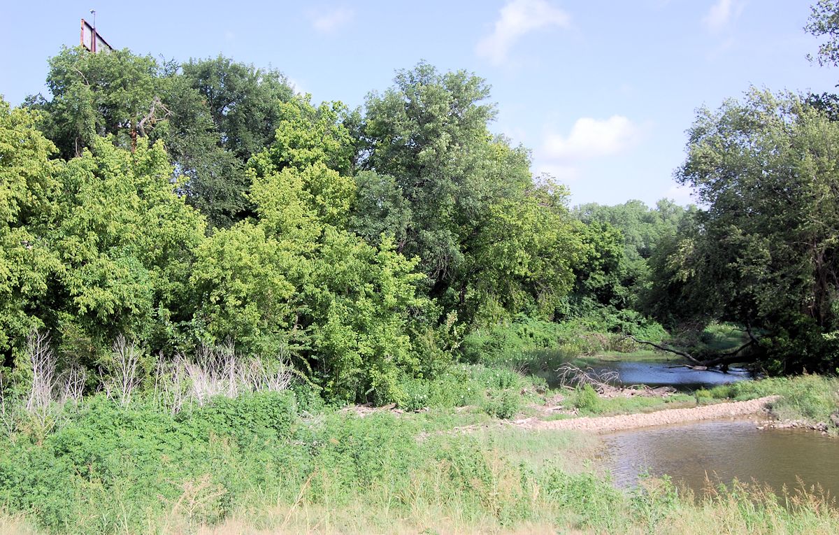
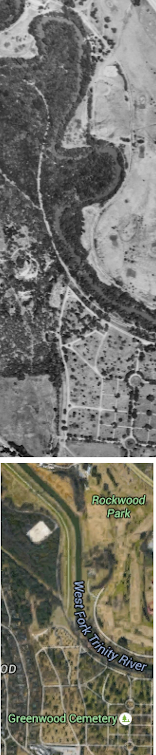 7. When you shoot a round of golf at Rockwood, the past plays through: You drive your cart past two tree-lined, boomerang-shaped arcs of the old channel of the West Fork. Use the two traffic circles in Greenwood Cemetery for reference.
 One arc is near a cul de sac on the course near the river.
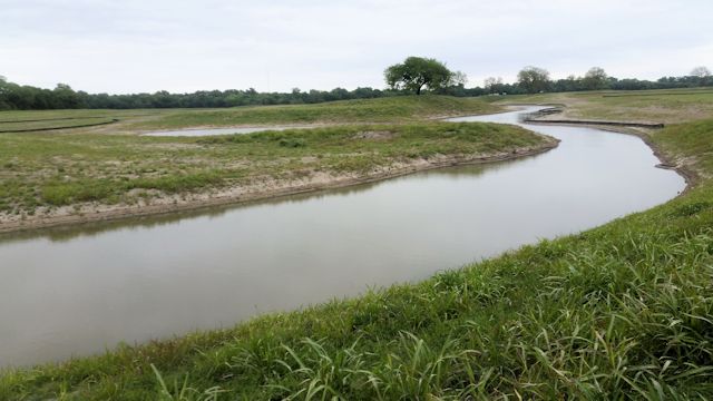
 The other arc is just west of the clubhouse and still has water in it. The foot path on the right is at the southern end of the arc.
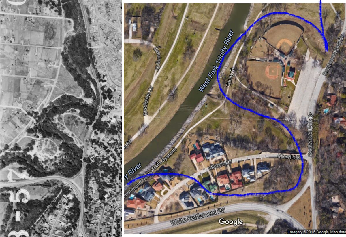
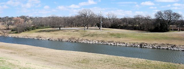
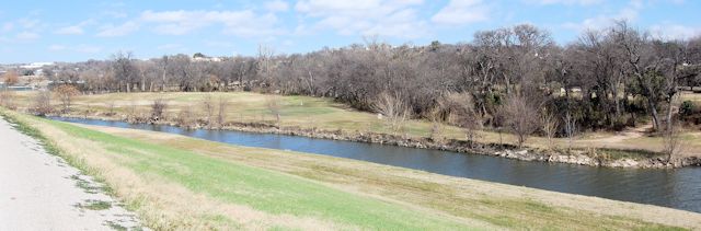
8. Kelly Park on Rockwood Park Drive north of the sharp bend in White Settlement Road sits in a curve of the old channel of the West Fork. Kelly Park has two Little League baseball fields. Blue line indicates the course of the channel before the river was straightened.
The outfield wall of the north ballfield follows a curve of the old channel, which holds water after heavy rain. The new channel and levee can be seen beyond.
The kids who shag flies in the outfield probably have no idea how close they are to the bad old days.
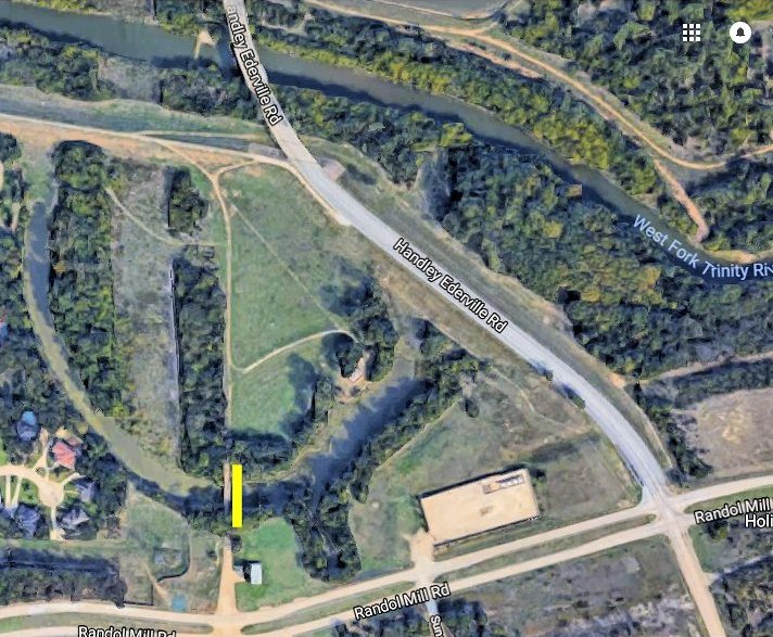
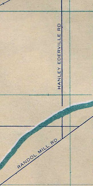
9. North of Randol Mill Road and west of Handley Ederville Road. The boomerang-shaped pond (left side of aerial photo) was a bend in the river with a bridge (next to yellow line) for Handley Ederville Road.
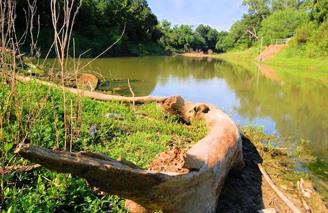 But in the 1980s the river was straightened to the north and Handley Ederville Road was rerouted to the east, resulting in a bend of the river and the bridge being orphaned.
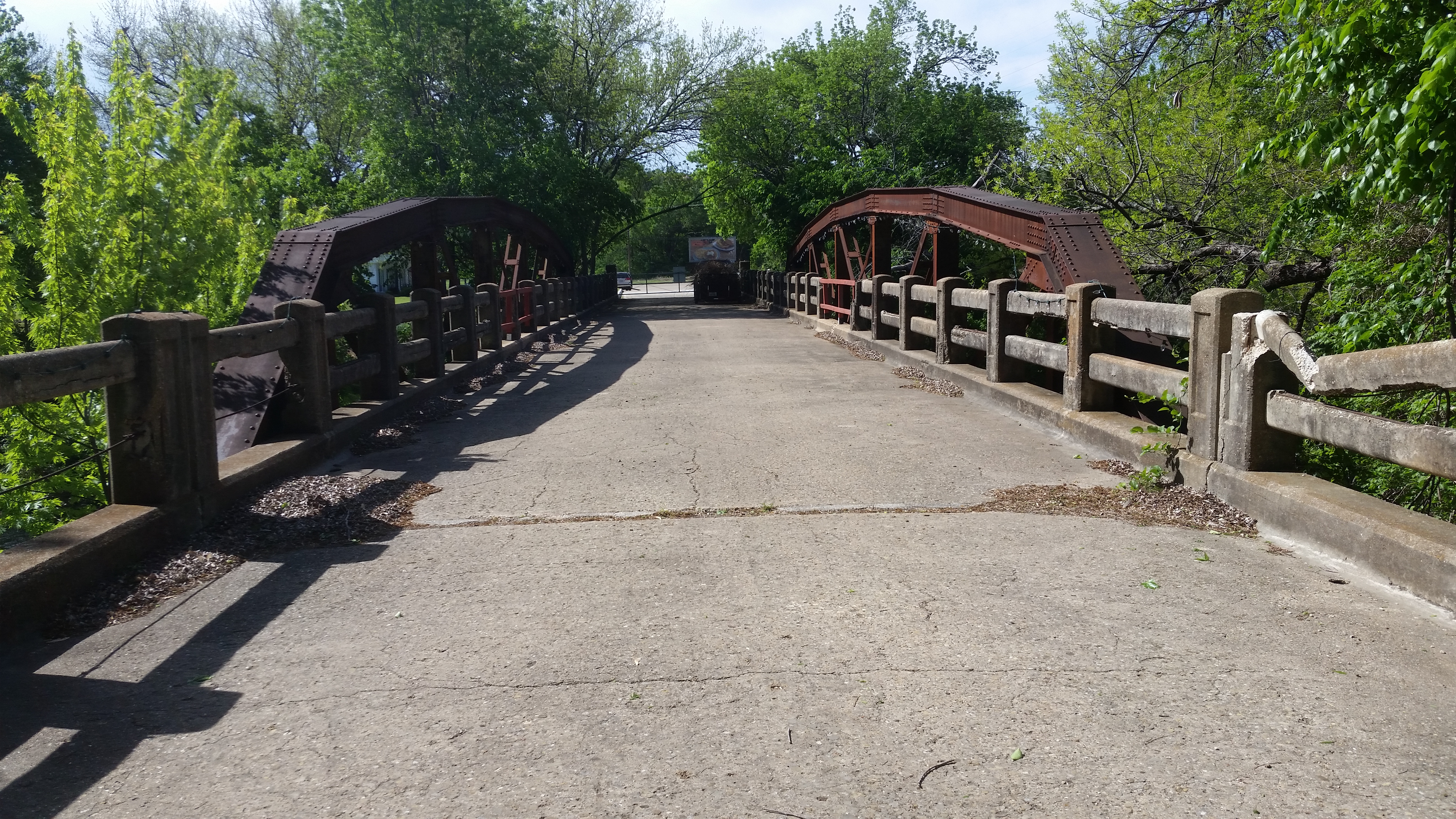 The bridge to nowhere. The bridge still crosses what once was the river, but only a few yards of the old Handley Ederville Road still exist, now on private property.
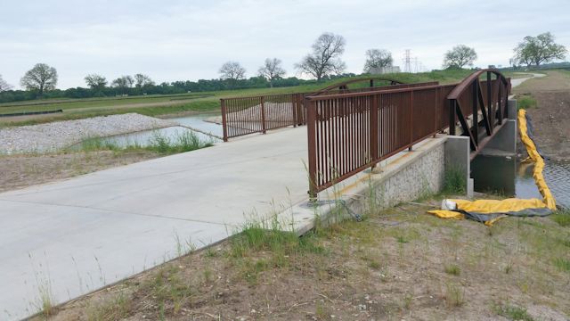
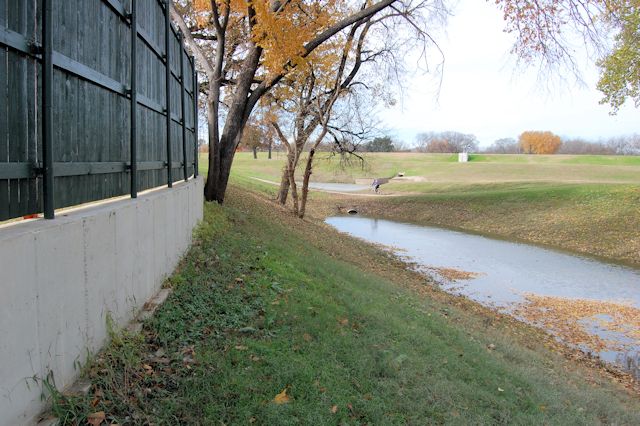
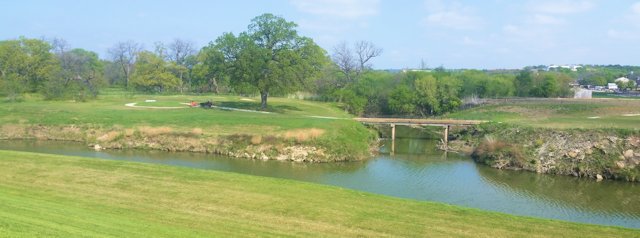 10. When Rockwood Golf Course was remodeled in 2016-2017 a new hole was added on the western side of the course. This photo shows the green on the left. To reach that green golfers must cross the small bridge over a stream that empties into the river.
That stream is part of the original channel of the West Fork, cut off when the new channel bypassed it.
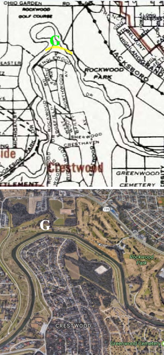 The 1945 city map shows the old channel. The loop of the old channel almost completed a circle. The yellow curved line shows the new channel. The green G indicates the location of the Rockwood green. In the aerial photo the white G indicates the location of the Rockwood green. The old channel to the left of the G has been filled in, but the surviving section of the tree-lined old channel wraps around the G and empties into the new channel.
These ten ghosts are reminders of a flood-control project of more than a half-century ago, a project that required years of work and cost millions of dollars—and surely has saved many lives.


Another great post! I’m old enough to remember the river in its wild state, as well as all the construction. When I was a mere pup, my family lived in the old Parkview Apartments on Camp Bowie, where the Modern Art Museum is now. The 1949 flood didn’t quite reach our unit, but it scared my mother to death. She never forgot it and was forever grateful to the Corps of Engineers.
Thanks. I bike along some part of the river every day and still marvel at the enormity of the floodway project. The river is easily handling the recent rains. That might not have been the case seventy years ago.
Thank you for the info. I would like to share this link on our Community Facebook, if it is OK with you 🙂
Be my guest, Judy.
Thank you for the river information and history. I can remember, as a kid, the river from the 7th Street Bridge. There were trees lining the banks and tree branches in the water. A bend to the West was visible. I thought it was rather picturesque. After the river was straightened I ask my Dad why they cut the trees down and lined the banks with rip rap and he said, “So the river can get the hell our out of town”. Thinking back to the flood, which came within 5 blocks of our home, getting the river to hell out of town was a very good idea.
Thanks, Richard. I suspect that the Trinity River back then had about the water-moving capacity of Sycamore Creek today. When the river was suddenly given a Mississippi River’s worth of water after a heavy rain, it just couldn’t process it. We have had a record rainfall this year, most of it in May and November, and you can tell from the debris line along the bank that the river has been easily contained. The water coming over the Lake Worth spillway in May was an awesome thing to see.
I really enjoyed reading this post. We’ve not lived in FTW for long so never saw the old river.
While the current version is somewhat featureless, the work done to the Trinity certainly works. We live right by the river and in all the rain this spring watched how quickly it rose. Even though there was a huge amount of water flowing east (sorry, Dallas!), the only place in the downtown area where the river seemed to be slightly out of control was in the #5 area of your map, where the trail was slightly flooded.
Even so, the river would have to have been much higher before causing a problem and my doggie liked splashing around in the water anyway 🙂
Thanks, David. This week I can tell by the debris line on the bank how high the river has risen lately. And the low-water crossings are under water now. But before the floodway, rain like we had in May and possibly in November surely would have created serious flooding. I have video online of the river just after the May rain: Clear Fork, Lake Worth spillway, Airfield Falls, River Legacy in Arlington. Pretty intimidating.
Oh, I hope so, Mike. Sorry to sound so grouchy about it- I recently reread “Goodbye To a River”!
I bike along the river most days, and it is pretty featureless now, other than the water itself. And some wildlife. I like to watch the cormorants take off, using the river as a runway. And today near Samuels Avenue I saw a flock of about forty seagulls in search of a beach.
These little “ghosts” are pretty scanty remnants of the beauty and natural diversity that early settlers and later residents long took for granted. It’s probably only a matter of time before people notice that they can be filled, leveled, and “exciting new commercial, residential and retail” properties will appear, to sit half empty for decades- while their cheap architecture falls off in chunks. Meanwhile, the new river has all the visual interest and ecological importance of a giant bar ditch.
I hope I get to see the recovery of the Riverside oxbow. That orphaned arc is pretty much what the river looked like before the floodway project, minus water. The Gateway Park master plan supposedly will restore the old channel.