You’ve probably heard of Stove Foundry Road, which existed for decades in the southwestern part of town. But where did that street name come from? Was there actually a stove foundry? You bet your cast-iron kettle there was!
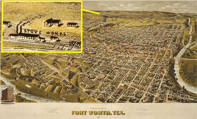 This 1891 bird’s-eye-view map of Fort Worth by American Publishing Company shows, out beyond the southwestern edge of town, seemingly on the edge of the Earth, the new “Stove Works.” Stove Foundry Road connected Fort Worth to the stove works.
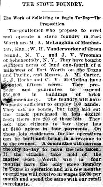 The stove foundry story began in 1889. The July 24 Fort Worth Gazette reported that a group of out-of-state entrepreneurs and three local investors had bought land west of town and would build a $50,000 ($1.3 million today) stove foundry if Fort Worth residents would help finance the project by buying lots adjacent to the foundry and building houses on the lots. Foundry workers—as many as one hundred—would live in the houses and provide income for lot owners. People starting a factory often would buy more land than needed for the factory so they could sell lots on the extra land to local residents to provide housing for factory workers and funding for the factory. Alternately, people planning a factory might make building that factory contingent on local residents buying a stated amount of stock in the factory.
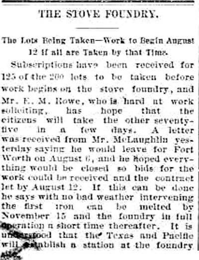 A week later, on July 31, 1889, the Gazette reported that 125 of 200 lots had been sold and that foundry manager M. A. McLaughlin hoped that construction of the foundry would begin soon. The foundry was located one block east of where today’s south Montgomery Street ends at the Union Pacific switchyard.
 The stove foundry opened on March 4, 1890, the Gazette reported the next day. A Gazette reporter was present at the opening and described the foundry: the furnace, machinery, moulding room, pattern room, railroad siding, piles of coke, coal, scrap iron, pig iron, wood. Nearby were the new houses for workers. Manager McLaughlin said the first grade of stoves turned out by the new foundry would be named in honor of Fort Worth’s Spring Palace because the foundry’s owners had learned about Fort Worth in 1889 through the Spring Palace exhibition.
 This photo of the stove foundry is in Photographs of Fort Worth. (Photo from University of Texas at Arlington Library.)
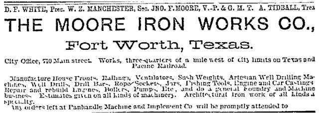 This ad in the March 31, 1891 Gazette shows that the foundry soon had a new name and new officers. The secretary was William Z. Manchester, a local capitalist who also had his hand—if not his name—in the Manchester Mills cotton mill in Polytechnic the same year.
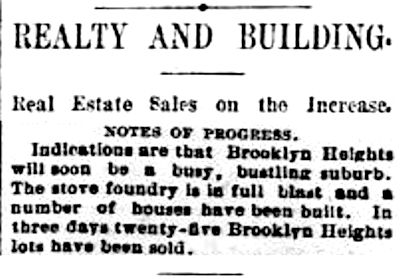 The stove foundry lured more nearby development, such as the Brooklyn Heights Addition (eastern Locke, Lovell, and Curzon streets). The December 11, 1890 Gazette reported that twenty-five lots had been sold in three days.
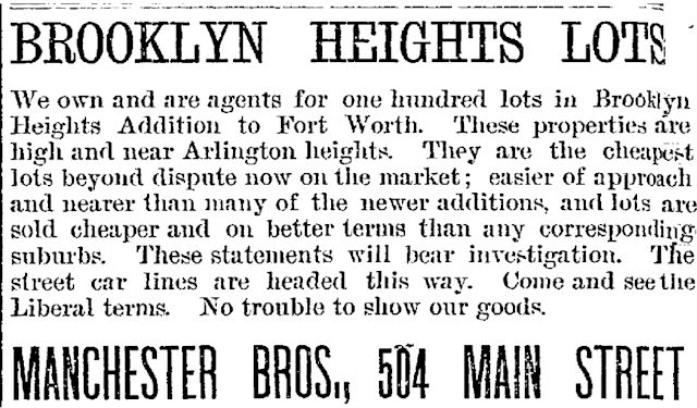 This ad for Brooklyn Heights in the June 21, 1891 Gazette promised liberal terms and streetcars. One of the “Manchester bros.” surely was William Z.
 Brooklyn Heights was quick to form a school district and even a literary and outing society. Clip is from the June 24, 1891 Gazette.
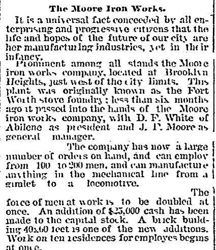 On May 3, 1891 the Gazette reported that the stove foundry could “manufacture anything in the mechanical line from a gimlet to a locomotive.”
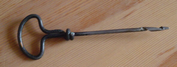 A gimlet.
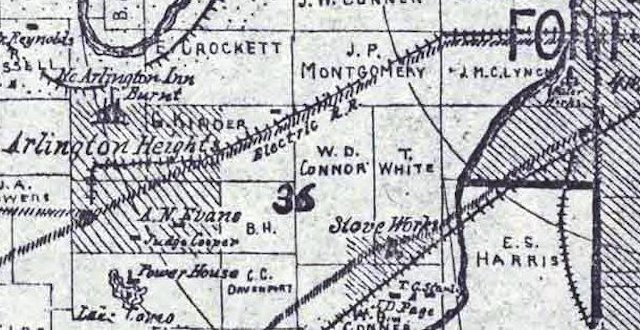 This 1895 county map shows the “stove works” as well as Arlington Heights, Lake Como and its powerhouse, the Arlington Heights “electric R.R.” streetcar line, and Ye Arlington Inn (at today’s Merrick and Byers streets), destroyed by fire in 1894. (That E. Crockett survey north of Arlington Heights belonged to Elizabeth, widow of Davy.) (Map detail from Pete Charlton’s “1000+ Lost Antique Maps of Texas & the Southwest on DVD-ROM.”)
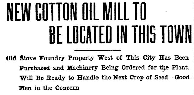 But by 1904, as people increasingly began to heat and cook with natural gas, the foundry had cast its last stove. This report in the June 15, 1904 Telegram said the “old” stove foundry would be converted into a cotton mill. Meanwhile, John F. Moore, former vice president of the foundry, had opened Moore-Holden Machine and Foundry on Hemphill Street.
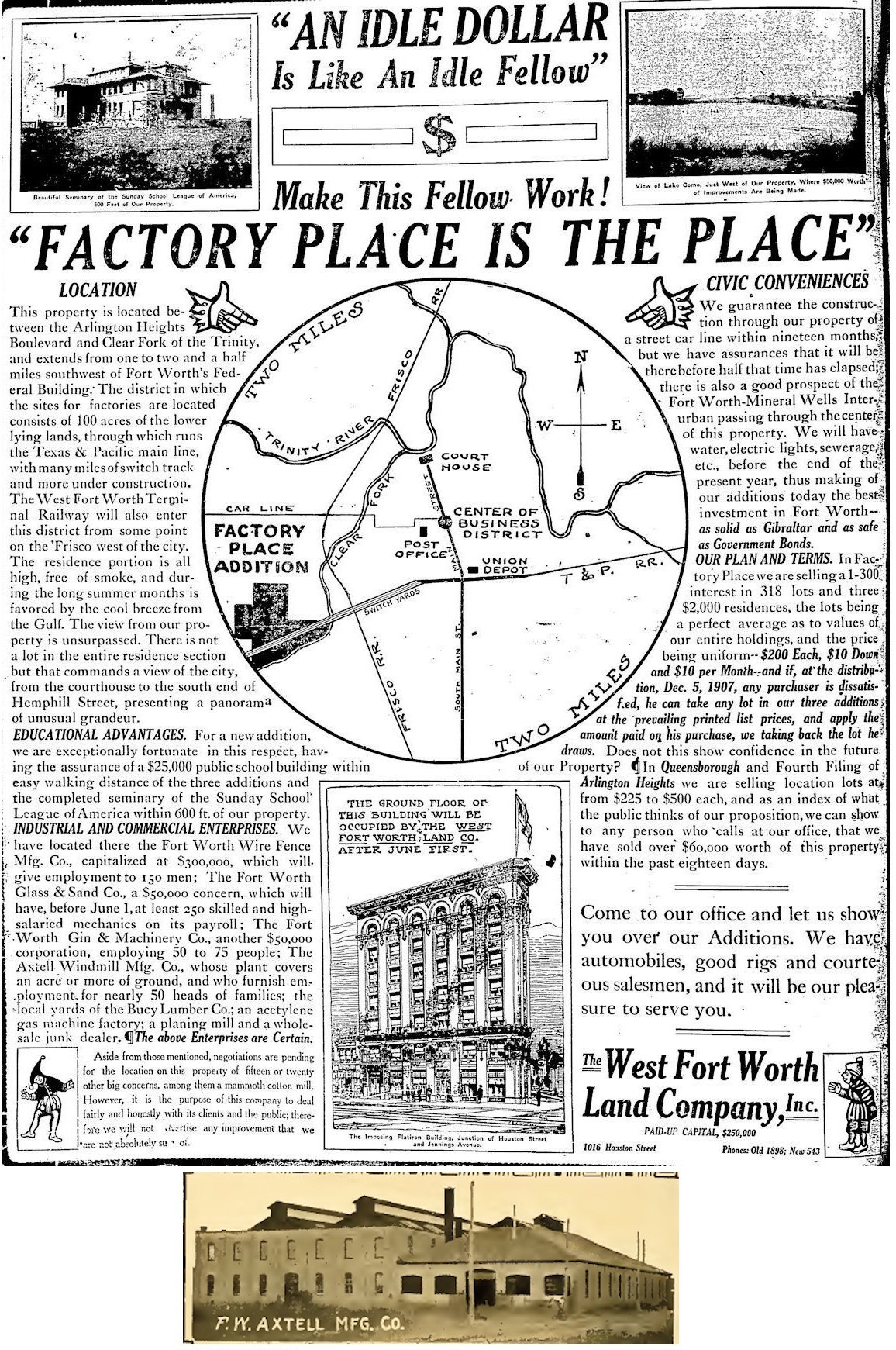 The stove foundry was history, but in 1907 West Fort Worth Land Company (occupying the ground floor of the new Flatiron Building downtown) began developing Factory Place Addition, promising both industrial and residential space in the industrial zone of the former foundry.
Among the businesses present or promised: Axtell Windmills, Fort Worth Wire Fence, Fort Worth Gin and Machinery, Fort Worth Glass & Sand, and Bucy Lumber. Homes would have “water, electric lights, sewerage,” and in the summer Factory Place Addition would be bathed by “the cool breeze from the Gulf.”
Axtell Windmills, representing another technology of the day, took over the stove foundry building about 1903. Photo shows the Axtell company in the slightly remodeled stove foundry building. In addition to making windmills, Axtell sold tanks, troughs, pumps, and hoses. Ad is from the March 24, 1907 Telegram; photo is from Greater Fort Worth, 1907.
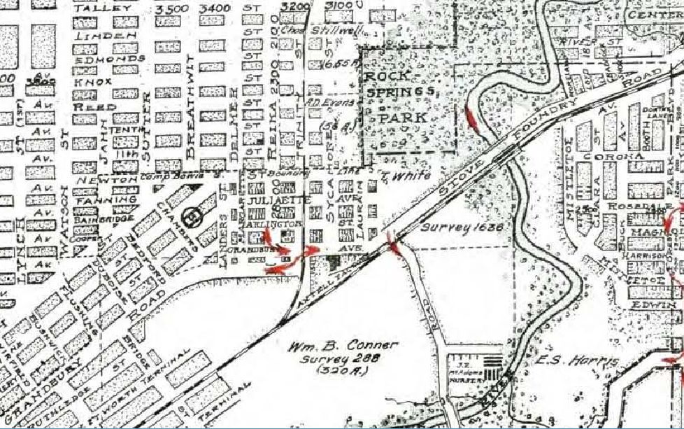 This 1920 Rogers map shows the “Axtell factory” southwest of Rock Springs Park (Botanic Garden). Reika Street became Montgomery Street by 1925.
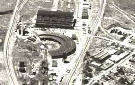 This 1930 aerial photo shows the factory to the right of the T&P roundhouse.
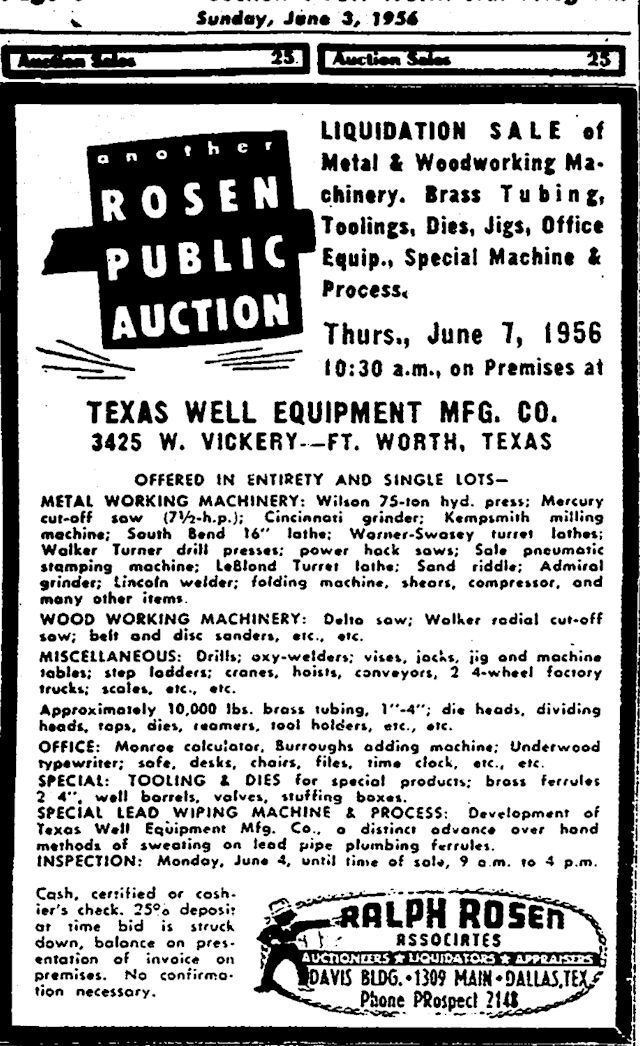 As the demand for windmills declined in the 1940s, the Axtell family made other well equipment in the old stove foundry building until 1956.
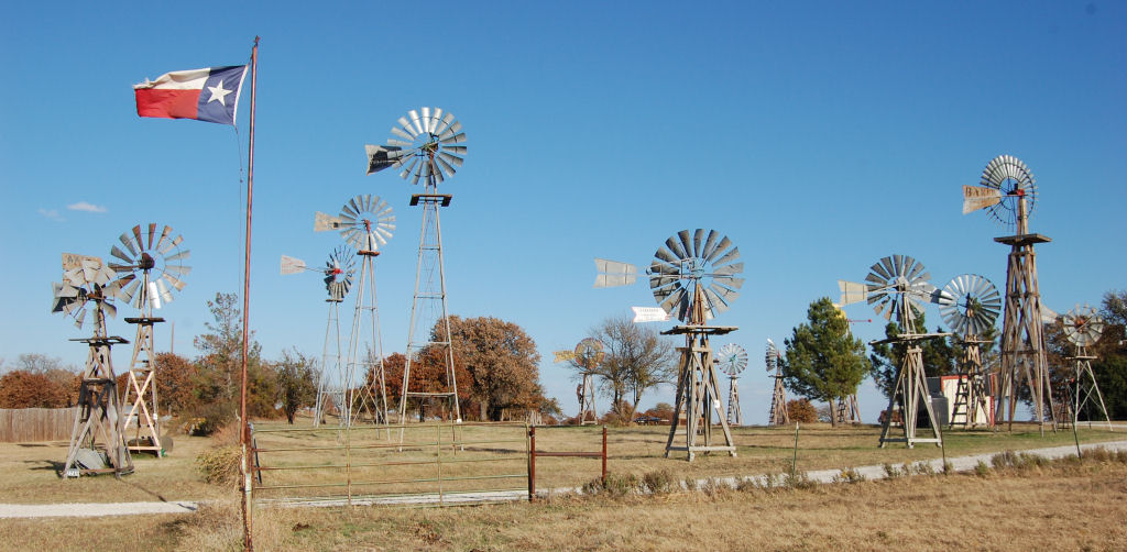 The windmill museum near Tolar has a couple of Axtell windmills on display.
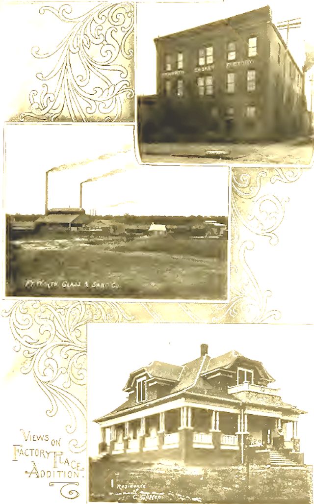 A page devoted to Factory Place Addition in Greater Fort Worth showed the Fort Worth Casket Factory, Fort Worth Glass & Sand, and the home of Cleveland Coffee, treasurer of West Fort Worth Land Company.
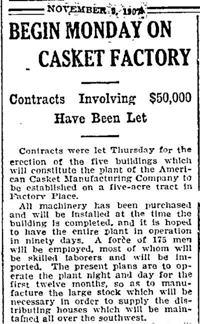 Fort Worth Casket Company was announced as “American Casket Manufacturing Company” in 1907. The plant would employ 175 workers.
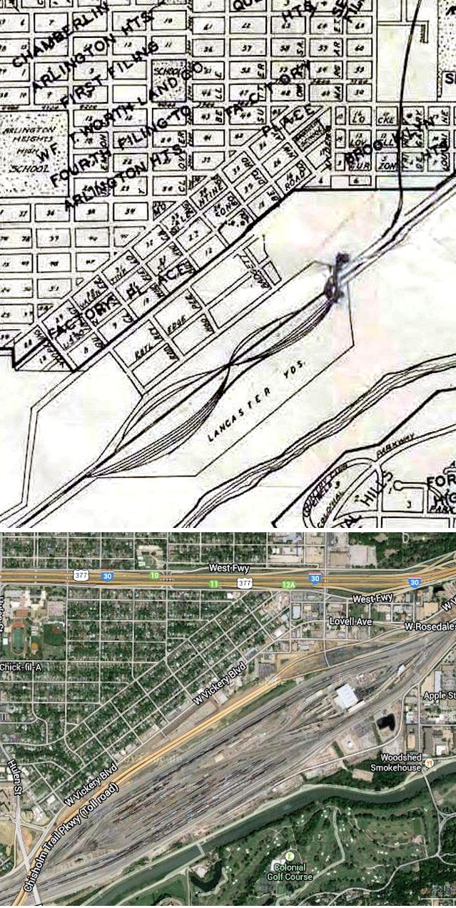 This map shows Arlington Heights, Brooklyn Heights, and Factory Place north of the T&P switchyard (named, as was the street, for T&P president John L. Lancaster of Dallas). Google map shows the area today, much of it taken by the expanded Union Pacific switchyard (named for UP CEO Richard Davidson), Interstate 30, and Chisholm Trail Parkway. (1936 map detail from Pete Charlton’s “1000+ Lost Antique Maps of Texas & the Southwest on DVD-ROM.”)
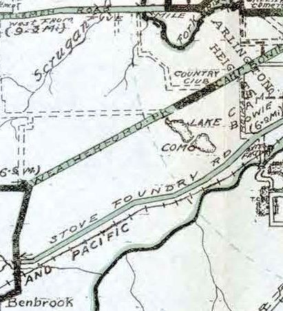 Into the 1920s, long after the stove foundry was gone, Stove Foundry Road was still so-labeled on maps, but the road also became known as “Granbury Road.” (1920 map detail from Pete Charlton’s “1000+ Lost Antique Maps of Texas & the Southwest on DVD-ROM.”)
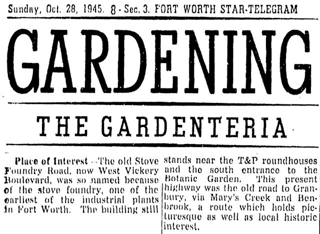 And then, in the 1940s, Fort Worth proved that the twain shall meet: Stove Foundry Road, which once connected Fort Worth to that then-distant factory west of town, was renamed “West Vickery Boulevard,” which was named for Richard L. Vickery, who had developed the Glenwood community to the east of town. The building was still standing in 1945.


FYI I spend ALOT of time on your site, I like my FW history….VERY INTERESTING, well done!!!
3039 N Glen Garden Dr in Fort Worth 76119 (or 3037 N Glen Garden Dr) is suppose to hold some historical significance, rumor has it the structure currently there dates back to the 1800’s as a school house, I was wondering if you could confirm that, I live a few houses over, and the owner of the school house told me this story, when we moved into the neighbor hood years ago but I haven’t found any information to back that, however I would assume you know where to go to find such facts? The house is very old and the architecture looks much older than the surrounding homes and its one of the only home structures I have EVER seen in the area with a basement, that’s not common in this area. Please advise if you can
Thanks
Thanks, Alexander. That’s intriguing. The Tarrant County Historical Resources Survey lists nothing. And the deed cards at TAD show nothing nearly that old. So I have no information.
That area would have been well outside the city limits in the 1800s, so a school there probably would have been a county school controlled by the country school board unless it was a private school.
Of course, the building could have been moved to that lot from elsewhere.
I hovered over those houses via Google satellite and saw nothing that looked especially old. A schoolhouse of the 1800s probably would have been board-and-batten or clapboard siding. A small schoolhouse would be simple, like a big shotgun house. My posts on the ward schools have several photos of larger schoolhouses of the late 1800s.
A basement is indeed unusual in this area.
I’ll pass this query along to another East Sider with a nose for nostalgia.
Thank you so much for this. I work at a land surveying company and I’m currently working a boundary that adjoins a platted neighborhood that is bounded on the south by “Stove Foundry Road”. When it comes to working with properties that that have deeds that refer to obscure/old streets and property owners, a site like yours is pure gold!
Glad to help. I rely on a CD of old maps (“The Lost Antique Maps of Texas” by the late Pete Charlton).
It the Stove Foundry Bridge still being used?
Rene, the original bridge where Stove Foundry Road/Old Granbury Road (now West Vickery) crossed the Clear Fork east of the foundry was demolished in 1930, replaced by a new bridge. The original bridge had been heavily damaged by the flood of 1908.
I’m glad you mentioned the Windmill Farm outside Granbury. I highly recommend it for everyone to go see. Who knew there are so many types of windmills?!
Thanks, Scott. One of my favorite “little” museums.