One mile upstream from the City Park dam on the Clear Fork of the Trinity River where the two Coughlin siblings drowned in 1898 (see Part 1) was another dam that provided Cowtowners with recreation in the next century.
By 1909 the Texas & Pacific railroad had built a low-water dam at its bridge over the Clear Fork just south of today’s West Vickery Boulevard bridge over the river. The railroad impounded the water to supply its steam locomotives just as other railroads impounded Katy and Echo lakes.
The city had complained to the railroad, claiming the dam would interfere with the functioning of the city’s own dams on the Clear Fork, built to impound water for the city waterworks. But lawyers determined that the railroad had riparian rights to dam the river on its right-of-way.
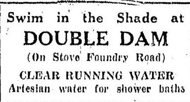 By at least 1921 the stretch of the river at the T&P dam became a popular swimming hole known as “Double Dam.” (Early in the twentieth century West Vickery Boulevard was called “Stove Foundry Road” and later “Granbury Road.”)
The Trinity River of Double Dam days was not the Trinity River of today. It was narrower and shallower (where not dammed), meandering, lined by shady trees. Double Dam would have looked more like Eakins’s The Swimming Hole than today’s Panther Island Pavilion.
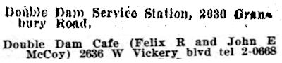 Double Dam lent its name to a nearby service station and café.
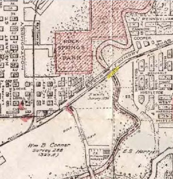 Even in 1925 Double Dam was barely in the city limits, surrounded by parkland and farmland. Only Stove Foundry Road and the T&P track crossed the river there.
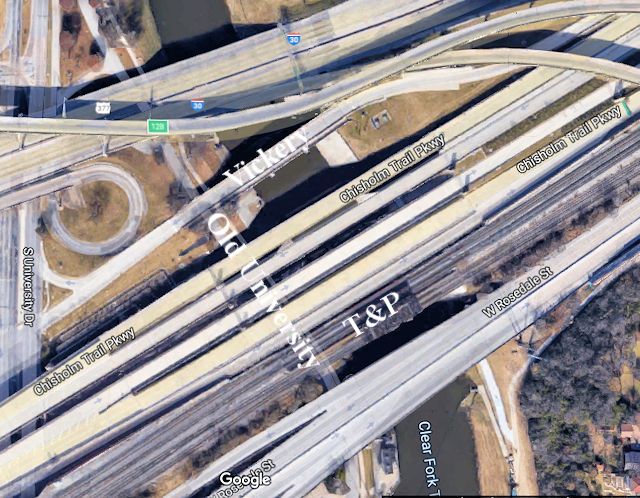 This is the Double Dam area today, the river now crossed by I-30, Chisholm Trail Parkway, and Rosedale Street in addition to Vickery Boulevard and the railroad—all in a swath just eight hundred feet wide. (Not to mention the Forest Park miniature train.)
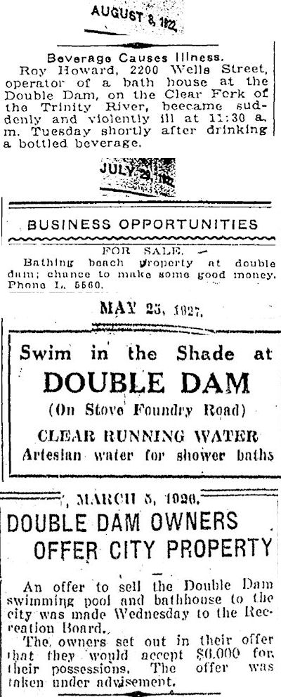 These briefs tell us that the stretch of the river at Double Dam had a privately operated bathhouse, beach, and artesian well. By 1926 the operators were willing to sell their improvements at Double Dam to the city.
By 1931 the city indeed had acquired the Double Dam area and incorporated it into the Trinity-Forest Park complex.
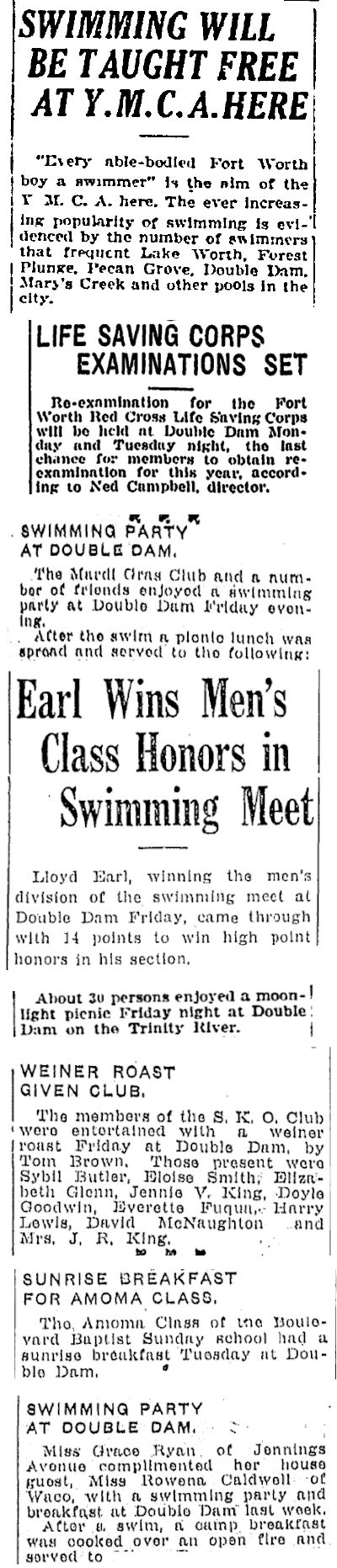 Double Dam was popular for swimming, fishing, picnicking, even ice skating.
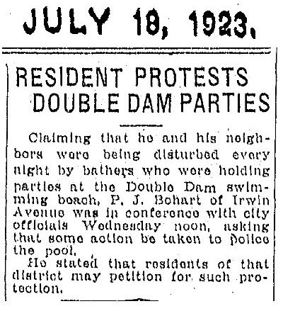 Sometimes the merriment became too merry for the scattered neighbors.
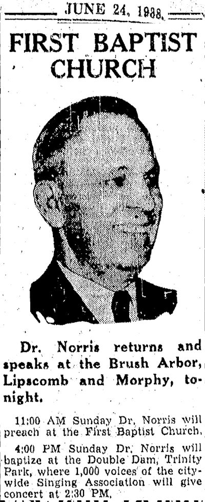
J. Frank Norris of First Baptist Church baptized people at Double Dam.
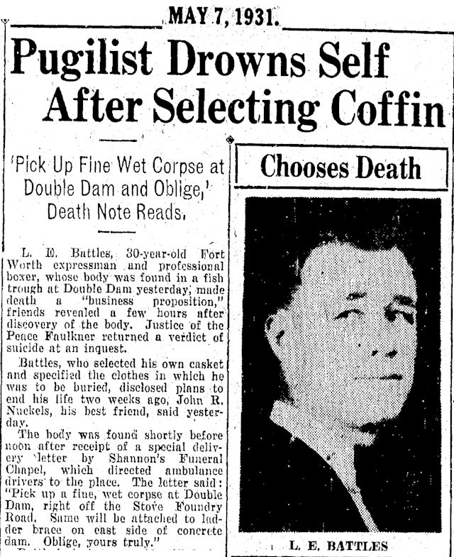 And one man, a boxer named “Battles,” chose to end his life there after picking out his coffin and mailing a macabre letter to Shannon’s Funeral Home.
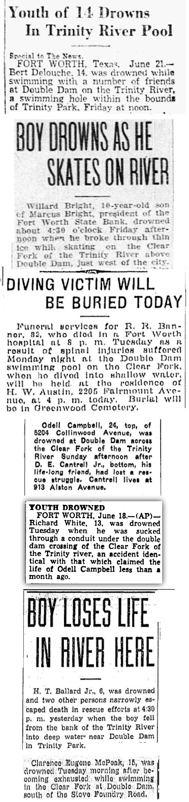 Others who died at Double Dam did so unintentionally.
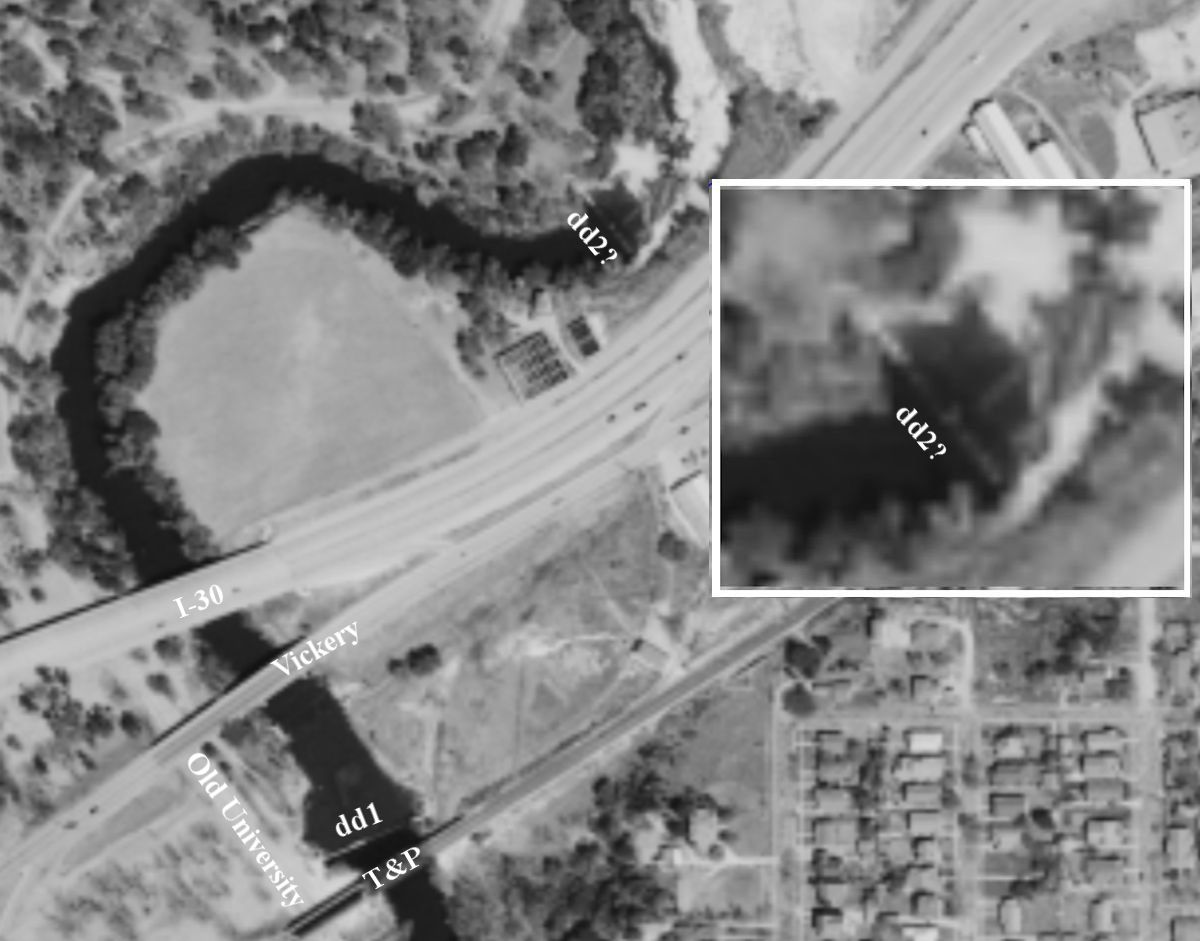
 This 1952 photo is the only one I have found showing “Double Dam.” A dam is shown almost under the T&P bridge over the river three hundred feet south of the Vickery Boulevard bridge. (As a point of reference, the house is on Mistletoe Drive on the bluff overlooking the river.)
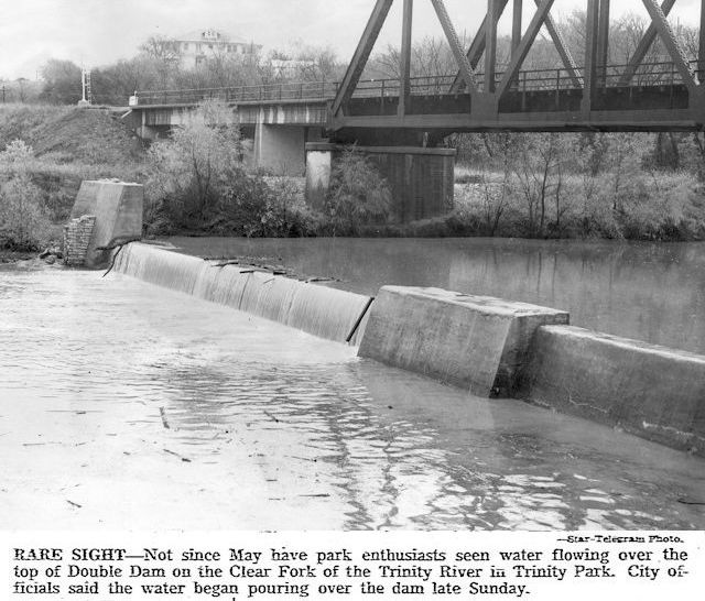
This dam was removed in the 1960s when the river channel was widened as part of the Trinity River floodway project.
Right about now those of you familiar with that stretch of the river might say, “Now hold your horses, Hometown. ‘Removed’? There is still a dam at the T&P bridge over the Clear Fork.”
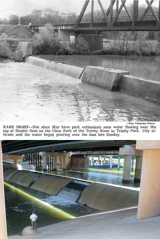
 Right you are. But it’s not the same dam.
Compare the two dams. Same location but different dams.
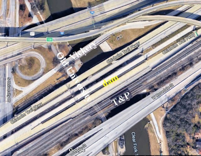
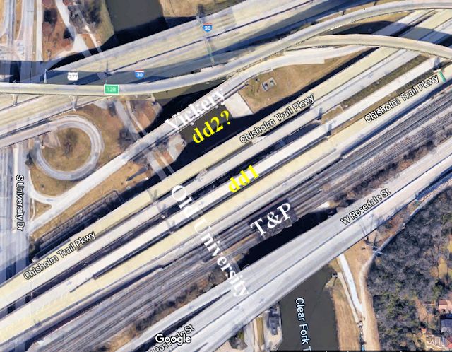
Today the dam is under the Chisholm Trail Parkway overpass, which in the middle photo obstructs a view of the railroad bridge just beyond. I have placed the label T&P to the right of the railroad bridge pier shown in the 1952 photo.
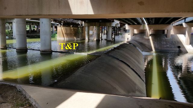 Here is the current dam from a reverse angle. I have placed the label T&P under the railroad bridge pier shown in the 1952 photo.
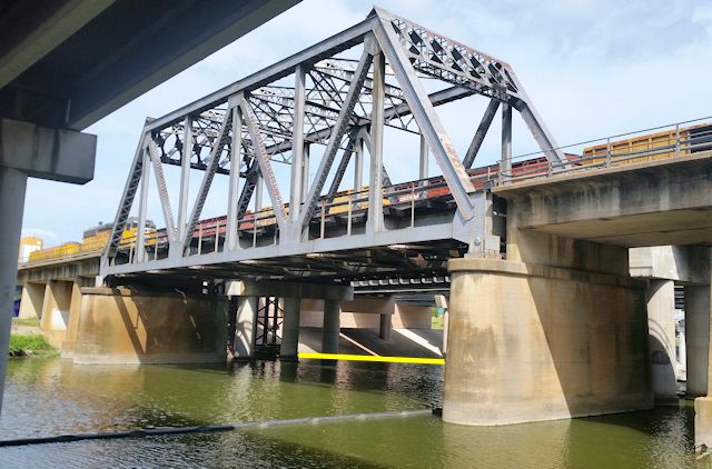
Here is a reverse angle of the T&P bridge. The yellow line is on the rim of the dam.
By the time the T&P dam was removed in the 1960s, the railroad no longer needed water for diesel locomotives and had no reason to rebuild the dam. But about 1968 the city built a low-water dam in the same location to impound water for the Clear Fork Pump Station, which pumps river water six thousand feet to the Holly water plant via a sixty-inch concrete conduit.
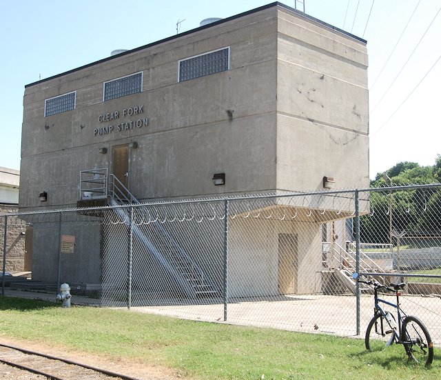
 The pump station (PS on aerial photo) is located four hundred feet upstream from the 1968 dam.
Right about now I hear you ask, “Now hold your horses again, Hometown. The Star-Telegram caption under that 1952 photo refers to that dam as ‘Double Dam.’ Not to quibble, but isn’t that photo one dam short of a double dam?”
Right you are again!
And indeed therein lies a mystery. Most news articles refer to “the dam” (singular) at Double Dam.
But no one would see a single dam and call it “Double Dam.” At least not sober.
The name itself aside, why else must we deduce that there was indeed a second dam in addition to the T&P dam?
I offer three reasons:
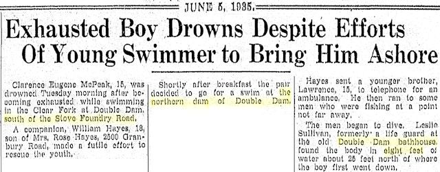
- This 1935 article refers to a second dam: “the northern dam.” The article also tells us the northern dam was south of Stove Foundry Road (West Vickery Boulevard), once had a bathhouse, and could hold at least eight feet of water. But we don’t know if “the northern dam” refers to the T&P dam or to the mysterious other dam.
Either way the second dam of Double Dam had to be one of the city’s four dams on the Clear Fork.
Newspapers of the time referred to the city dams as “dam no. 1,” “dam no. 2,” etc. and did not give precise locations, although dam no. 1 may have been the dam in City Park where the Coughlin siblings drowned in 1898.
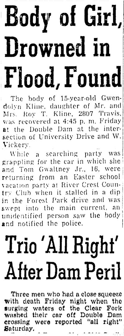
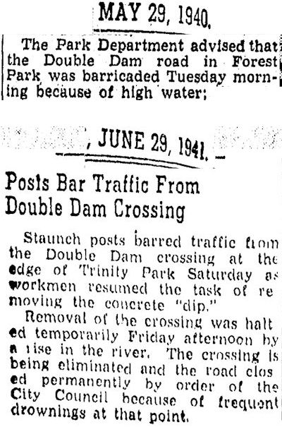
- There had to be a second dam because newspaper articles say cars were swept off the dam while crossing it in high water until finally the city closed the dam to automobiles in 1941. The T&P dam shown in the 1952 photo was not crossable by a car: It was too narrow, and it had obstructions at one end, in the middle, and probably at the other end.
- According to Charles W. Beavers, stepson of the owner of nearby Double Dam Service Station, “The name Double Dam came from the two dams on the Trinity River . . .”
So, Double Dam indeed was composed of two dams.
But where was the mysterious second dam? Upstream from the T&P dam? Downstream?
After hovering over old maps and aerial photos I found two possibilities. Let’s refer to them as “Candidate A” and “Candidate B.”
Here is Candidate A:
 A 1952 aerial photo shows what might be a dam on a bend of the river three thousand feet downstream from the T&P dam.
Now here is the full description of Double Dam by Charles Beavers:
“The name Double Dam came from the two dams on the Trinity River, one just north of West Vickery and the other just around the bend of the river south of Vickery.”
That description fits Candidate A: “north of West Vickery” and “around the bend of the river” from the dam “south of Vickery.”
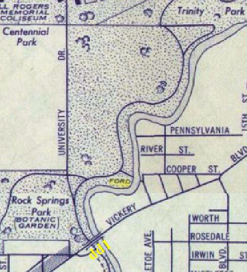 This 1939 map labels a ford for a park road at about the location marked on the 1952 aerial photo. Was that ford the crossable low-water dam of Double Dam?
Here is Candidate B:
 The 1956 aerial photo shows Candidate B just south of Vickery Boulevard. The rear edge of the top of the dam appears to be crenelated. The top of the dam may be obscured by water in the photo, but the concrete abutments on each bank appear to show the dam wide enough for a car to cross. The dam would have been closed to cars since 1941.
Remember that the 1935 article places “the northern dam” south of Stove Foundry Road.
Ah, but placing both Candidate B and the T&P dam south of Vickery Boulevard does not fit the Beavers description. However, Candidate B was only about three hundred feet from the T&P dam, and I think that the closer the two dams were to each other, the more likely that they would be linked as “Double Dam.”
Later aerial photos indicate that Candidate A and Candidate B, like the T&P dam, were removed when the river was widened in the 1960s. The bend in the river where Candidate A was located was orphaned when the river channel was straightened.
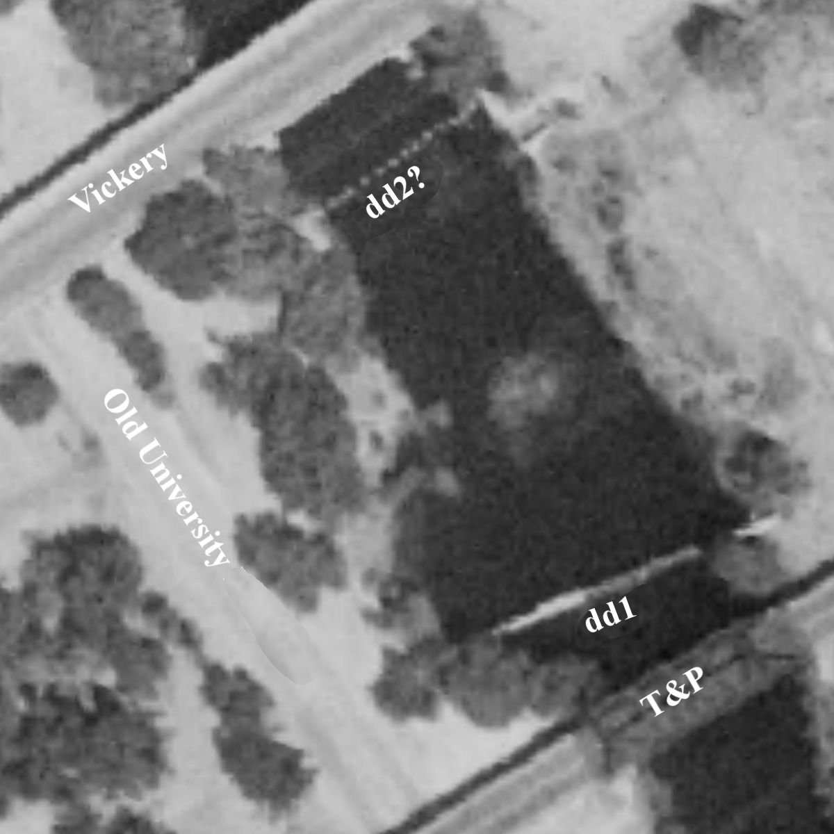
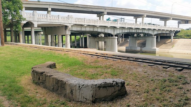
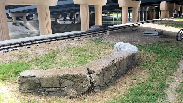 One more artifact to ponder: Now that we know more about Double Dam, I am intrigued by an old concrete structure that I have passed for years on the bike trail alongside Old University Drive. It’s located just two hundred feet from where the T&P dam was. You can see the current dam in the shadows under the Chisholm Trail Parkway overpass.
 And it’s located less than one hundred feet from where Candidate B was just south of the Vickery Boulevard bridge over the river.
 The concrete structure is in the circle.
 The concrete structure would have been in the circle.
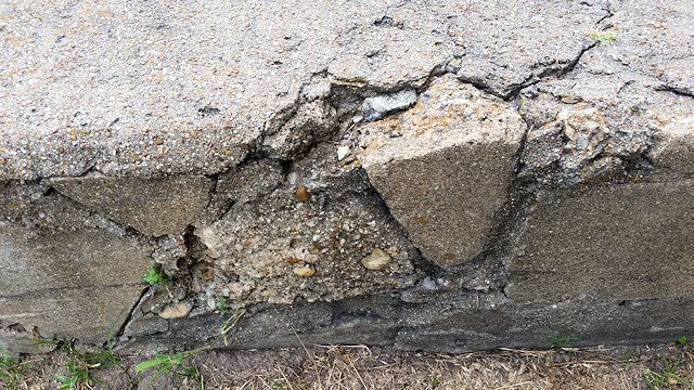 Could this concrete structure have been part of the bathhouse/beach area of Double Dam? I don’t think the city built this structure. Someone built it on a shoestring, recycling chunks of concrete instead of stone (compare the lovely stone masonry of nearby Botanic Garden). It could be the remnant of a larger structure that extended toward the river until finally one of the surrounding construction projects (widening the river, building the freeways, even laying the track of the Forest Park miniature train?) bit off the rest of it.
If the old concrete structure is a remnant of Double Dam, it’s the only one I know of. Oh, there was one remnant that survived at least into the 1960s:
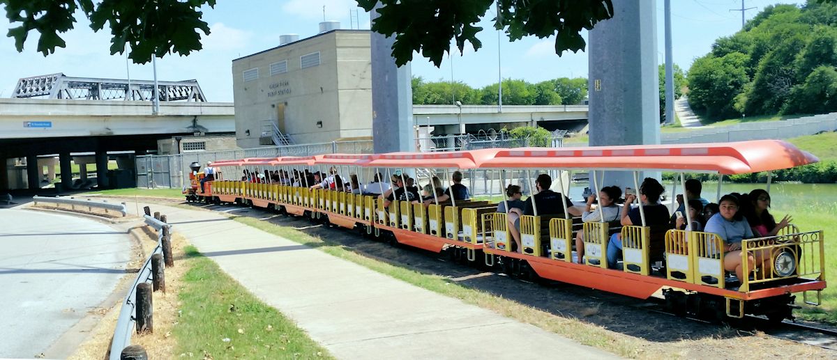 Fort Worth historian Barbara Love Logan says that at the nearby concession stand of the Forest Park miniature train once hung a sign reading “Double Dam.” But some passengers complained about the twin profanity, so park officials removed the sign.
Double darn!


From your article. “This 1939 map labels a ford for a park road at about the location marked on the 1952 aerial photo. Was that ford the crossable low-water dam of Double Dam?”
The dam was about 100 yards up stream from what is labeled ford on your 1939 map. The street that ran from Vickery directly to the ford was Moreland. One of your articles shows the crossing was destroyed and barricaded in 1941. I lived in the house closest to the barricade in 1946. The asphalt remains of the low water crossing were huge and clearly visible at that time. The article that refers to cars being swept off the double dam crossing probably means the low water crossing at the double dam, not the dam its self. Neither dam was wide enough for a car to cross. I have another newspaper article from 1944 about a rescue at double dam that names my step-father and the street address where I lived .
The dam near the T&P and Vickery was built sometime prior to 1897 as Clear Fork Dam No 2.
An article in the October 18, 1899 “Fort Worth Register” indicates that it was located “above the Texas and Pacific bridge.” The same newspaper had an article from May 30, 1901 about a man who drowned in the river a quarter mile above “Dam No. 2 or what is perhaps better known as Texas and Pacific Dam.”
It was one of four dams built by the city waterworks department during the 1890s to supplement the city’s water supply, which mostly relied on artesian wells, with surface water for sprinkling the dirt streets and fire protection and as a backup for drinking when artesian wells became low. I have seen some articles that imply that there might have been, at some point, five dams – but most mention that four existed.
According to a “Register” article from May 9, 1901 all of the dams were combination stone and concrete with the exception of Dam No 1 located in today’s Trinity Park under what is now the Lancaster Street bridge which was a wooden dam.
One of the dams actually still exists! Dam No 4 (or, if there were 5 dams, it is possible it might have been Dam No 5) is along the Trinity Trails in Oakmount Park. Here is a Google Maps Street View – click on the arrow at the top left to see the location mapped:
https://goo.gl/maps/nmNfeKJJ4JgaVK5n9
I have not been able to find exactly where Dam No 3 was. I have seen a few mentions that make me suspect it might possibly have been either at or near the location of a modern dam just to the northeast of Southwest Blvd where the river transitions from flowing through its original bed into the modern channelized flood control bed.
https://goo.gl/maps/aUFP47xAGLW6euFL8
Google Maps shows a concrete object that makes me curious if it might be a remnant of the older dam – assuming that the dam was even at that location. When I get a chance I check it out in person – but I am not sure when that might be:
https://goo.gl/maps/DVpM4rUfSCLtNjKCA
Sadly, images on Historic Aerials before the river was channelized are too blurry to prove or disprove whether that was the location of Dam No 3.
The “Star Telegram” reported on April 26, 1911 that the city ordered an immediate stoppage of work on a dam that the T&P railroad was constructing on the Clear Fork of the Trinity River below Dam No 3. It said that under the new city charter, the city was given control of both forks of the river for a distance of ten miles. The stoppage was taken to protect the city’s control of the stream. It stated should the Clear Fork be determined for the site of a new reservoir the railroad dam might interfere with the city’s ability to let water down the river temporarily to save the cost of a pipeline.
But, on November 7, 1928 the paper reported that “Use of the water from dams Nos 2, 3 and 4 on the Clear Fork of the Trinity River was granted the Texas and Pacific Railway Tuesday by the City Council, provided the road reconstructs Dam No 3 and maintains it along with the others. Request for the use of the water at the new Texas and Pacific roundhouse was made by R.L. Holmes, engineer in charge of water supplies for the road. Holmes explained that dams Nos 2 and 4 are not now in use but that if the road could get the water which would be impounded by them it would reconstruct and maintain them. It is now using water from dam No 3, he said. The council turned down a proposal from the road that it surrender its rights in connection with the dams”
Also, I came across a photo of Dam No 2/Double Dam different than the one you posted on UTA’s website:
https://library.uta.edu/digitalgallery/img/20138683
Finally, I wonder if, perhaps, the fact that the dam had been built and known for a long period of time as “Dam No 2” might have also played a role in it later on being called “Double Dam”
Excellent sleuthing, Dismuke.
I remember riding the miniature train around the early 1960s when I was around eight or ten years old that the “Clear Fork Pump Station” at that time had a sign made of large stainless-steel letters that said “Double Dam Pump Station,” which my parents found to be rather amusing. I don’t know when the “Clear Fork” lettering was installed, but I remember that for many years the “Double Dam” lettering mounting posts were still visible where they were embedded in the concrete after the letters had been cut off.
Thanks for that detail. That may be the sign that Barbara’s source remembered.