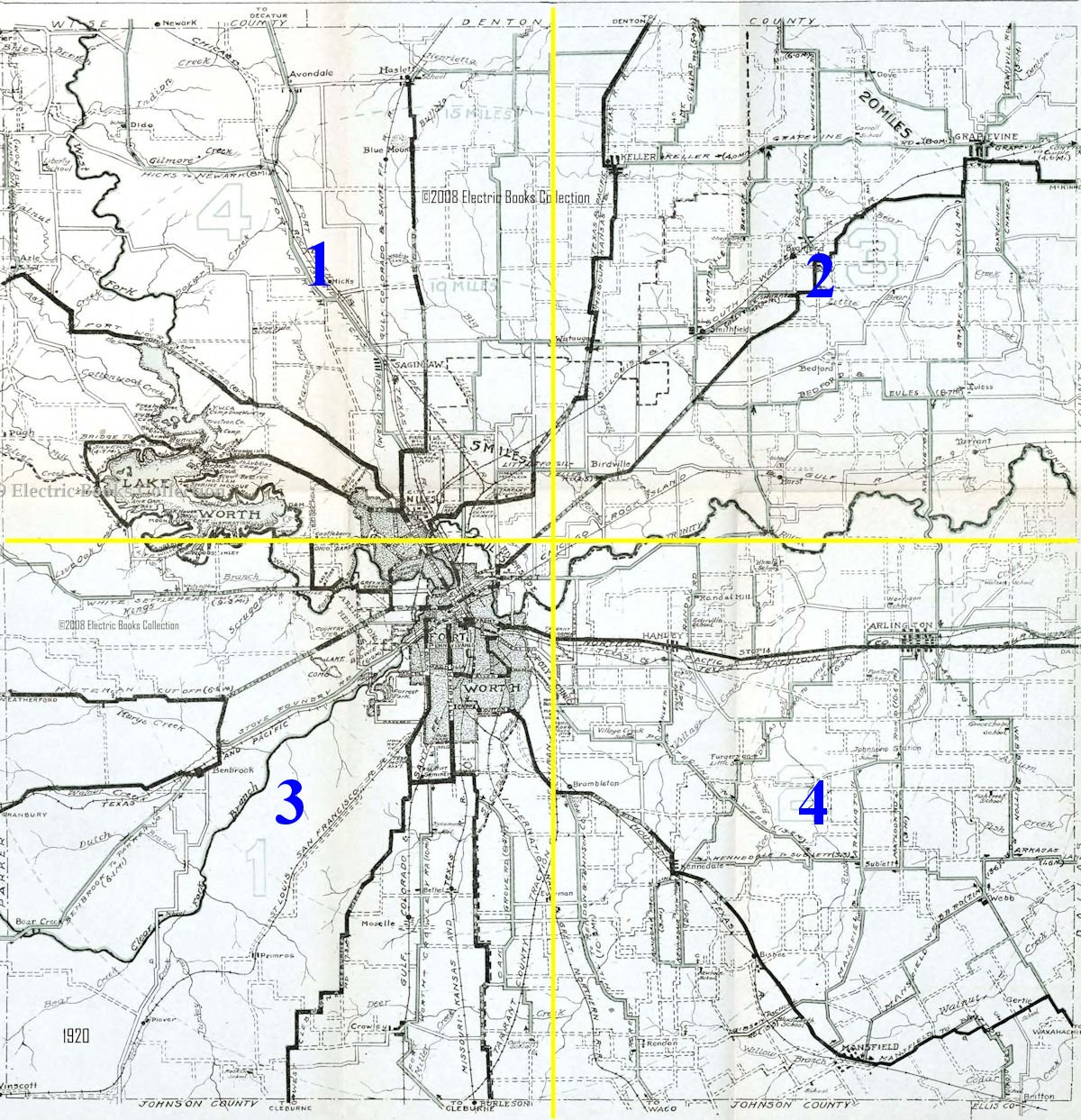
In 1920 Quadrant 3 (see Part 1) probably was the least populated corner of the county. However, through that sparsely populated area passed five railroads—Texas & Pacific, Katy, Santa Fe, St. Louis-San Francisco (Frisco), International & Great Northern—and the interurban to Cleburne.
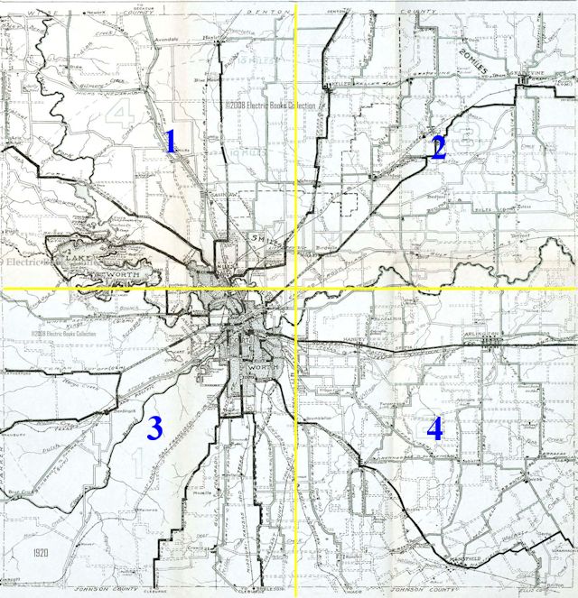
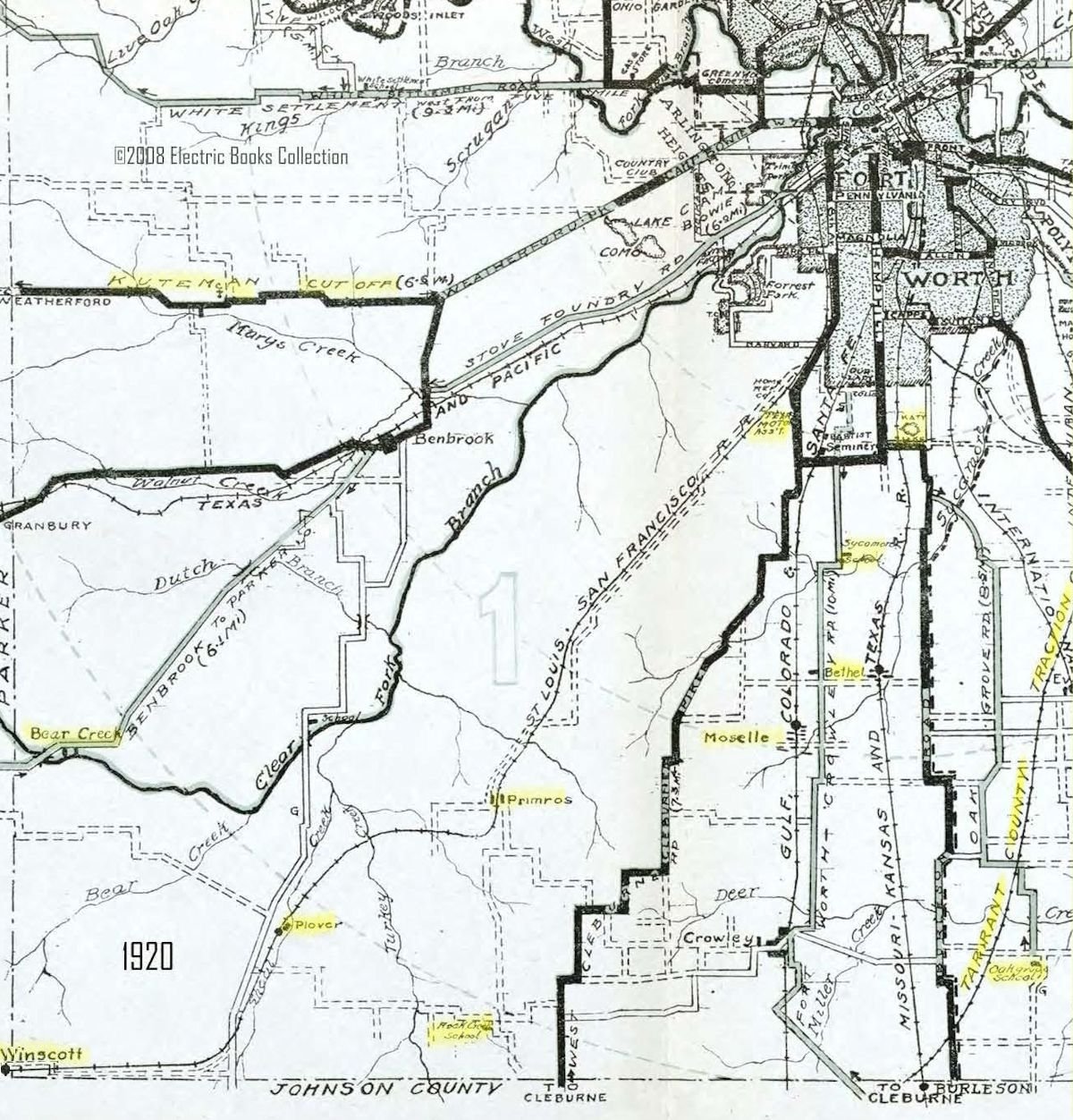
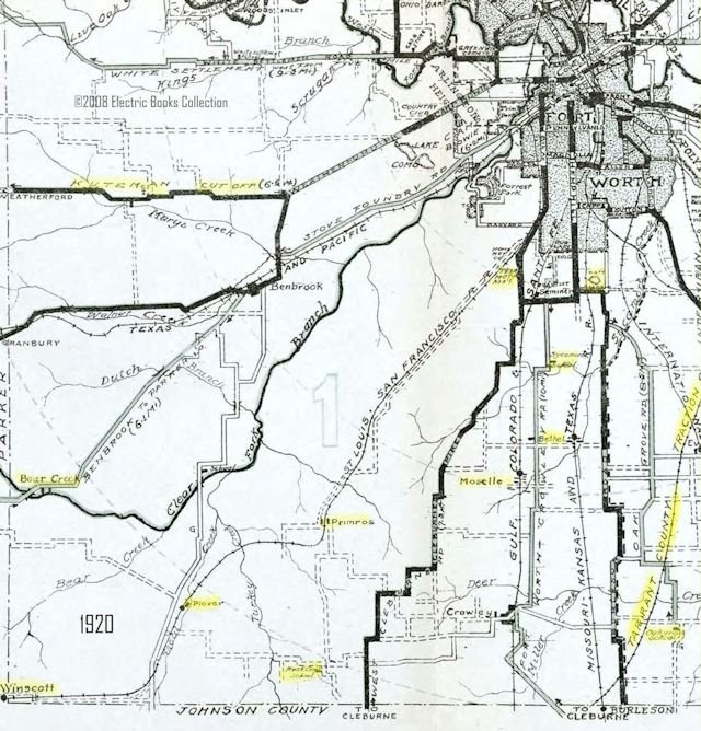 Place names in Quadrant 3 include the schools of Oak Grove, Rock Creek, and Sycamore, the communities of Bear Creek, Bethel, Moselle, Primrose, Plover, and Winscott, Katy Lake, Texas Motor Car Association, and Kuteman Cutoff. (See larger maps at bottom of post.) (From Pete Charlton’s “1000+ Lost Antique Maps of Texas & the Southwest on DVD-ROM.”)
 Harry W. Kuteman, born in 1861, was a Weatherford attorney and banker. He had once been a law partner of Governor James Hogg.
Kuteman also was an avid autoist. He and his 1908 Rainier were often mentioned in the local newspapers early in the twentieth century when merely driving a car was newsworthy.
In the bottom clip Kuteman’s route from Weatherford to Fort Worth was forty-two miles.
And therein lay a problem.
Kuteman, who often drove to Fort Worth on business, thought the road between Weatherford and Fort Worth should be shorter. The route in 1908 went too far south—from Weatherford down to Aledo and Benbrook and then back up to Fort Worth.
In 1913 when the federal government planned to cut a new post road between Fort Worth and Weatherford, Kuteman and others in Parker County began to lobby for an “air line” route—a straight line east to west. Such a route would be only twenty-eight miles. And on the unpaved roads of 1913, every mile mattered.
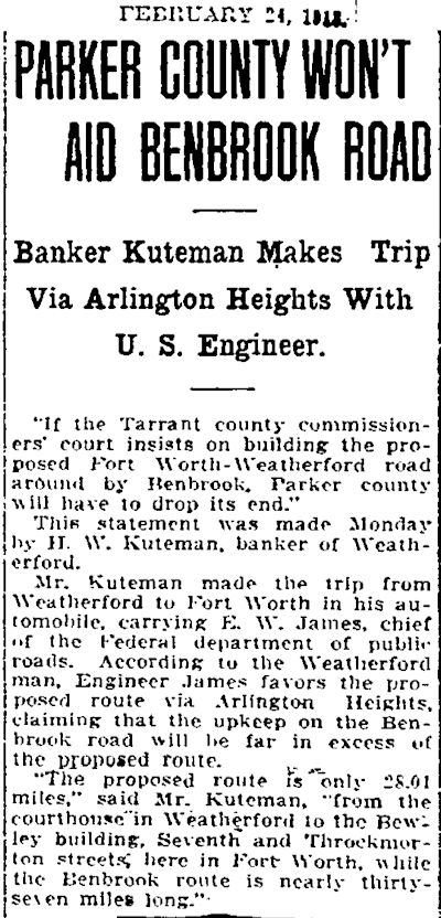 Proponents of the straight route secured right-of-way from landowners, but the straight route was controversial. The government also was considering a longer route to the south through Benbrook.
Kuteman and others from Parker County went to Washington to lobby for the straight route.
Harry W. Kuteman prevailed. The shorter route, named in his honor, opened in 1915.
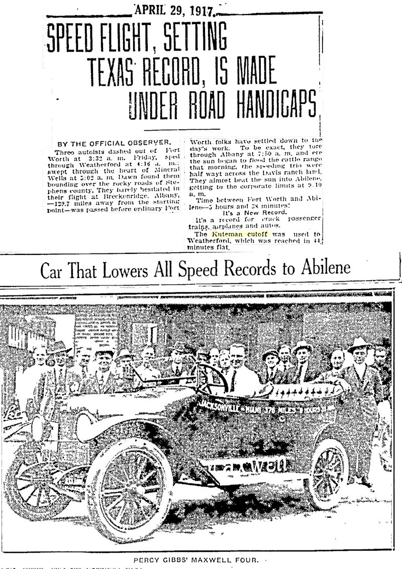 Two years later the Kuteman Cutoff was part of the route driven by three autoists who set a new record by driving from Fort Worth to Abilene in five hours and thirty-eight minutes.
The route of the Kuteman Cutoff was later used by the Bankhead Highway (the nation’s first all-weather transcontinental highway) and U.S. 80.
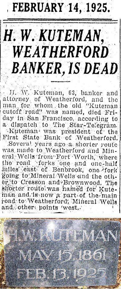 Harry W. Kuteman died in 1925.
(A few years later his daughter, Ina Kuteman Hill, met English portrait artist Douglas Chandor at a dinner party in New York City. They were married in 1934. In 1935 they began creating their ideal home and surrounding gardens, which they named “White Shadows,” on 3.5 acres of land in Weatherford. Workers used picks, shovels, and dynamite to turn a barren hillside into a lavish garden with English and Chinese motifs. Architect Joseph Pelich designed Chandor’s studio and the couple’s home. Today the property is known as “Chandor Gardens.”)
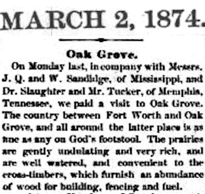 Twelve miles southeast of the Kuteman Cutoff in 1920 was the community of Oak Grove. In 1874 a representative of the Fort Worth Democrat visited Oak Grove and proclaimed it “as fine as any on God’s footstool.”
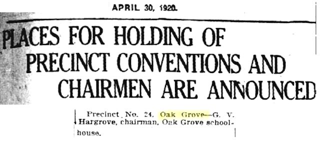 Oak Grove had a school, and, like most rural schoolhouses, the Oak Grove School was used for extracurricular activities.
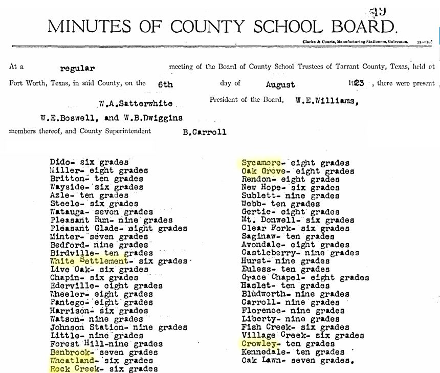 The minutes of a 1923 county school board meeting show the grades taught by each school. Oak Grove School taught eight grades. To the west Rock Creek School, named for the nearby creek, taught six grades.
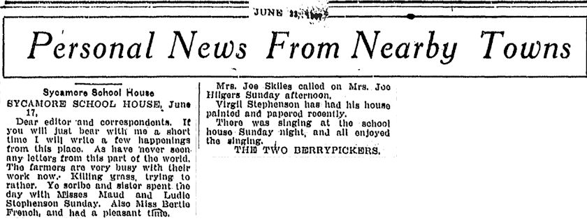 Sycamore School, also named for a nearby creek, taught eight grades.
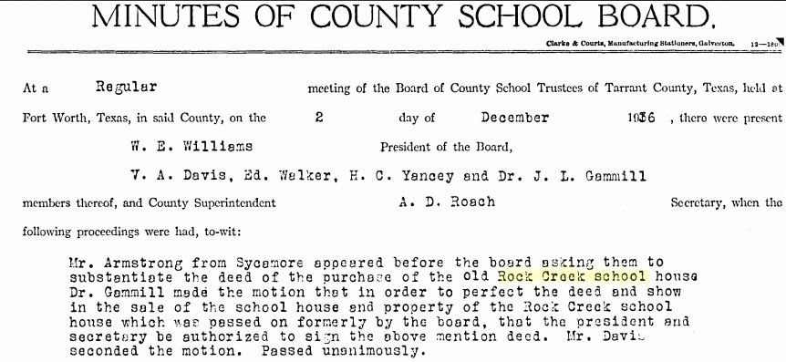 In 1936 the Sycamore school district bought the Rock Creek School.
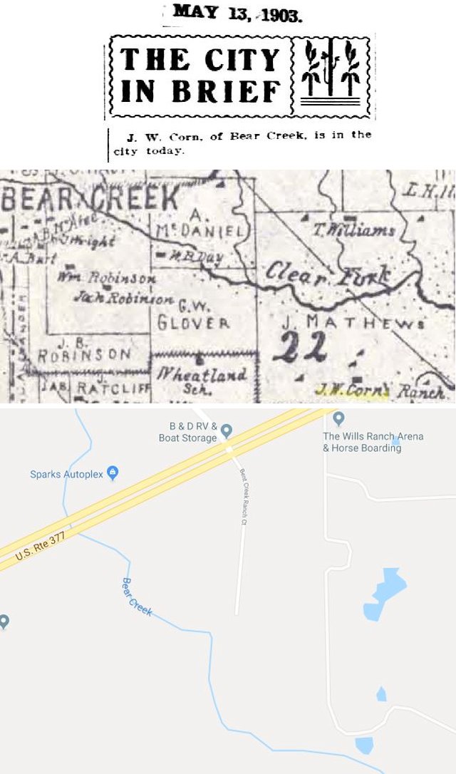
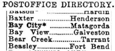 Although the 1920 map shows the community of Bear Creek to be on the Clear Fork of the Trinity River, the community was named for the nearby tributary. One prominent resident was rancher J. W. Corn. James William Corn was born in Alabama in 1850. His family migrated to Johnson County in 1857. When he was eighteen he took to the Chisholm Trail with no assets except the pony under him. He drove cattle north to Kansas for three years, saving his pay until he had enough money to start buying and selling cattle and let someone else do the driving. By 1895 he owned a ranch in New Mexico running four thousand head of cattle and the six thousand-acre ranch in Tarrant County running one thousand head.
 Quadrant 3 had five communities on railroad tracks. Bethel, on the Katy railroad, was typical. Although Bethel never had a post office, it served farmers and ranchers for twenty years or more. Then it disappeared.
Moselle, just southeast of Bethel, was founded on the Santa Fe track in 1882. By 1935 Moselle had a population of forty.
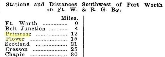 Three communities were founded on the St. Louis-San Francisco (Frisco) track. The Frisco by 1901 operated B. B. Paddock’s Fort Worth & Rio Grande railroad.
Primrose was a community center and rail station for farmers and ranchers. The Frisco track had a cattle switch on the ranch of J. W. Corn. The population of Primrose in 1935 was twenty.
Quadrant 2 had the community of Dove. Quadrant 3 had the community of Plover, named for the bird that was plentiful in the area. Plover’s population in 1935 was twenty-five.
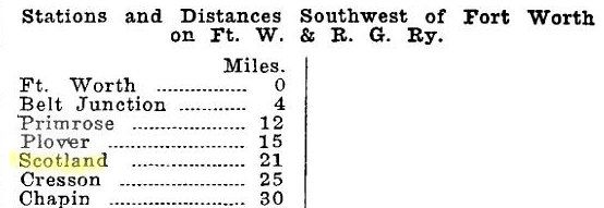 And then there was Scotland.
Scotland?
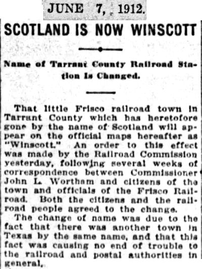 That’s what the “little Frisco railroad town” had been called until 1912, when its name was changed to “Winscott” because Texas already had a town named “Scotland.”
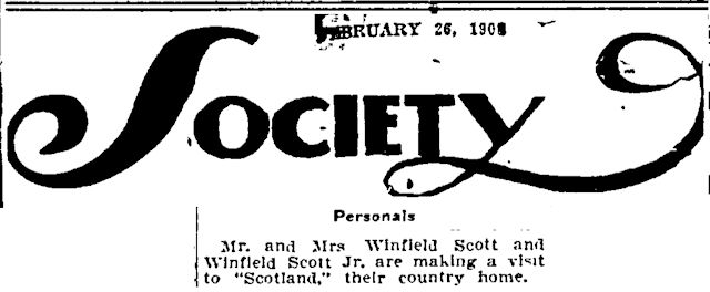 Either way, the railroad town was named after the nearby country estate of Winfield Scott. The estate was sometimes called “Winscott,” sometimes “Scotland.” Scott was one of Fort Worth’s most prominent capitalists (cattle, real estate, hotels). In 1911 he bought the Thistle Hill mansion on Quality Hill but died during its renovation. His estate was valued at $123 million.
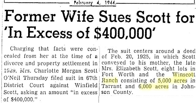 By 1920 Scott’s eleven thousand-acre ranch was a bone of contention between Scott’s son and the son’s ex-wife.
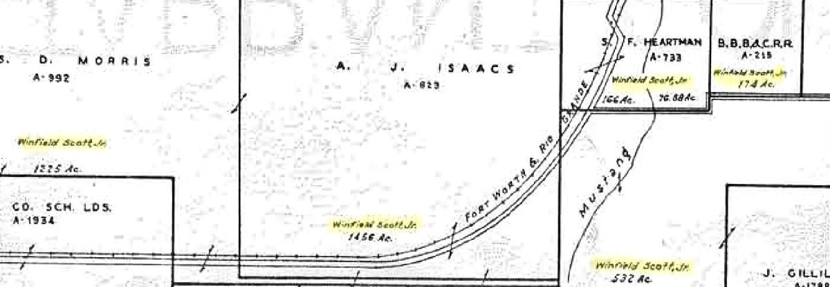 In 1941 the name of Scott’s son still appeared on tracts of land in Quadrant 3. In 1991 Ed Bass bought the ranch.
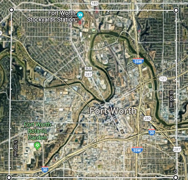 How big was the Scotland/Winscott ranch? Eleven thousand acres would measure just a scootch more than four miles on a side.
You’d love to own it, but you’d hate to have to mow it.


Chapin Elementary was also in this quad. All of the “Westland” area students attended through sixth grade and continued at Aledo or Arlington Heights. Westland is located at the intersection of FM 2871 (Longvue St.) and Camp Bowie West (old Hwy 80).
Thank you. I have a little about Chapin School in the posts on “pocket” cemeteries.