In the early days, before Fort Worth called itself “Panther City” or “Cowtown,” Fort Worth called itself the “City of Heights.”
(Did I just hear someone in Denver snicker?)
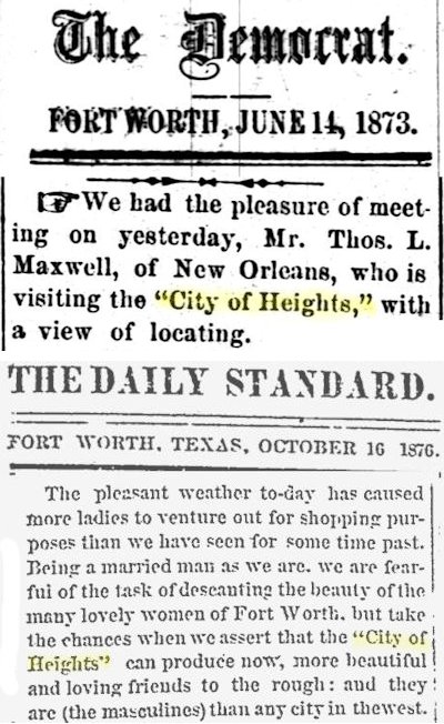 It’s true. Both B. B. Paddock’s Fort Worth Democrat and the Fort Worth Daily Standard referred to Fort Worth as the “City of Heights.”
Later in the nineteenth century as developers such as John C. Ryan began to market Fort Worth’s first housing additions, it was common for names of such additions to end with the word “Heights.” Hence Fort Worth has additions named “Arlington Heights,” “Polytechnic Heights,” “Sycamore Heights,” “Washington Heights,” “Shaw Heights,” “Prospect Heights,” “Lexington Heights,” “Fostepco Heights,” “Bowie Heights,” “Mistletoe Heights,” “South Hemphill Heights,” “Brooklyn Heights,” “Rosen Heights,” and “Frisco Heights.”
“How about ‘Hills’?” I hear you ask.
You betchum. We got “Eastern Hills,” “Western Hills,” “South Hills,” “White Lake Hills,” “Colonial Hills,” “Westover Hills,” “Melody Hills, “Richland Hills,” “Ridglea Hills,” “Diamond Hill,” and “Park Hill.”
Not to mention “Fairmount” and “Hi Mount.”
You can get a nosebleed just reading a city map.
But is the nickname “City of Heights” topographically justified? And how about all those “Heights” addition names? Are they justified, or are they merely high-toned marketing terms that were invented to make buyers in an addition envision being able to look down upon—literally and figuratively—residents in other neighborhoods?
Looking beyond Fort Worth, a wider question: Just what is the nature of Tarrant County’s topography, its high and low elevations? What can you see from where and why?
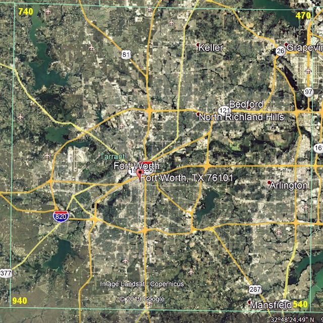 For starters, this map shows the elevations of the four corners of the county. The elevation drops from 940 and 740 feet on the west to 470 and 540 feet on the east.
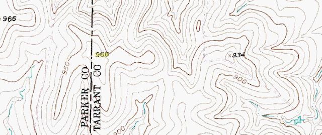 A United States Geologic Survey topographic map confirms that the western edge of the county is the highest part, much of it 700-900 feet above sea level, with 966 feet on the Tarrant-Parker county line being the highest point in Tarrant County.
The tightly packed contour lines on the map also show that the western edge has the county’s most undulating terrain. (The distance between two contour lines represents ten feet of difference in elevation.)
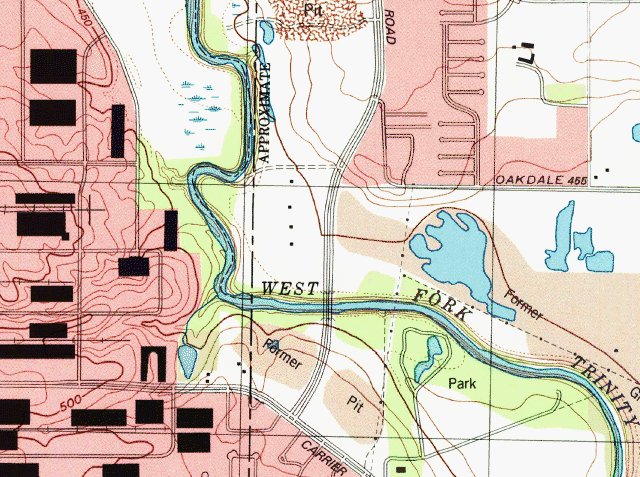 The topo map shows that the eastern edge is much lower—450-500 feet in the section shown. Note also the wider spacing of the contour lines—the topography is less undulating than that of the western edge.
If topography were expressed in terms of emotional states, the western edge, with its dramatic ups and downs, would be mood swings. Thirty miles away the eastern edge, with its low profile, would be apathy.
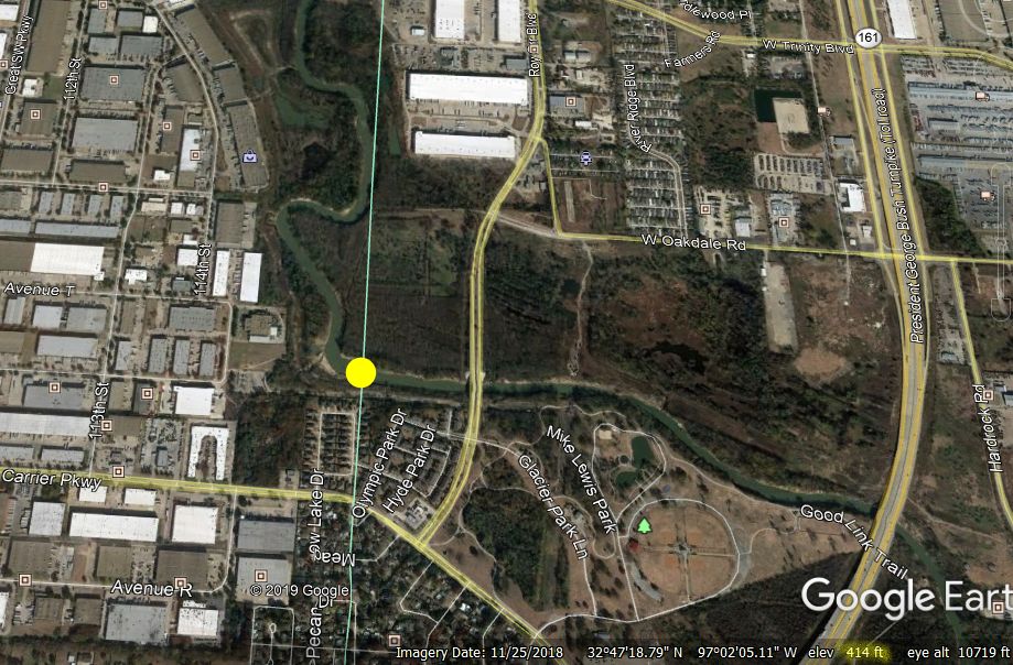 The lowest point in the county is on the eastern edge where the Trinity River flows into Dallas County as the river rides the Gravity Express to sea level. According to Google Earth geospatial software the river leaves Tarrant County at 414 feet. That’s quite a drop: The Clear Fork enters the county on the west at 727 feet. The West Fork enters the county (as Eagle Mountain Lake) at 647 feet.
That lowest point in the county is 552 feet below the highest point (966) feet on the western edge.
Ok. So, Tarrant County has a range in elevation of 552 feet across thirty miles. But Fort Worth, located in the middle of the county between the high and the low, has an average elevation of 653 feet and is relatively flat.
“Then how come,” I hear you ask, “there are places in town where we can see for miles?”
That’s because in a relatively flat area such as Fort Worth all you have to do to gain a vantage point is climb just a bit higher than your surroundings. Think of the stepped seating in a stadium or theater: You can see the field or stage because you are sitting just a couple of feet higher than the people in the row in front of you, who are sitting just a couple of feet higher than the people in the row in front of them, etc.
In Fort Worth an elevation of 100 feet or less can clear trees and most buildings and provide a view for miles.
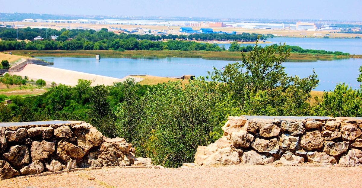 For example, in northwest Fort Worth, Inspiration Point in Sansom Park is 740 feet high. But looking west from there, the water of Lake Worth is only 600 feet high, easily allowing a view beyond Carswell Air Force Base and the mile-long assembly building at the bomber plant (657 feet) 2.5 miles away.
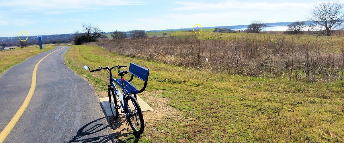 Similarly, in southwest Fort Worth the dam of Lake Benbrook is 750 feet high—97 feet above that average of 653 feet. On the left horizon the water tower may be the one on South Bellaire Drive at Interstate 20 three miles away. On the right horizon I think the water tower is the one just east of Granbury Road four miles away.
 Perhaps the best-known elevation in Fort Worth is the downtown bluff overlooking the river, the North Side, and, to lesser extents, the East Side and the West Side.
When Fort Worth declared itself the “City of Heights” in the 1870s, the city was confined to the plateau of today’s downtown. None of the parts of town named “Heights” existed. The nickname surely was based on the view from the bluff.
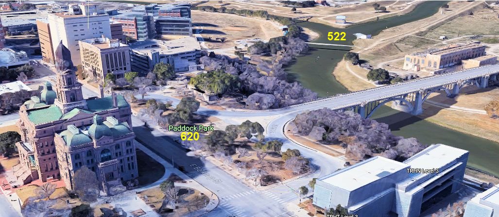
This photo was taken from Paddock Park on the bluff between the courthouse and Paddock Viaduct at 620 feet. The north end of the viaduct, 1,900 feet away, is at 540 feet—a drop of 80 feet.
On the horizon are the grain elevators at Saginaw (730 feet) six miles away.
 These two photos remind us of two factors in Major Ripley Arnold’s decision to establish the Army’s Fort Worth where he did: the bluff and the river.
The bluff provided a view for miles—a great advantage to a military outpost. The river provided water.
The confluence of the Clear and West forks of the river below the bluff is at 522 feet, 100 feet below the bluff.
North of downtown, Oakwood Cemetery is at 560 feet, LaGrave Field at 530 feet, and the stockyards and Rockwood Park at 540 feet.
But our scenic views are not all grain elevators and water towers.
In Fort Worth, as in most cities, the most prominent scenic feature is the downtown skyline, which tops out at 567 feet (Burnett Plaza building, forty stories).
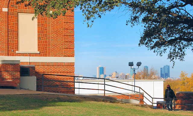 Many of our older high school buildings were built on higher ground. Poly High School is at 600 feet, well above the Sycamore Creek valley that lies between the school and downtown three miles away.
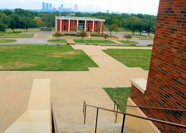 Likewise, two miles north of downtown, the North Fort Worth High School (the J. P. Elder Annex today) building has an elevation of 620 feet.
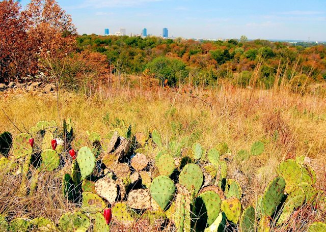 Three miles east of downtown, Tandy Hills Natural Area is at 650 feet.
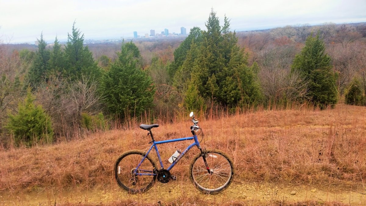
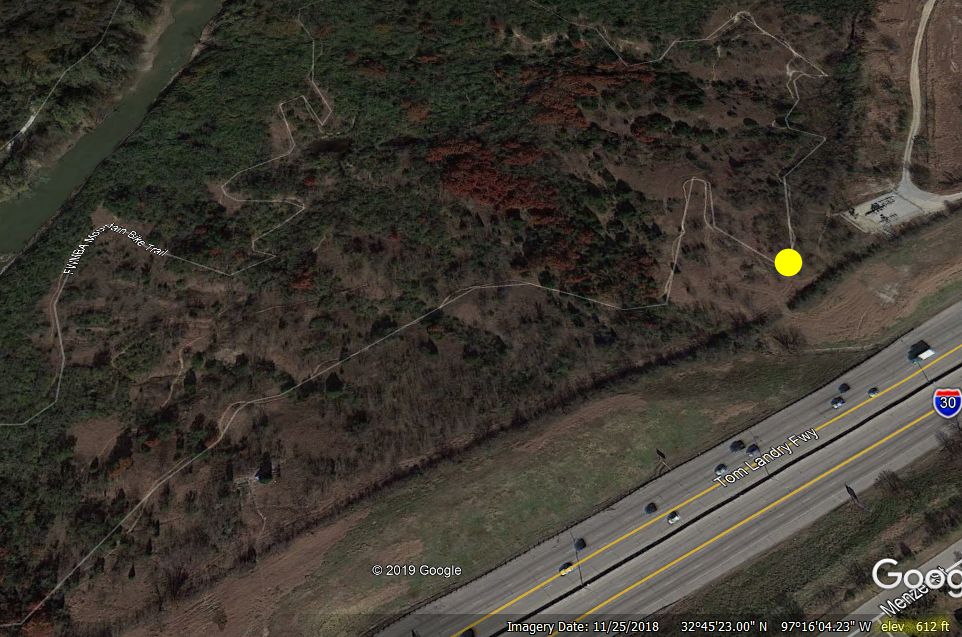 Four miles east of downtown some areas of the rugged Gateway Park Trail of the Fort Worth Mountain Bikers Association also are above 600 feet.
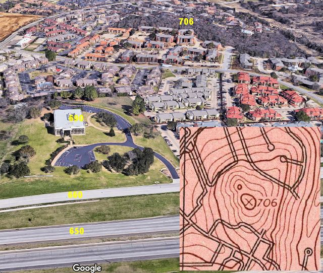 The Interstate 30 corridor between Woodhaven Boulevard and East Loop 820—six miles from downtown—is one of the highest areas east of downtown.
Interstate 30 is at 650 feet.
Even higher is Bridge Street at 660 feet.
Even higher is the National Farm Life building (6001 Bridge Street) at 690 feet.
Even higher is a wooded area of Woodhaven at 706 feet. It’s one of highest points in the eastern half of the county.
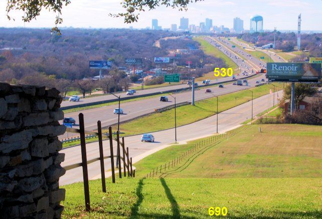 On the other hand, at the bottom of the hill 4,000 feet to the west of National Farm Life, Woodhaven Boulevard is only 530 feet high. Westward from Woodhaven Boulevard the terrain again climbs to 630 feet at the city water tower.
In the Woodhaven Boulevard valley, as is often the case, there is a creek. It flows north through Meadowbrook golf course, Woodhaven Country Club golf course, and Quanah Parker Park to the Trinity River.
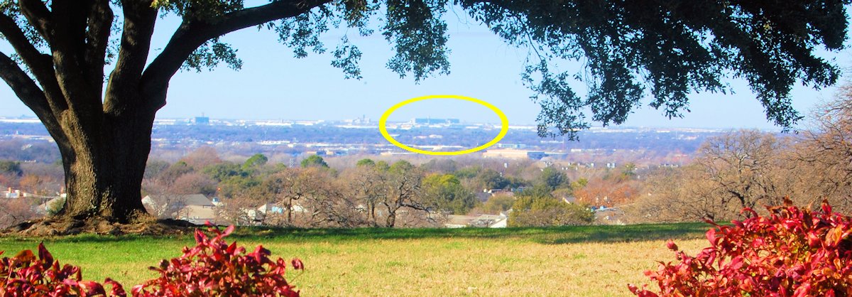 The grain elevators at Saginaw are ten miles from the National Farm Life building.
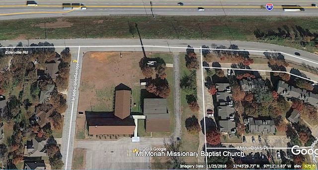 No survey of local scenic elevations is complete without Mount Moriah.
No, not the Mount Moriah in the book of Genesis.
And Fort Worth’s Mount Moriah is not a mount. It’s a church on a mount.
Mount Moriah Missionary Baptist Church is located atop a mount on Ederville Road overlooking Interstate 30 in east Fort Worth. The mount has an elevation of 675 feet.
I made a topographical pilgrimage to the mount of Mount Moriah church, and unto me was revealed a curious fact:
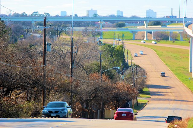 The mount does double duty. If you look to the west from the mount you can see the tops of some downtown Fort Worth buildings (from the left, Omni Hotel, Burnett Plaza, 777 Main and The Tower, and Wells Fargo and Bank of America) seven miles away.
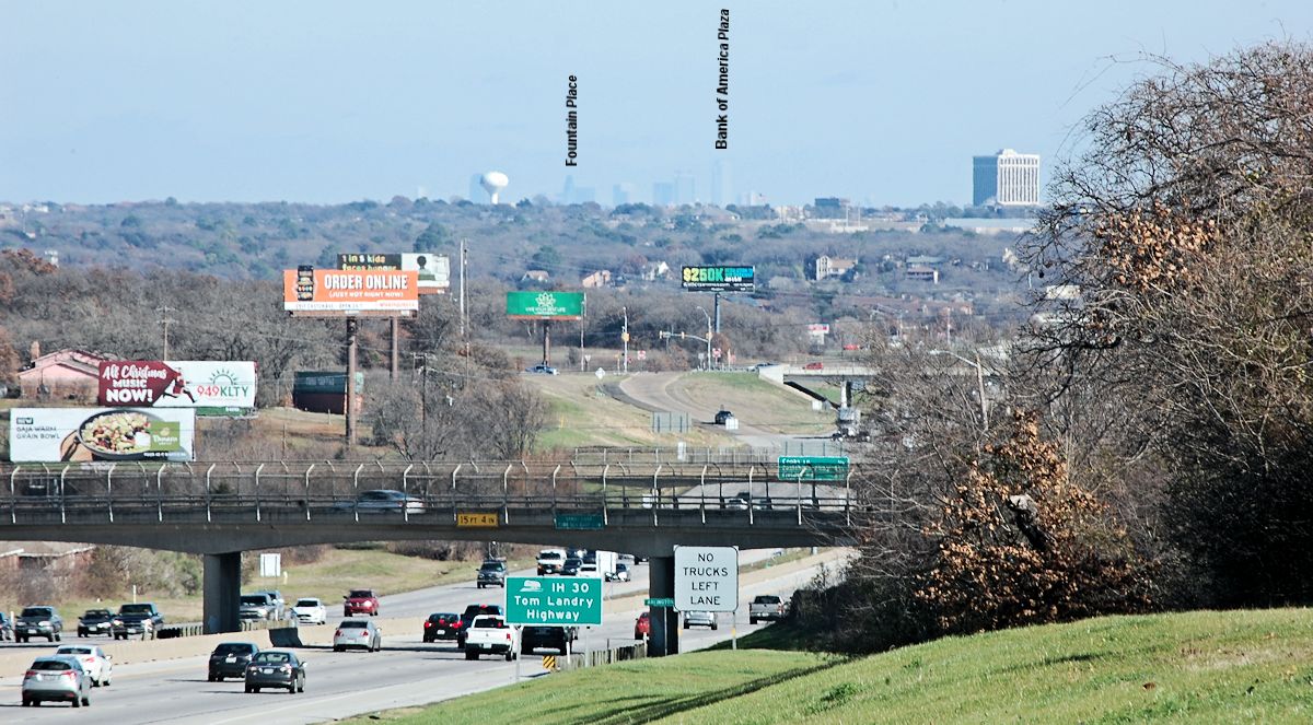
 And if you look to the east from the mount you can see the Dallas skyline twenty-three miles away. The sugar cube building and water tower are in Arlington.
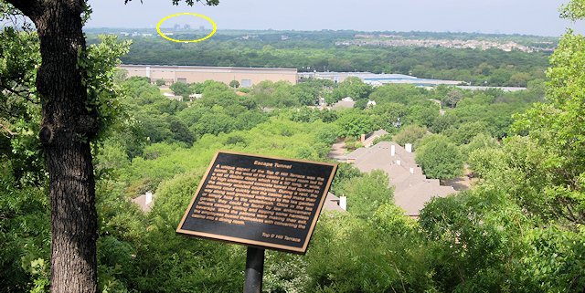 Farther east in Arlington, Top o’ Hill Terrace at 610 feet has a view to the west over the valley of Village and Rush creeks. Those three buildings on the horizon are the electric plant in Handley three miles away.
 So far we have looked at places named “Heights,” “Hills,” and “Mount.”
Anyone up for a “Mound”?
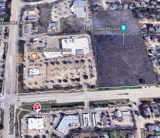
The city of Flower Mound was named for a mound about 50 feet high located near the intersection of Flower Mound Road and Long Prairie Road. The mound is thought to have been sacred to the Wichita Native Americans. Peters colonists named the mound for its wildflowers and domed profile.
To its credit, the city of Flower Mound has preserved the mound in a twelve-acre natural area of blackland prairie.
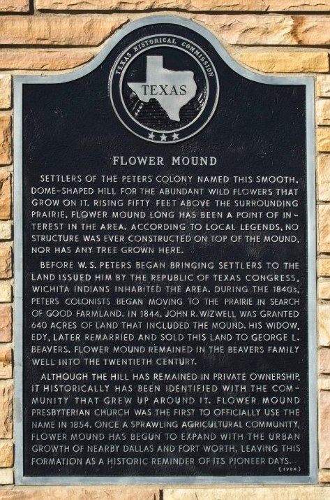 In fact, the mound is quite a celebrity in its hometown. A book has been written about it. It has its own foundation to preserve it. And its own website.
 Yes, you’ll find a flower mound in Flower Mound. But don’t go to the city of Blue Mound looking for a blue mound.
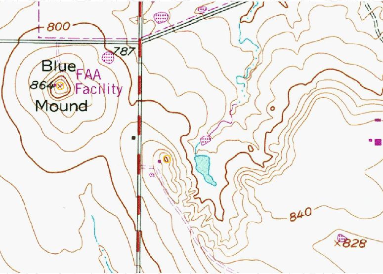
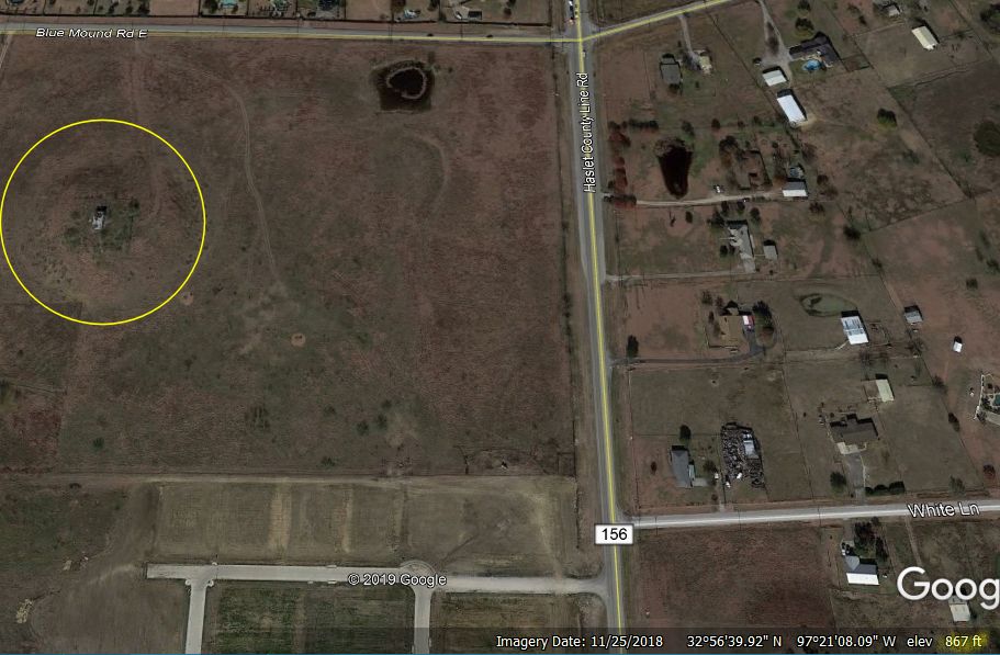
The prominence named “Blue Mound” is actually located five miles north of the city of the same name,
near the intersection of Blue Mound Road West and Haslet County Line Road.
And it’s not blue.
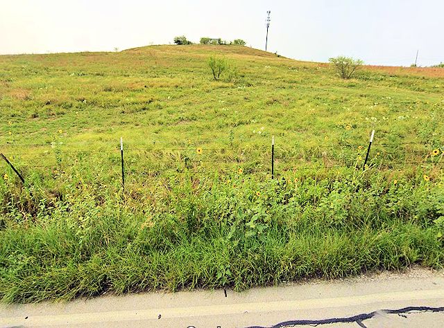 The mound is 864 feet high; the intersection of the two roads is 787 feet. Thus, the mound is only about 75 feet higher than the surrounding terrain. But modest prominences such as Flower Mound and Blue Mound were high enough to provide lookout points for Native Americans and Anglo settlers.
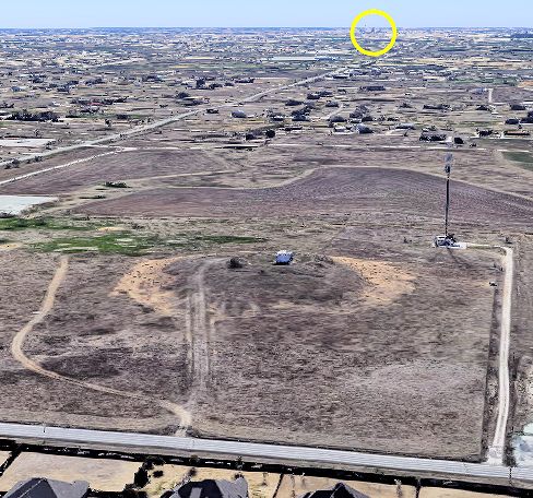 The Federal Aviation Administration once maintained a facility on top of the mound, probably in that building on the summit.
The mound, historian Julia Kathryn Garrett writes in Fort Worth: A Frontier Triumph, is so-named because when soldiers at the fort viewed it on the northern horizon it had a bluish cast.
But I am doubtful that a mound only 75 feet high could be seen from today’s downtown bluff—thirteen miles away and at a lower elevation—even in the clean air of 1849.
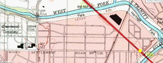 What can be seen from thirteen miles? To answer that, let’s go on another topographical pilgrimage. This time let’s start at the eastern end of White Settlement Road at Henderson Street—an elevation of 554 feet—and go west.
You drive. I’ll narrate.
[Ten minutes later.]
You: “We’ve crossed the river twice. How much farther?”
We’re just getting started. Keep going.
[Ten minutes later.]
You: “We just passed Carswell and the bomber plant.”
Keep going.
You: “We just passed the West Loop. Are we there yet?”
Keep going.
You [Looking at trip odometer.]: “We’ve driven ten miles. We’re on a two-lane country road. Are we there yet?”
Keep going.
You: “Eleven miles. [Looking around at countryside.] Are we lost? I don’t recognize anything. There’s nothing out here but gas wells and scrub oaks. Are we there yet?”
Keep going. Notice how we’ve been gradually climbing? We’re at 800 feet now.
You: “Now we’ve driven fourteen miles. [Pointing.] Look at that sign! We just crossed the county line. We’re in Parker County! And me without a passport!”
Turn right here on Cattlebaron Road. We’re now at 875 feet. Go north to the first gas well on your right. That will get us 25 feet higher. . . . Right about . . . here. . . . Stop.
We’re there yet.
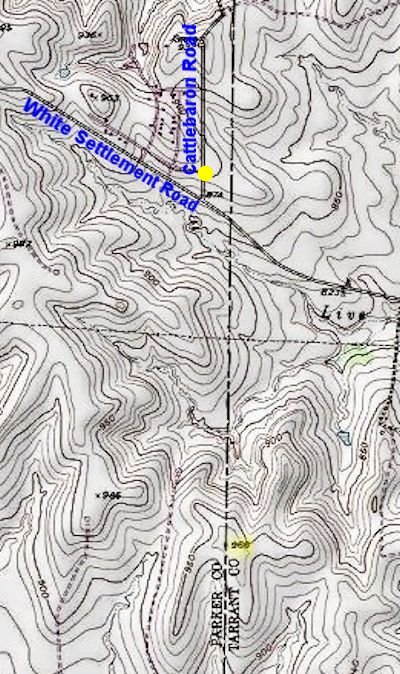 We’re at an elevation of about 900 feet here. The highest point in Tarrant County at 966 feet is only about 1.5 miles southeast of here.
Now look back east at where we came from. What do you see?
You [Staring at the eastern horizon and pointing.]: “Over those rooftops . . . what’s that? . . . Is . . . is that . . . no way! . . . downtown Fort Worth?!”
 ’deed it is.
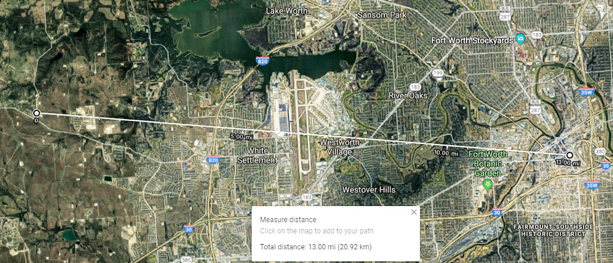 You’re looking—with the naked eye—at a skyline that is thirteen miles from here as the crow flies. The Wells Fargo and Bank of America towers are on the left; the Omni Hotel is on the right. That long, low, white building is the Lockheed Martin assembly building six miles away.
The housing addition in the foreground is 4,200 feet away and 80 feet lower in elevation.
 That airplane took off from Carswell.
 Being able to see a downtown skyline from thirteen miles is impressive. But in 2005 John T. Roberts of Fort Worth Architecture went one better. From this vantage point he took a photo—using a moderate telephoto lens—that includes not only the downtown Fort Worth skyline but also the downtown Dallas skyline—forty-four miles from here! That’s seeing all the way across Tarrant County and half of Dallas County. And his 2005 photo from forty-four miles shows the Dallas skyline much more distinctly than my 2020 photo from Mount Moriah at just twenty-three miles.
Fifteen years later can we replicate the 2005 photo showing the Dallas skyline from forty-four miles away?
 The yellow line shows where the Dallas skyline is due east of this point on Cattlebaron Road. But even with 7x binoculars we can only faintly make out parts of the skyline.
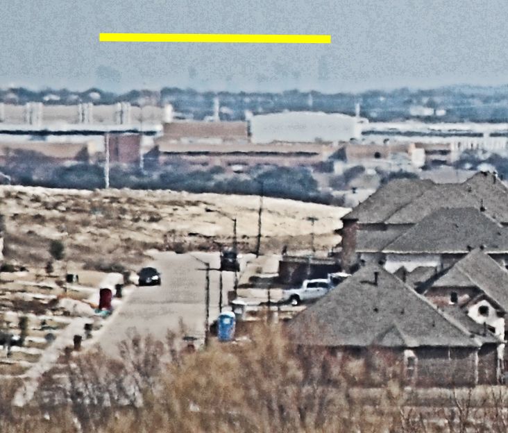 And if we photograph the eastern horizon from here with a camera outfitted with a 200-millimeter lens we later have to enhance the image to within an inch of its life in editing software to bring out even the faint shape of buildings in downtown Dallas. I think the tall, lanky ghost on the right is the Bank of America Plaza building (921 feet tall in its stocking feet).
Maybe the Dallas skyline is still doable from this Parker County vantage point on a day with better air quality. Or maybe that 2005 view of two skylines from thirteen and forty-four miles away is gone forever.
Either way, right now what we gotta do is find our way back thirteen miles to that skyline of the “City of Heights.”
You: “I wish we’d left a trail of bread crumbs.”
(Thanks to Dennis Hogan for the suggestion.)
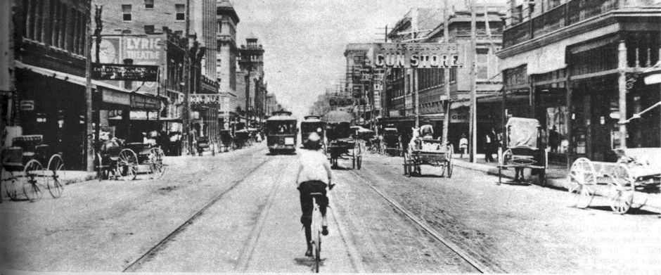


On FM2331 near Sky Road in the NW corner of Johnson County there is a fantastic view of the downtown FW skyline due to the height differences.
I really like your articles, especially this one.
Thanks, Larry. In these parts it doesn’t take much elevation to provide a view for miles.
I’ve watched the sun rise from that hilltop on Cattle Baron Road, on a clear, cold morning. In those conditions it’s easy to see downtown Dallas in some detail with the naked eye. The relatively modest office towers in Las Colinas are visible as well.
Something to keep in mind if you get the itch to take more photos…
Thanks for letting me-and others-know that the shot is still possible under better conditions. I waited for a day after rain to go out there, but apparently that was not the key to a clear view.
The office building up there on that rise above Bridge Street is the home of National Farm Life Insurance Company, not Farmers National Life.
Thank you. I have made that correction. Looked right at the sign and miswrote it.
You’ve reached the pinnacle of your reporting career! Feeling a natural high yet?
Nice job with this feature!
LOL! I had to run this one ASAP so I’d stop fiddling with it. It was great fun. I learned a lot. Thanks for the suggestion.