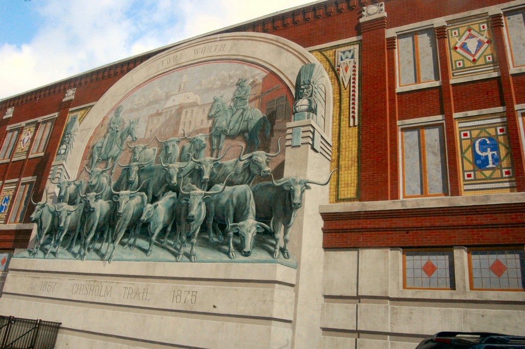
 Sure, it’s the Chisholm Trail mural at Sundance Square Plaza. But there is a building behind that mural. And there is some history behind that building. A century ago the building (c. 1902) was headquarters of Northern Texas Traction Company, which operated the interurban line between Fort Worth and Dallas from 1902 until 1934.
 As a Fort Worth news story in 1902 the building of the interurban was overshadowed only by the building of the packing plants. Every development as the interurban tracks were laid was reported in local newspapers. In February enough of the system was in place to make a trial run from Fort Worth to Handley, where the line’s generating plant was located at Lake Erie. The motorized car averaged a breakneck twenty-eight miles per hour, making the six-mile trip out in thirteen minutes but requiring three additional minutes for the return trip because of “a brisk wind blowing against the car.”
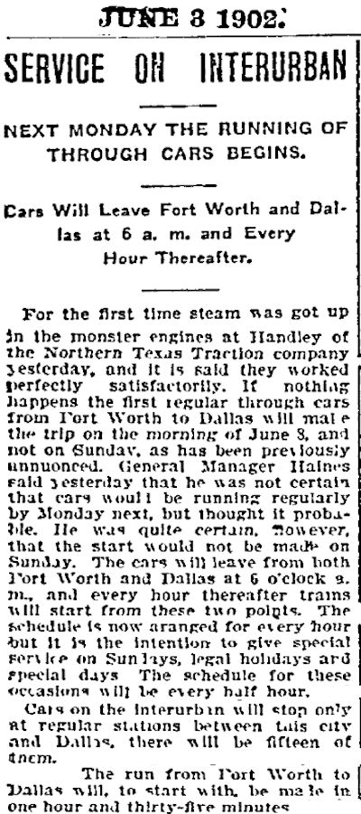
By early June the system was almost completed. The steam engines that turned the electric generators at the Handley power plant were fired up successfully.
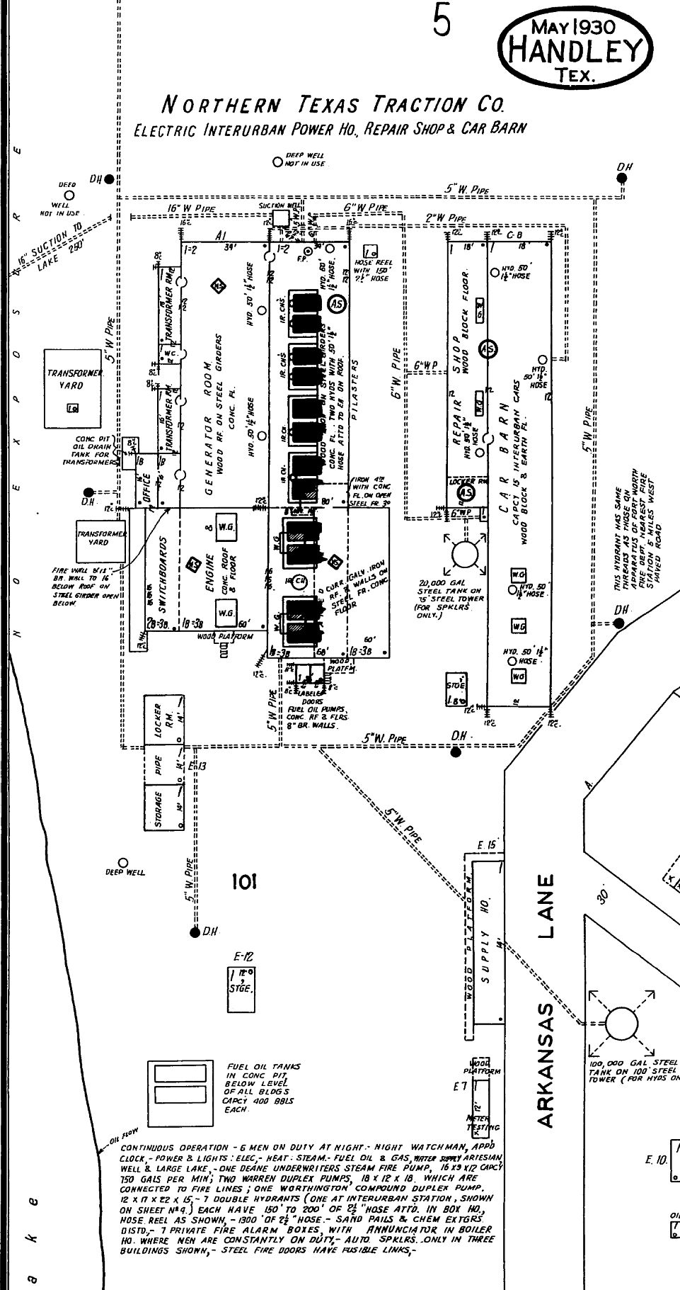
Sanborn map of 1930 shows the Handley power plant. Note the pipe labeled “suction to lake” in upper left.
When the interurban opened in 1902 initially there would be fifteen passenger stations along the track between Fort Worth and Dallas, and the trip would take ninety-five minutes. Cars would leave both cities on the hour beginning at 6 a.m.
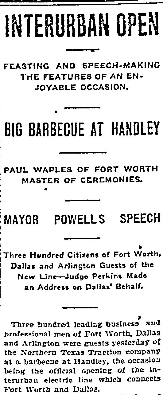 The interurban officially opened on June 18, 1902 with a ceremony at the NTTC’s generating plant in Handley. Paul Waples was master of ceremonies. (Fourteen years later he would be struck and killed by an interurban car.) Clip is from the June 18 Fort Worth Register.
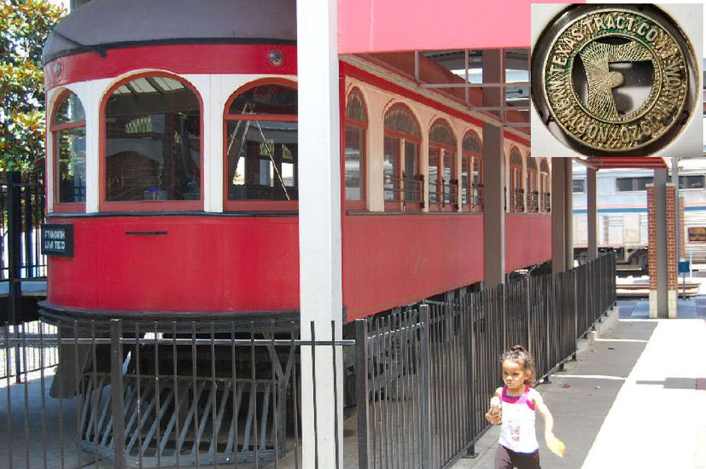 Today car no. 25 (built in 1913) of NTTC’s Crimson Limited express service cools its cowcatcher at the Intermodal Transportation Center downtown. (Car no. 25 is the car that killed Paul Waples.) The interurban’s motto was “Speed with safety.” There was more safety than speed in the beginning: In 1905 interurban cars were plodding along at 20 mph. But by 1923 cars were zooming along at up to 65 mph.
The fare was seven cents (see inset).
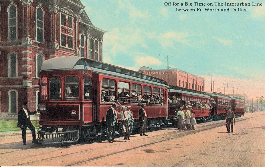 This interurban “special” was loading passengers on Belknap Street downtown. In the background on the left is the 1883 county jail, which was replaced by the Criminal Justice Building in 1918. The building to the right is the Natatorium laundry. (Postcard from Barbara Love Logan.)
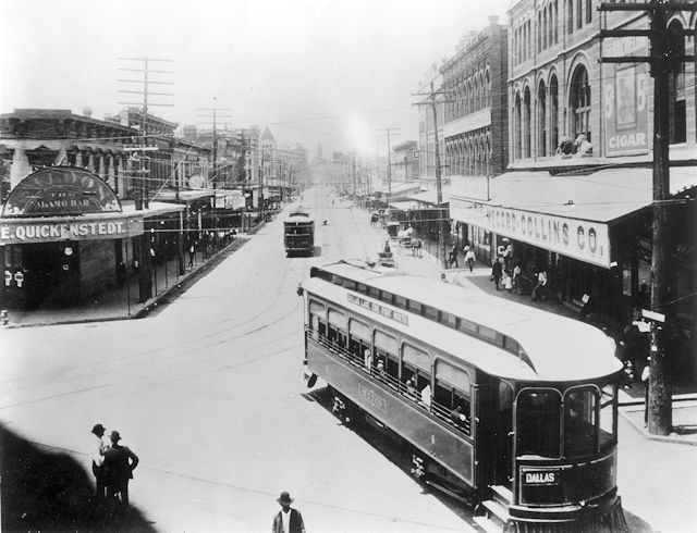 An interurban car marked “Dallas” turns the corner from Main onto Lancaster. The building on the right is the 1886 Joseph H. Brown building, which was demolished in 1958 to make way for the I-30 overhead. (Photo from University of Texas at Arlington Library.)
Northern Texas Traction Company ran electric trains on tracks alongside present-day Lancaster Avenue and U.S. 80 between Fort Worth and Dallas. The track ran through Poly and Handley and a lot of undeveloped countryside.
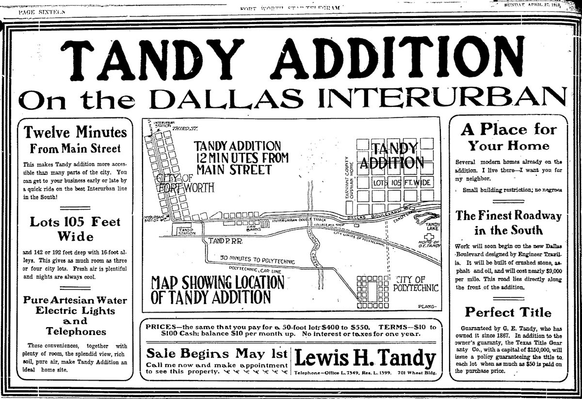 Being located near the interurban line was a big selling point in real estate. This 1913 ad for Tandy addition points out that the addition was just twelve minutes from downtown by interurban. Tandy Lake even had its own stop on the interurban.
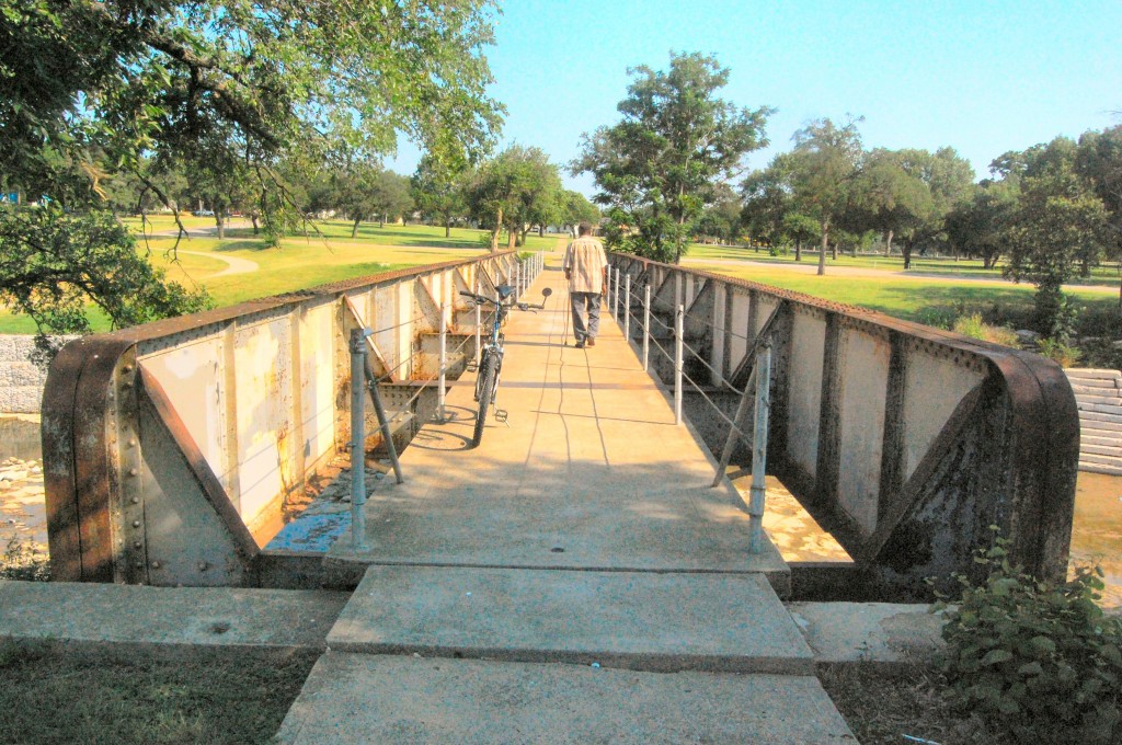 The tracks are gone now, but this little iron bridge in the East Side’s Sycamore Park (1907) was built in 1912 when the Fort Worth Southern Traction Company opened an interurban line between Fort Worth and Cleburne. The Cleburne track branched off the track to Dallas just east of Riverside Drive. By the time the Cleburne line closed in 1931, eight million passengers had clattered over the little iron bridge.
 The Cleburne line had stations in Poly. (Map detail from Pete Charlton’s “1000+ Lost Antique Maps of Texas & the Southwest on DVD-ROM.”)
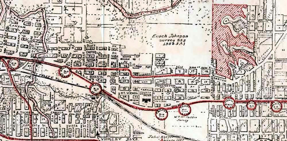 The Fort Worth-Dallas line had stations in Poly and Meadowbrook. (Map detail from Pete Charlton’s “1000+ Lost Antique Maps of Texas & the Southwest on DVD-ROM.”)
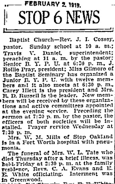 The East Side neighborhood named after Stop 6 on the interurban line (at today’s Rand Street) was outside the city limits in 1919 when the Star-Telegram reported Stop 6 news in a column. The Stop 6 neighborhood today is bounded by Rosedale Street on the north, Berry Street on the south, Loop 820 on the east, and Miller Street on the west.
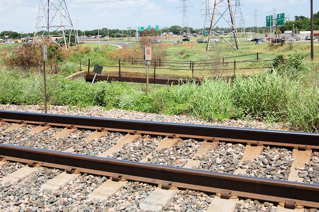
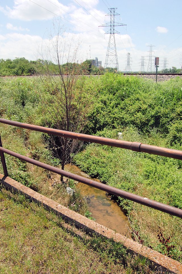 The next time you eat at the Dixie House on East Lancaster, if you want a little history for dessert, just southwest of the parking lot is a narrow concrete overpass that carried Handley Road (now “Old Handley Road”) over the depressed interurban track near Lake Erie. The interurban track then passed under the T&P tracks via a tunnel Top photo views the overpass from the T&P tracks. Bottom photo views the tunnel under the T&P tracks from the Handley Road overpass. A trickle of water flows through what is left of the tunnel toward the power plant in the distance.
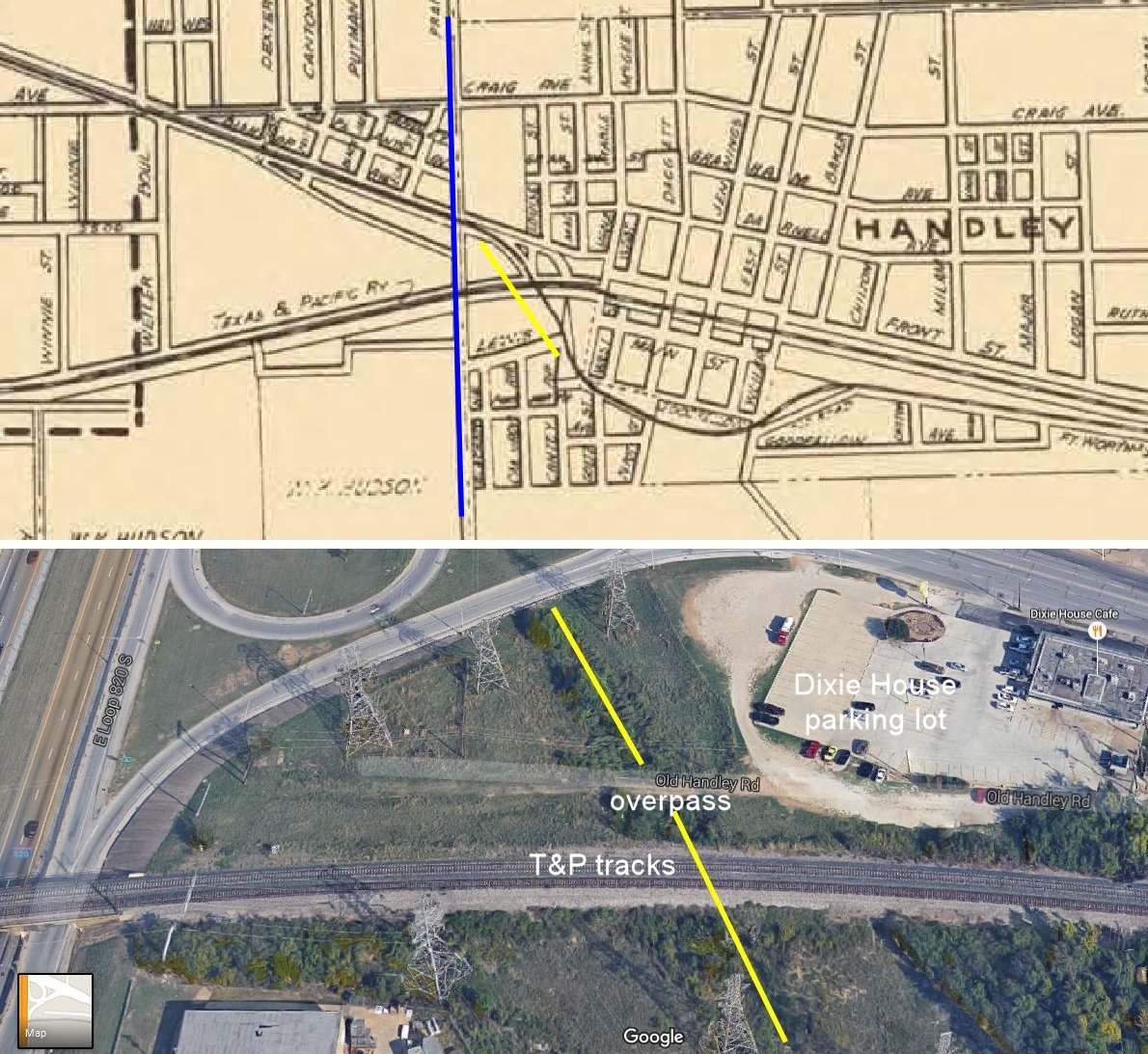 The interurban track veered southeast off the Dallas Pike (Lancaster Avenue), passed under Handley Road and the T&P tracks, and then proceeded to Northern Texas Traction Company’s Lake Erie trolley park and then east to Dallas again along the pike. Old Handley Road begins at Lancaster near Erie Street in downtown Handley. The road once ran west parallel to the T&P tracks to Tierney Road. Although now split by the east Loop, Old Handley Road still exists. Erie Street runs south toward Erie Lake (absorbed by Lake Arlington in 1957). On the map and aerial photo, the yellow line indicates the path of the interurban track. The blue line indicates where Loop 820 is today. (Map detail from Pete Charlton’s “1000+ Lost Antique Maps of Texas & the Southwest on DVD-ROM.”)
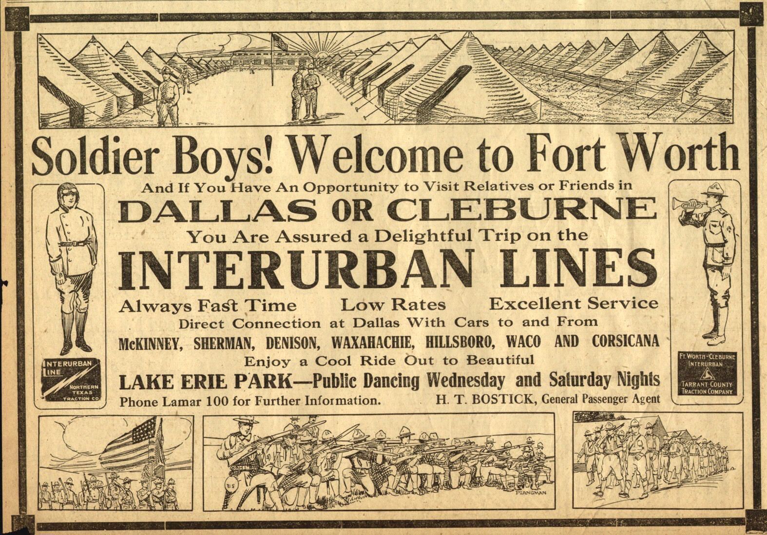 In 1917 Northern Texas Traction invited the Sammies of Camp Bowie to take a ride to Dallas or Cleburne or go ride out to Lake Erie. (From Pete Charlton’s “1000+ Lost Antique Maps of Texas & the Southwest on DVD-ROM.”)
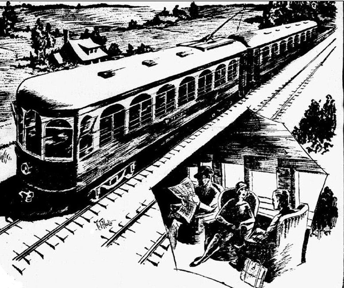
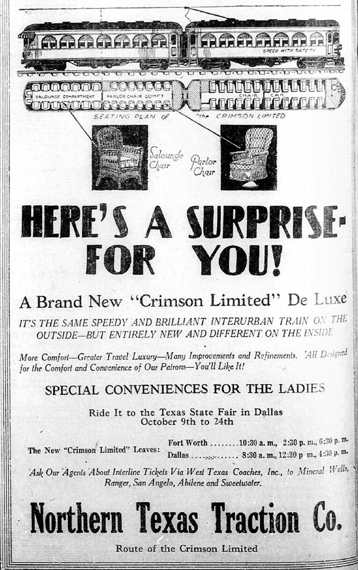 These ads are from the 1925 and 1929 Dallas Morning News.
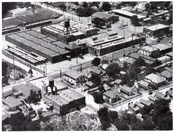 Fort Worth’s interurban car barn was on East Lancaster where the T is headquartered today. (From Pete Charlton’s “1000+ Lost Antique Maps of Texas & the Southwest on DVD-ROM.”)
 In 1916 Dallas built a new Interurban Building on Jackson Street. Clip is from the September 1 Dallas Morning News.
Some photos taken at the Interurban Building in Dallas:
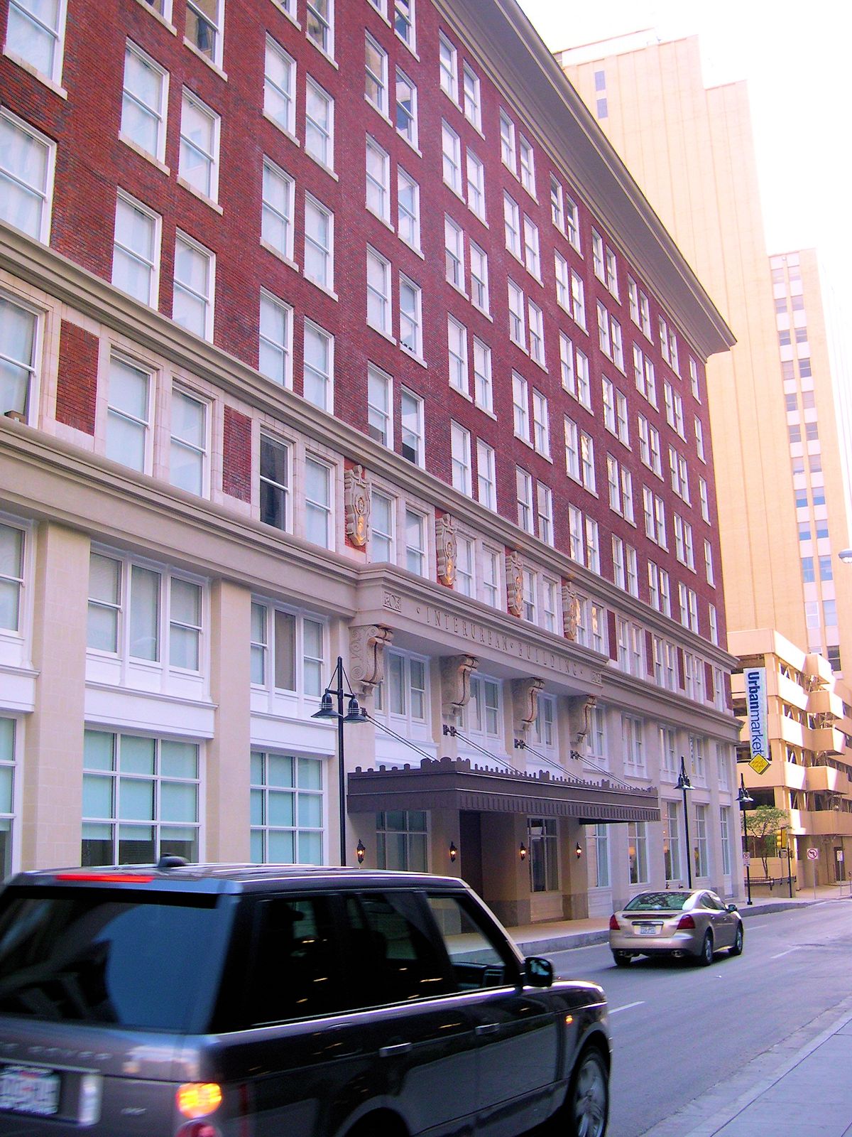
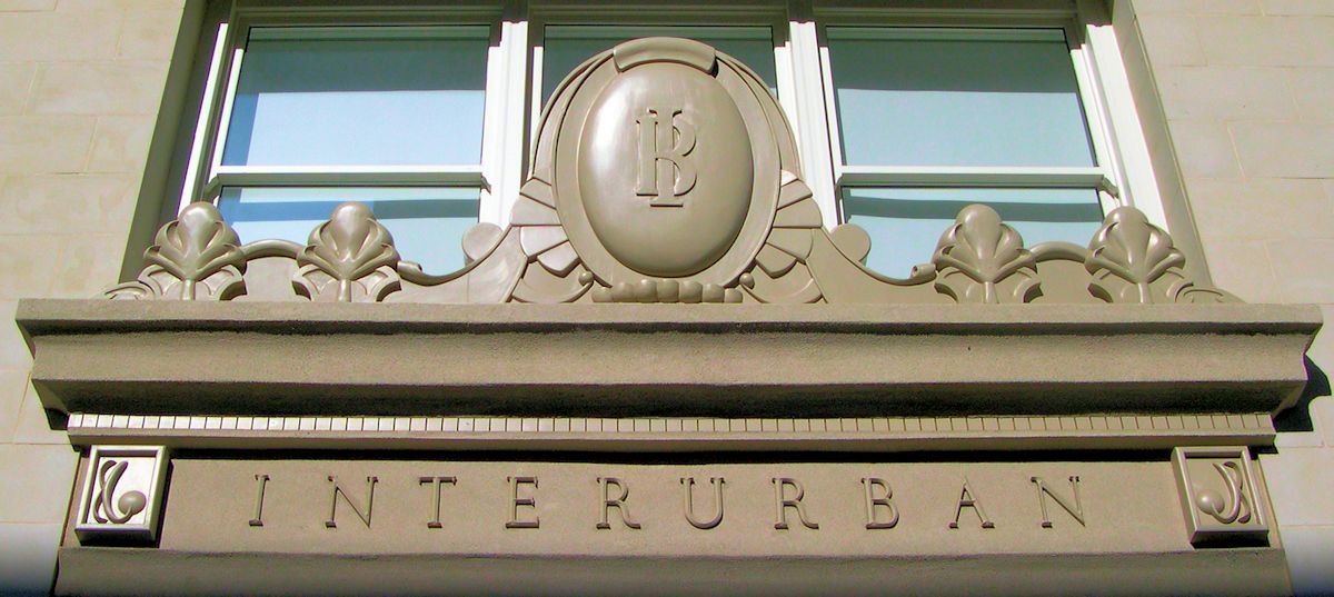
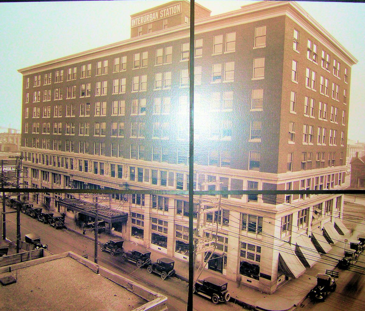
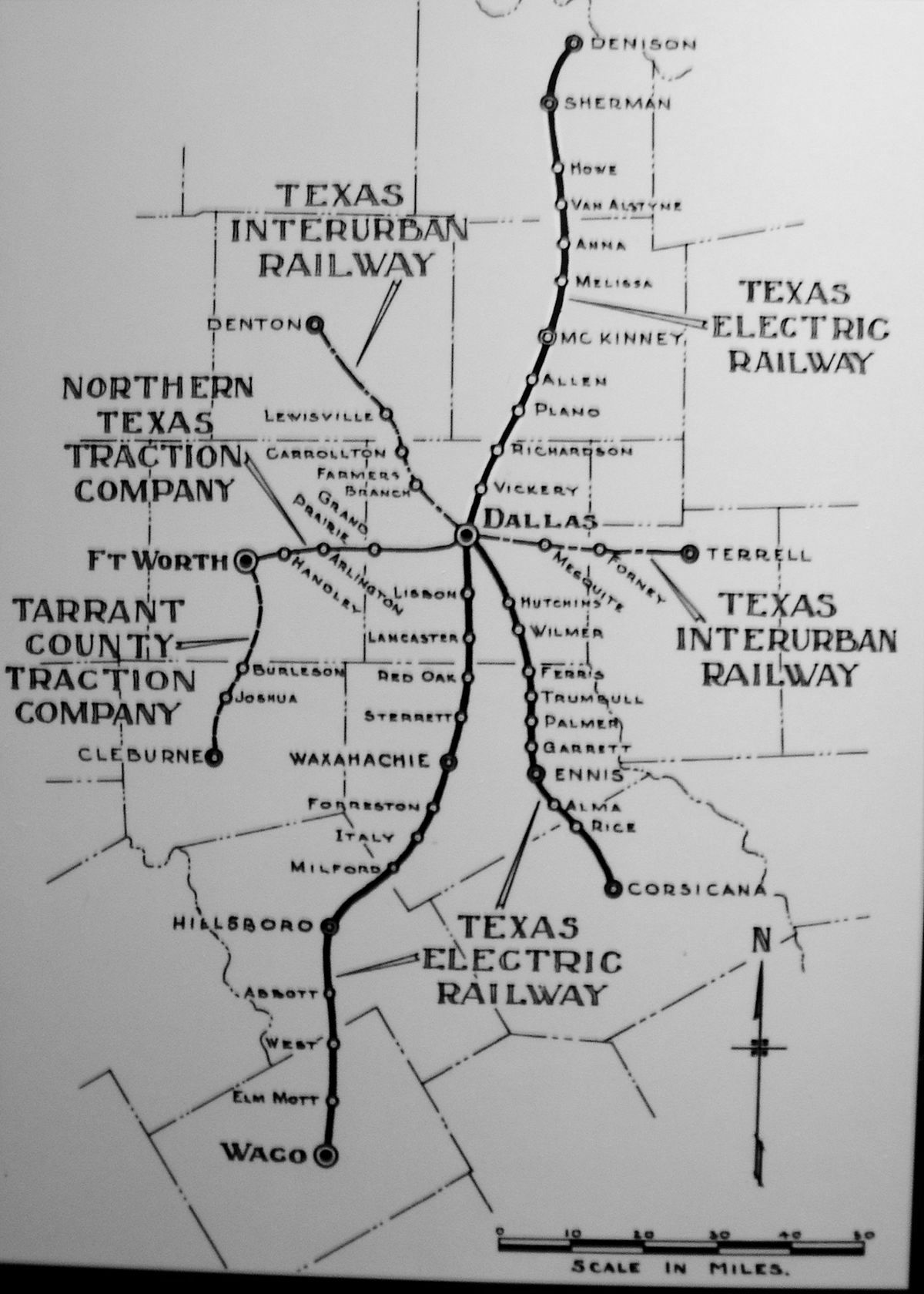 At the peak of interurban travel, north Texas cities were connected by an extensive network. But one by one the interurban lines closed, the victims of changing times. More people were buying automobiles. Bus lines were competing, providing passengers with an alternative to the interurban. The Fort Worth-Dallas line closed in 1934.
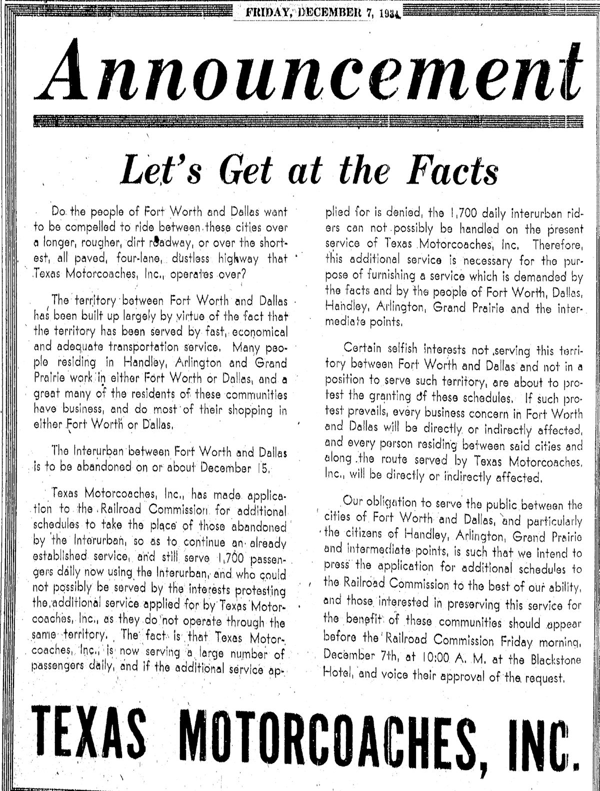 One such competitor was Texas Motorcoaches, which was ready to provide increased service between Fort Worth and Dallas to the interurban’s seventeen hundred daily riders. And who owned Texas Motorcoaches? Northern Texas Traction Company! Yes, its bus line was competing with its interurban line.
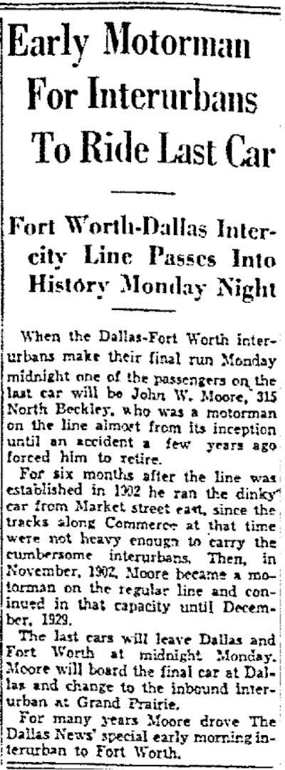
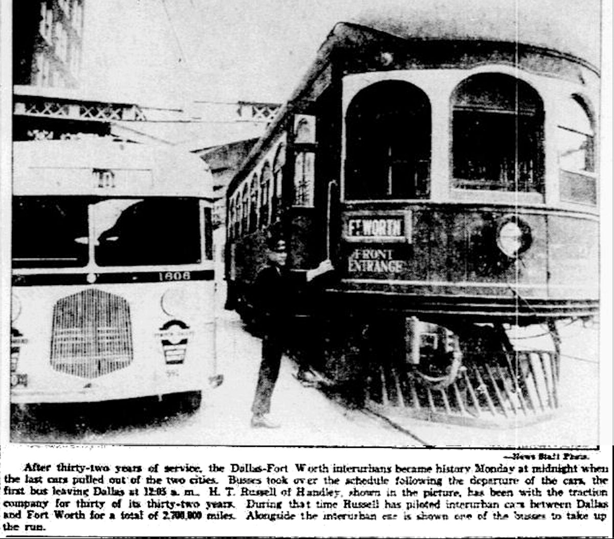 After thirty-two years of providing mass transit to Fort Worth and Dallas, on Christmas Eve 1934 the interurban made its last run. Clips are from the December 24 and December 25 Dallas Morning News.


Such great information! I grew up in Poly in a house built by my great-grandfather. He was the “Ellis” part of the Ellis-Kellner Harness Co.on Houston Street. My great-uncle would catch the Dallas bound Interurban just east of Sycamore creek and ride out to Village Creek to hunt rabbits all day. All at 14 years of age and carrying his 410 shotgun on the train! Thanks for all the wonderful storiea and Info!
NTT Co. records can also be found at the Fort Worth Public Library:
https://fortworthlibrary.lyrasistechnology.org/repositories/2/resources/310
Thanks, Dennis.
The Fort Worth Public Library has some NTT publications available online:
http://www.fortworthtexasarchives.org/digital/collection/p16084coll27/search
Thanks, Dennis.
can you help me find what was located at the corner of east lancaster & greenlee st & wilson? specifically on the corner on greenlee where the new developments are, from 1970s-1990s?
Lily, I am not sure I understand which “new developments” you mean. I have not been in that area in years. I have limited resources for that time period. The 1967 city directory shows the north side of Greenlee between Wilson and Emily (5200 and 5300 blocks) to be residential. A 1968 aerial photo shows four commercial buildings filling that space on the north side of Greenlee from Wilson to Emily. Because the outer two buildings were identical, I assume the four buildings were one complex. And because 5301 Greenlee was the Monaco Apartments, I assume all four buildings were the Monaco. In a 2001 aerial photo the apartment buildings are gone. The north side of the 5200 and 5300 blocks was empty for a few years. A 2014 aerial photo show a few houses again on the north side of the 5200 and 5300 blocks of Greenlee. By 2016 the north side is almost completely single-family housing.
Mike, I have a friend writing a book and wanted to know about Ft Worth’s traditional neighborhoods. I sent a link to your blog and the above article.
Thanks, Keith.
Hello. Do you have any photographs of Stop 6 on the Northern Texas Traction Company’s Dallas-Fort Worth Line? My alumni class of 1970 is planning our 50th reunion in 2020 and our theme is the history of the Stop Six community. We are commissioning a replica of the train car to use as a backdrop for photo ops. We would appreciate whatever you can provide. Is the railcar in Burleson the same kind that would have been used on the DFW line? I appreciate your stories on Fort Worth History in the Star-Telegram.
Thanks, Brenda. I’m glad your class is celebrating the history of the Stop 6 neighborhood and the interurban. I do not have any images specific to the Stop 6 stop. The Tandy Lake stop is all I have. Both of the cars in Burleson and the car in Fort Worth ran on the Fort Worth-Dallas line.
So, Mike, are there really no tracks left anywhere downtown Fort Worth or, for that matter, between Fort Worth and Dallas?
Malcolm, none that I know of. Or at least not visible. Now and then some ties will be found under the surface of a street during roadwork, but I think the rails were taken up and sold for scrap in the 1930s.
There may not be any tracks but there is still a bridge that the Interurban rode on that is still standing…
Google map this:
32.738073, -96.897951
It is just north of Jefferson Blvd.
The bridge was built wtih SF was building the N-S RR here. They raised the Interurban over the RR and lowered the street under the RR.
Thanks for that information, Joe. I have not researched the interurban on the Dallas County end except for the old headquarters downtown.
I grew up at Hampshire and Winnie, a post-WWII development mostly. I had friends who lived in what looked like a former estate to me on Old Handley and Handley. When the trains came by, the rumbling created waves in the swimming pool. There were several other places on Winnie, Old Handley and Hampshire that looked like they were once the homes of the well-to-do — or at least people with land. I’ve often wondered when they developed and who lived there.
Linda, development of the area between downtown and Handley was intermittent. Generally, the farther from downtown, the later the development. Of course, the Tandy family, starting with Roger in the 1850s, owned much of the land in Meadowbrook—all the way to Handley, one Tandy ex-slave recalled. Son George Tandy’s farm and Tandy Lake were on Ayers between Lancaster and Hampshire. Parts of what is now Meadowbrook, such as Beacon Hill, developed before 1920 (spurred by the interurban). Dry cleaning czar W. B. Fishburn owned a horse farm at Ayers and Lancaster. It was developed as “Fishburn Place” in 1921. But by 1952 there was still a lot of open land in Meadowbrook and Handley. And there were indeed some large estates along the Dallas Pike on both sides of Handley. Major Handley himself had a plantation and planned to build a home for his bride-to-be on top of the hill where Rose Hill Cemetery now is.
I have a very cute photograph, 1912 or earlier, of the brother of my husband’s great grandmother posed in a painted set that resembles the back of a train. The sign refers to the Intraurban and Cleburne, and I had always wondered about it. Perhaps some sort of early 20th century photo booth as advertising or celebration of the opening of a new line?
The image of such a set rings a very faint bell with me, but I can’t find it now. The Cleburne line opened in 1912, so that might indeed have been a promotional gimmick.
Are there any other structures that you are aware of besides the Sycamore bridge that along the interurban line (besides the offices in FW, Burleson, and Dallas)? Also, are there any books, theses, or extensive research papers on the subject of the NTTC or Interurban?
I love your work and am interested in more details!
Thanks, David. The interurban is one of my favorite parts of Fort Worth history. In addition to the iron bridge, buildings in FW, Dallas, and Burleson, and the car at the ITC:
The A. J. Wright Building, which housed the Cleburne station, still stands, but I have had only e-mail contact with someone who works in the building.
Just behind the Dixie House on East Lancaster is a small concrete over the creek that fed Lake Erie.
The Tandy Lake station sign remains in the Tandy family.
Fare tokens still turn up on eBay.
In Google aerial photos you can still make out the ROW of the line to Burleson. A guy in Burleson city government said he’s interested in giving some recognition to the ROW between Burleson and Cleburne. Until a few years ago a brick substation just south of FM 1187 still stood. It was demolished despite attempts to save it.
http://www.burlesonhistory.com/interurban.html
http://www.burlesonhistory.com/An%20Electrifying%20Idea.pdf
Sadly, the best source of information on the interurban died recently. Pete Charlton, whose DVD of old Texas/FW maps is a treasure, was writing an electronic book on the interurban when he died.
http://www.amazon.com/1000-Antique-Texas-Southwest-DVDROM/dp/B00FJDYCCU/ref=pd_sim_14_26?ie=UTF8&dpID=61QyfbJJloL&dpSrc=sims&preST=_AC_UL160_SR160%2C160_&refRID=04FV4BYBB1WM18HQAYR5
Mike